Three Bridges in Hunterdon County, New Jersey — The American Northeast (Mid-Atlantic)
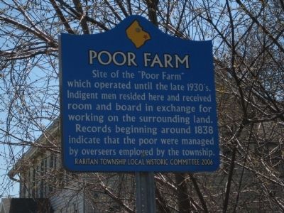
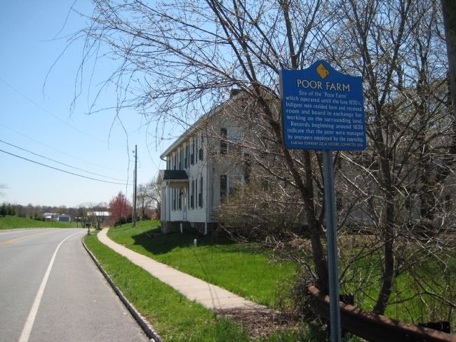
Poor Farm
Records beginning around 1838 indicate that the poor were managed by overseers employed by the township.
Erected 2006 by Raritan Township Local Historic Committee.
Topics. This historical marker is listed in this topic list: Agriculture. A significant historical year for this entry is 1838.
Location. 40° 29.773′ N, 74° 48.102′ W. Marker is in Three Bridges, New Jersey, in Hunterdon County. Marker is at the intersection of Clover Hill Road and William Penn Drive, on the right when traveling south on Clover Hill Road. Touch for map. Marker is in this post office area: Three Bridges NJ 08887, United States of America. Touch for directions.
Other nearby markers. At least 8 other markers are within 2 miles of this marker, measured as the crow flies. Old York Road (approx. 0.4 miles away); Mattisons Corner (approx. one mile away); The Province Line (approx. 1.2 miles away); a different marker also named The Province Line (approx. 1.3 miles away); Reaville Historic District (approx. 1˝ miles away); Stagecoach Stop (approx. 1˝ miles away); Three Bridges (approx. 1˝ miles away); Reaville Church (approx. 1.6 miles away). Touch for a list and map of all markers in Three Bridges.
Credits. This page was last revised on August 9, 2021. It was originally submitted on April 17, 2009, by Alan Edelson of Union Twsp., New Jersey. This page has been viewed 1,623 times since then and 77 times this year. Last updated on August 8, 2021, by Walter P Barlow of Spotswood, New Jersey. Photos: 1, 2. submitted on April 17, 2009, by Alan Edelson of Union Twsp., New Jersey. • J. Makali Bruton was the editor who published this page.

