Hanover in Grafton County, New Hampshire — The American Northeast (New England)
The Appalachian Trail
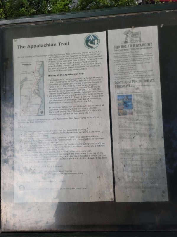
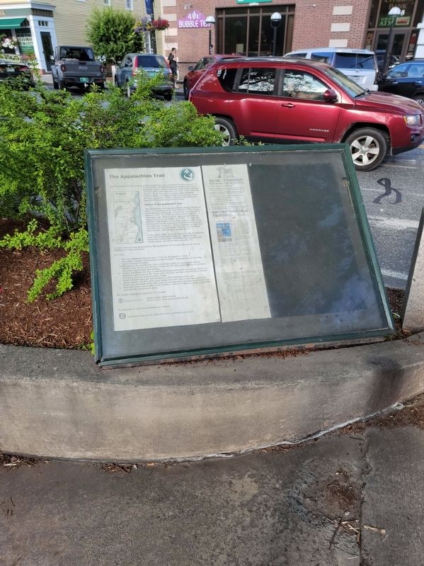
We are standing at this moment on the Appalachian Trail (commonly known as the "A.T.”). The Trail links Springer Mountain in Georgia with Mount Katahdin in Maine and is marked by white blazes painted on trees, utility poles (like here in town), rocks, and other objects. On its way north it runs up West Wheelock Street from the Connecticut River, south on Main Street, and east on Lebanon Street; it reenters the woods just beyond the Hanover Coop service station.
History of the Appalachian Trail. The Appalachian Trail was proposed by Benton McKaye in 1921. Construction of the Trail started in 1922; it was completed as a continuous marked trail from Georgia to Maine in 1937. The 1938 hurricane in New England damaged major sections of the Trail and World War II delayed the its re-completion until 1951. In 1968, the National Trails System Act created National Scenic Trails and provided for the acquisition of buffer lands to ensure the protection of the A.T. Today, a corridor of more than 250,000 acres, an area larger than that of Yellowstone National Park, now serves to protect the A.T.
In the Upper Valley, portions of the A.T. are on trails that were first created early in the 20th Century by the Dartmouth Outing Club. Some of the DOC's black and orange blazes can still be seen along the A.T.
In 2010, Hanover was designated by the Appalachian Trail Conservancy as an official Appalachian Trail Community.
A.T. Facts
· The first completed National Scenic Trail (so designated in 1968).
The nation's longest continuously marked footpath-approximately 2,181 miles.
· Passes through 14 states.
· Managed by the Appalachian Trail Conservancy '(ATC) in cooperation with the National Park Service and the U.S. Forest Service, and maintained by 31 volunteer trail clubs and multiple partnerships.
· In New Hampshire the Trail is maintained by the Dartmouth Outing Club (DOC), an affiliated organization of ATC since 1929; the DOC had been maintaining a network of trails in the area şince the early 1920s.
· About 200,000 hours are contributed by 6,000 volunteers every year.
· Approximately 165,000 white paint blazes mark the Trail's route (they are on the street light standards along Main Street); a double blaze indicates a turn in the trail.
· First hiked from end-to-end by Earl Shaffer in 1948 in 4 months, 4 days; it had been said that this could not be done.
For furthermoration about the A.T. contact: Appalachian Trail Harpers Ferry, West Virginia (304/535-6331, www.appalachiantrail.org). To Volunteer for local trail maintenance, contact: Dartmouth Outing Club (603/646-2429, [email protected])
Hiking to Katahdin?
There Are Some Things You Should Know.
Katahdin is in Baxter State Park.
Baxter is different from anywhere else on the AT. Wilderness comes first. Recreation comes second. Katahdin is sacred to Maine's native people. It is a fragile and special place to finish a thru-hike.
In Baxter State Park and on Katahdin, plan to:
✓ Hike in small groups
✓ Celebrate quietly
✓ Save alcohol for later
You need to get an AT long distance hiker permit from Baxter State Park. Permits are free. The future of the AT in Baxter State Park depends on partnership and good ethics from AT hikers.
Don't Just Finish The AT. Finish Well. www.friendsofbaxter.org
Baxter State Park Announces At Hiker Permit Process
Myron Avery established the northern terminus of the Appalachian Trail (AT) on Baxter Peak in 1933, two years after Percival Baxter donated more than 6,000 acres on Katahdin to the State of Maine as the first parcel of Baxter State Park. Since the AT's establishment, the Baxter State Park Authority has hosted the northern terminus of the Appalachian Trail. The Trust Guidance and informal communications left by Percival Baxter to direct the governance and management of Baxter Park are silent regarding the AT. They are not silent, however, as to the need 15 balance human use and resource protection.
For the past decade the increasing numbers of AT long-distance hikers entering the Park has been drawing the attention of Park management as the Park has applied increased resources to administer this group's unique needs.
Use of the Park by AT long-distance hikers has increased an average of 9% annually over the past 25 years. In 1991, the total number of recorded AT long-distance hikers in Baxter State Park was 359. In 2016. 2,733 AT long-distince hikers registered in the Park, an increase of more than 700% from 1991. Even in the last year (2016). 23% more AT hikers registered in the Park than in 2015.
in order to protect natural resources of Katahdin and the visitor experience at Baxter Park, The Baxter State Park Anthonty has managed hiker access to Katahain and Baxter Peak for several decades under a limited use model - with the exception of AT long-distance hikers. All Park visitors both resident and non-resident with the exception of AT hikers, work within a system that limits daily hiker access to Baxter Peak on Katahdin.
Based on the significant growth rates of the AT, the Baxter Park Authority has detentined that the time has come to include AT hikers in the same model respected by all other Katahdin hikers.
in 2016 Baxter Park initiated an AT Hiker Permit Card process that required AT hikers in Baxter Park to acquire a permit card. This process will continue, but to improve our management of AT long-distance hikers in the years ahead and to be consistent in our management of all of BSP visitors wishing to climb Katahdin, the number of permit cards available to AT long distance Hikers in 2017 will be capped at 3,190.
All Northbound and Southbound Thru Hikers, Section Hikers and Flip-Flop AT Hikers entering Baxter Park in 2017 will be required to secure an AT long-distance Hiker Permit card for the Hunt Trail section of the AT.
The number of cards available in 2017 is 417 cards more than were issued in 2018. AT Hikers will be required to have a stamped permit card prior to hiking the Hunt (AT) Trail from Katahdin Stream Campground to Baxter Peak.
Here are the specifics that AT Hikers will need to know
1. AT Hiker Permit Cards will be available when the Hunt Till opens to hiking in the spring (usually in early June).
2. AT Hiker Permit Cards must be secured in person at Park Headquarters or Katahdin Stream Campground. Hikers must provide their actual name, trail name and an emergency contact phone number to receive a card. 3. There is no fee for a card. 4. The cards will be issued to four categories of long distance AT hikers: Northbound, Southbound, Section and Flip-Flop. Each hiker will be required to self-determine and declare their category prior to being issued on AT-Hiker Permit card.
5. The available number at AT-Hiker Permit Cards for 2017 will be as follows:
Northbound 1,350
Southbound 610
Section 840
Flip-Flop 350
Total 3,150
6. Hikers must stop at the Kalahdin Stream Ranger Station to have their permit card stamped. Hikers can obtain a yellow hiker registration sheet at this time.
7. Hikers determined by Park Rangers to be AT Long Distance Hikers hiking on the Hunt Trail without a card will be subject to a summons and a fine in accordance with Rule 4.3.
8. If all available 2017 permit cards have been issued, registration of AT hikers will end for the season, the Long Distance hiking campsite will be closed and the normal Access protocols will apply to AT Shuttle traffic arriving at Togue Pond Gatehouse.
9. If all available cards have been issued, AT hikers may still complete their hike by entering the Park through the Togue Pond Gate following the same process as other day use or camping visitors.
Topics. This historical marker is listed in these topic lists: Environment • Parks & Recreational Areas. A significant historical year for this entry is 1921.
Location. 43° 42.065′ N, 72° 17.376′ W. Marker is in Hanover, New Hampshire, in Grafton County. Marker is on Main Street near Allen Street, on the left when traveling north. Located in front of Hanover Town Hall. Touch for map. Marker is at or near this postal address: 41 Main Street, Hanover NH 03755, United States of America. Touch for directions.
Other nearby markers. At least 8 other markers are within walking distance of this marker. Hanover World War I Monument (here, next to this marker); Thomas E. Byrne, III (here, next to this marker); Dartmouth Weather Post (about 500 feet away, measured in a direct line); "Senior Fence" (about 600 feet away); Wilson Hall (about 700 feet away); Butterfield Museum (about 700 feet away); Hanover World War II Memorial (approx. 0.3 miles away); Early Settlers & Allen R. Foley (approx. 0.6 miles away in Vermont). Touch for a list and map of all markers in Hanover.
Also see . . .
1. Appalachian Trail Conservancy. (Submitted on August 9, 2021, by Michael Herrick of Southbury, Connecticut.)
2. Baxter State Park. (Submitted on August 9, 2021, by Michael Herrick of Southbury, Connecticut.)
3. Friends of Baxter State Park. (Submitted on August 9, 2021, by Michael Herrick of Southbury, Connecticut.)
4. Appalachian Trail (Wikipedia). (Submitted on August 9, 2021, by Michael Herrick of Southbury, Connecticut.)
Credits. This page was last revised on February 16, 2023. It was originally submitted on August 9, 2021, by Michael Herrick of Southbury, Connecticut. This page has been viewed 258 times since then and 24 times this year. Photos: 1, 2. submitted on August 9, 2021, by Michael Herrick of Southbury, Connecticut.

