Near Sandstone in Summers County, West Virginia — The American South (Appalachia)
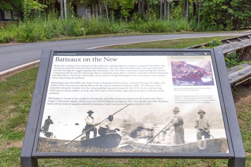
Batteaux on the New
New River Gorge National River
| — | National Park Service, U.S. Department of the Interior | — |
Photographed by J. J. Prats, July 25, 2021
1. Batteaux on the New Marker
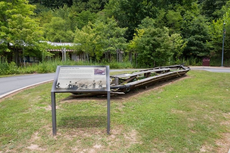
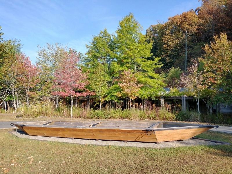
Before the coming of the railroad and the whitewater rafting industry, commerce along the New River was carried by long, flat-bottomed boats called batteaux. The New River has always been an important travel corridor through the rugged Appalachian Mountains. The New River watershed helped bridge the Eastern Continental Divide and the Mississippi River, joining the James River’s Atlantic watershed with the Kanawha and Ohio Rivers. From the earliest days of our nation, George Washington had envisioned a cross-country canal route along this pathway.
Beginning in the mid-1800s, the Army Corps of Engineers blasted sluice channels through the ledges and rapids of the New and Greenbrier Rivers for the use of commercial batteau traffic. The batteaux were propelled along the shallow river by crews pushing long poles along the side of the boats, and steering with long sweeping rudders at each end. The boats carried lumber, agricultural produce, and mercantile products.
Washington’s dream of the southern Chesapeake and Ohio Canal was dashed by the Lower New River Gorge’s whitewater rapids, which were too wild for batteau
this page online
[Sidebar:]
The name batteau derives from the French word bateau, meaning boat. The plural form is Batteaux.
Many of the captains and crews of the New River batteaux were African Americans.
Thirty feet long and constructed of white oak, the “Minner” is a historic reproduction built in 2005. This boat was used in historic reenactments and for recreational trips on the New River at Hinton.
Erected by National Park Service, U.S. Department of the Interior.
Topics and series. This historical marker is listed in this topic list: Waterways & Vessels. In addition, it is included in the Chesapeake and Ohio (C&O) Canal series list. A significant historical year for this entry is 1872.
Location. 37° 46.98′ N, 80° 53.844′ W. Marker is near Sandstone, West Virginia, in Summers County. It is on Meadow Creek Road 0.7 miles west of Interstate 64, in the median. The marker stands in front of the New River Gorge National Park Sandstone Visitor Center. Touch for map. Marker is at or near this postal
Photographed by J. J. Prats, July 25, 2021
2. Batteau and Marker

Regionally, this marker is in the Southern Coalfields. It is also in the American South, specifically in the Upper South, in Appalachia, and specifically in Southern Appalachia. Globally, it is in North America, the Western Hemisphere, the Western World, and the Anglosphere. Historically, it finds itself in what was once the territory of the Mississippian Culture.
Other nearby markers. At least 8 other markers are within 6 miles of this marker, measured as the crow flies: Sandstone School (a few steps from this marker); Millstones (within shouting distance of this marker); Lelia Pearl Bragg Laska Chamberlain (approx. 0.7 miles away); William Richmond Homeplace / Sandstone Falls (approx. one mile away); Environmental Engineers (approx. 1.7 miles away); Brooks Overlook-Welcome (approx. 3.3 miles away); Andrew & Charles Lewis March (approx. 4.8 miles away); Fayette County / Summers County (approx. 5.2 miles away). Touch for a list and map of all markers in Sandstone.
Photographed by Tom Bosse, September 21, 2025
3. Batteaux Display
Credits. This page was last revised on February 3, 2026. It was originally submitted on August 10, 2021, by J. J. Prats of Powell, Ohio. This page has been viewed 432 times since then and 52 times this year. Photos: 1, 2. submitted on August 10, 2021, by J. J. Prats of Powell, Ohio. 3. submitted on February 3, 2026, by Tom Bosse of Jefferson City, Tennessee.
