Near Cumberland in Allegany County, Maryland — The American Northeast (Mid-Atlantic)
Folck's Mill
Retaliation Rebuffed
— 1864 Chambersburg Raid —
During the Civil War, retribution by one side for "atrocities” committed against civilians by the other quickly escalated. Confederate Gen. Jubal A. Early, during his 1864 Maryland invasion, demanded that several towns pay "ransoms" or be torched to avenge Union Gen. David Hunter's destruction of houses in the Shenandoah Valley. After Early returned to Virginia, he ordered Gen. John McCausland north to demand a ransom of Chambersburg, Pa. When Chambersburg residents refused, McCausland burned the town on July 31. The timely arrival of Union troops prevented his burning Hancock, Md., and McCausland retreated to Virginia.
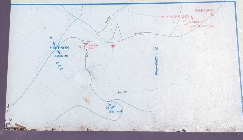
After Confederate forces under Gen. John McCausland burned Chambersburg, Pennsylvania, on July 31, 1864, they began moving back toward the Potomac River. McCausland briefly occupied Hancock, Maryland, but ordered a quick departure when Union Gen. William W. Averell's cavalry command approached. Riding west, with Gen. Bradley T. Johnson's rear guard delaying Averell, McCausland paused briefly about 14 miles east of here at Bevansville to rest his men and horses, then continued west at dawn. The Confederates arrived here the next day, on the afternoon of August 1.
Gen. Benjamin F. Kelley, learning of McCausland's raid and approach to Cumberland, had positioned a blocking force on the hills behind you. His line extended from the hills to your left and along the road behind you to present-day Williams Road. When McCausland deployed his force, his men occupied the high ground on the hill directly in front of you, with skirmishers on the current Hillcrest Cemetery site. Folck's Farm and Mill site was located in the center of the engagement, about where the current entrance ramp from U.S. Rte. 220 joins I-68.
The fight began at about 3 P.M. when the Federals opened fire on McCausland's men. For the next four and a half hours, the shooting continued. McCausland, however, realized that with Averell closing in behind him, he had no choice but to break contact and retreat south. Under cover of darkness, leaving his campfires burning as a decoy, McCausland and his men slipped away southeast toward Oldtown.
Erected 2003 by Maryland Civil War Trails.
Topics. This historical marker is listed in this topic list: War, US Civil. A significant historical date for this entry is July 31, 1864.
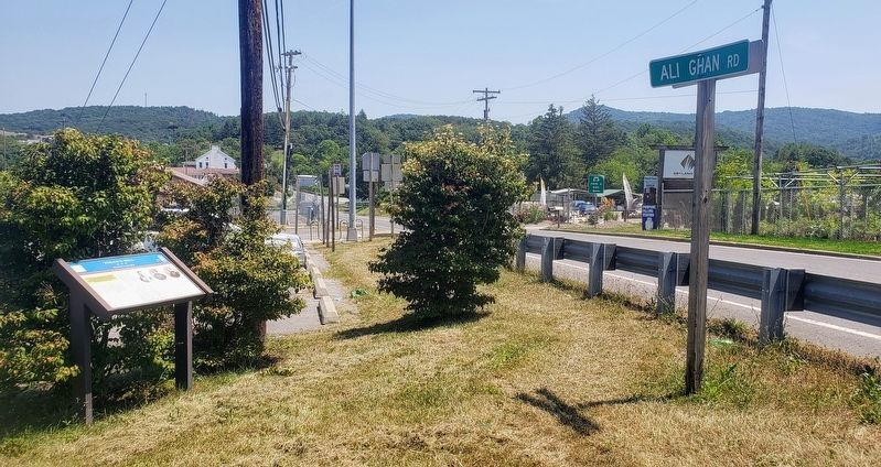
Location. 39° 40.371′ N, 78° 43.651′ W. Marker is near Cumberland, Maryland, in Allegany County. Marker is at the intersection of Ali Ghan Road (County Route 144) and Christie Road NE, on the right when traveling west on Ali Ghan Road. Marker is located at the western edge of the Park and Ride parking lot. Touch for map. Marker is in this post office area: Cumberland MD 21502, United States of America. Touch for directions.
Other nearby markers. At least 8 other markers are within 2 miles of this marker, measured as the crow flies. A different marker also named Folck's Mill (about 700 feet away, measured in a direct line); a different marker also named Folck's Mill (approx. 0.3 miles away); a different marker also named Folck's Mill (approx. 0.3 miles away); Ali Ghan Shriners Legion of Honor (approx. 0.3 miles away); Veterans Memorial (approx. 1˝ miles away); 30th Regiment Infantry U.S.C.T. (approx. 1.7 miles away); Cumberland (approx. 2 miles away); Cumberland Surrenders (approx. 2 miles away). Touch for a list and map of all markers in Cumberland.
Credits. This page was last revised on December 9, 2021. It was originally submitted on July 31, 2021, by Bradley Owen of Morgantown, West Virginia. This page has been viewed 280 times since then and 25 times this year. Last updated on August 10, 2021, by Bradley Owen of Morgantown, West Virginia. Photos: 1, 2, 3. submitted on July 31, 2021, by Bradley Owen of Morgantown, West Virginia. • J. Makali Bruton was the editor who published this page.


