Coupeville in Island County, Washington — The American West (Northwest)
Ebey's Landing National Historical Reserve
Photographed by William Fischer, Jr., August 1, 2021
1. Ebey's Landing National Historical Reserve Marker
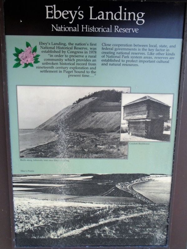
Ebey's Landing, the nation's first National Historical Reserve, was established by Congress in 1978 "in order to preserve a rural community which provides an unbroken historical record from nineteenth century exploration and settlement in Puget Sound to the present time...."
Close cooperation between local, state, and federal governments is the key factor in creating national reserves. Like other kinds of National Park system areas, reserves are established to protect important cultural and natural resources.
[Photo captions, clockwise from top left, read]
• Bluff's along Admiralty Inlet near Ebey's Landing
• Crockett Blockhouse
• Ebey's Prairie
Topics. This historical marker is listed in these topic lists: Parks & Recreational Areas • Settlements & Settlers. A significant historical year for this entry is 1978.
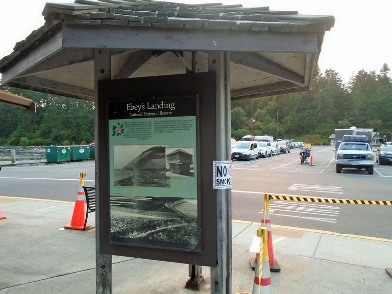
Location. 48° 9.573′ N, 122° 40.355′ W. Marker is in Coupeville, Washington, in Island County. It is on Engle Road (Washington Route 20), on the left when traveling west. Marker is at the Coupeville Ferry Terminal. Touch for map. Marker is in this post office area: Coupeville WA 98239, United States
this page online

Regionally, this marker is in the Puget Sound Region and in Greater Seattle. It is also on the American Pacific Coast, in the Pacific Northwest, and in the Lewis & Clark Corridor. Globally, it is in North America, in the Inside Passage, on the Ring of Fire, on the Pacific Rim, in the Western Hemisphere, in the Western World, and in the Anglosphere.
Other nearby markers. At least 8 other markers are within 4 miles of this marker, measured as the crow flies: Washington State Ferries (here, next to this marker); Northern Olympic Peninsula (here, next to this marker); Guarding the Entrance to Puget Sound – Coast Artillery Corps (approx. 0.3 miles away); The Crockett Blockhouse (approx. 0.9 miles away); Sunnyside (approx. 3½ miles away); A Bold New Idea (approx. 3½ miles away); Ebey Blockhouse (approx. 3½ miles away); Mary Barrett (approx. 3.6 miles away). Touch for a list and map of all markers in Coupeville.
Also see . . . Ebey's Landing National Historical Reserve. (Submitted on August 12, 2021, by William Fischer, Jr. of Reynoldsburg, Ohio.)
Photographed by William Fischer, Jr., August 1, 2021
2. Ebey's Landing National Historical Reserve Marker
Credits. This page was last revised on August 12, 2021. It was originally submitted on August 12, 2021, by William Fischer, Jr. of Reynoldsburg, Ohio. This page has been viewed 319 times since then and 18 times this year. Photos: 1, 2. submitted on August 12, 2021, by William Fischer, Jr. of Reynoldsburg, Ohio.
