Near Mount Morris in Livingston County, New York — The American Northeast (Mid-Atlantic)
Cabin Area C & Caretaker's Cabin
Photographed by Bruce Kelly, August 4, 2021
1. Cabin Area C & Caretaker's Cabin Marker
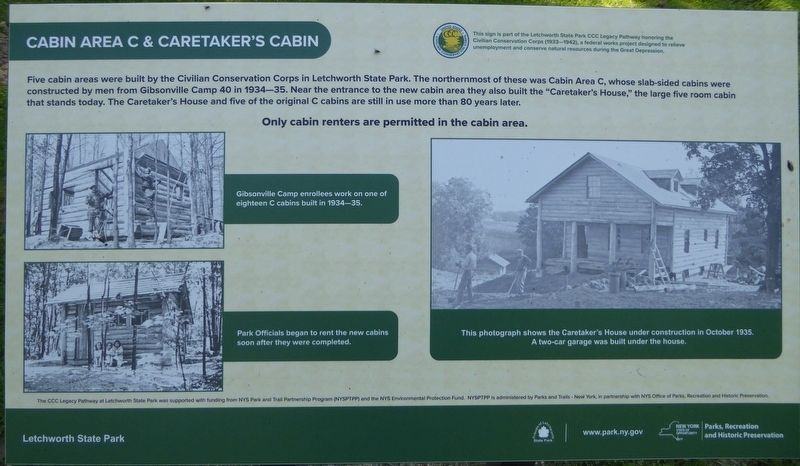
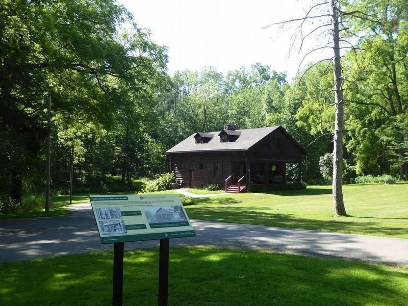
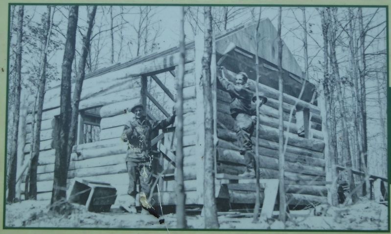
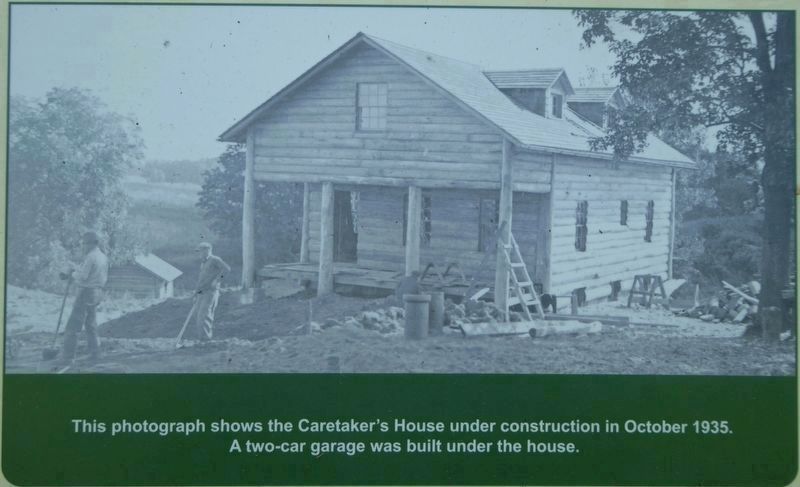
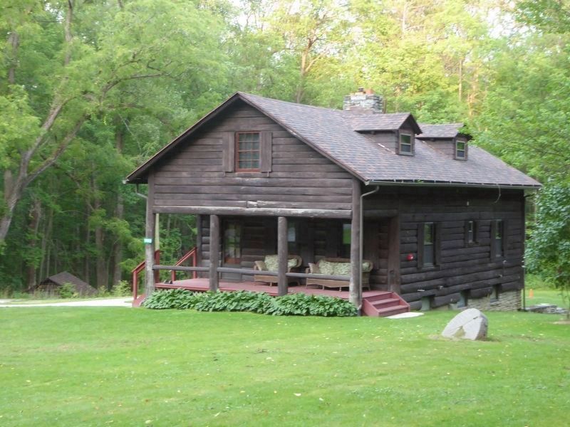
Five cabin areas were built by the Civilian Conservation Corps in Letchworth State Park. The northernmost of these was Cabin Area C, whose slab-sided cabins were constructed by men from Gibsonville Camp 40 in 1934-35. Near the entrance to the new cabin area they also built the “Caretaker's House," the large five room cabin that stands today. The Caretaker's House and five of the original C cabins are still in use more than 80 years later.
Only cabin renters are permitted in the cabin area.
This sign is part of the Letchworth State Park CCC Legacy Pathway honoring the Civilian Conservation Corps (1933–1942), a federal works project designed to relieve unemployment and conserve natural resources during the Great Depression.
Erected 2021 by The CCC Legacy Pathway at Letchworth State Park was supported with funding from NYS Park and Trail Partnership Program (NYSPTPP) and the NYS Environmental Protection Fund. NYSPTPP is administered by Parks and Trails - New York, in partnership with NYS Office of Parks, Recreation and Historic Preservation.
Topics and series. This historical marker is listed in these
this page online
Location. 42° 42.899′ N, 77° 55.877′ W. Marker is near Mount Morris, New York, in Livingston County. It is on Park Road north of Letchworth C Cabins Road, on the right when traveling north. Located in Letchworth State Park. Touch for map. Marker is at or near this postal address: 1980 Park Rd, Mount Morris NY 14510, United States of America. Touch for directions.

Regionally, this marker is in Upstate New York, specifically in Western New York, in the Finger Lakes, and in the Rochester Metropolitan Area. It is also in the American Northeast and in the Mid-Atlantic. Globally, it is in North America, the Western Hemisphere, the Western World, and the Anglosphere. Historically, it finds itself in what was once the Haudenosaunee (Iroquois) Confederacy, New Netherland, and one of the original Thirteen Colonies.
Other nearby markers. At least 8 other markers are within 2 miles of this marker, measured
Photographed by Bruce Kelly, August 4, 2021
2. Cabin Area C & Caretaker's Cabin Marker
The Caretaker's House is in the background.
Also see . . .
1. Letchworth State Park. (Submitted on August 17, 2021, by Michael Herrick of Southbury, Connecticut.)
2. Letchworth State Park (Wikipedia). (Submitted on August 17, 2021, by Michael Herrick of Southbury, Connecticut.)
Photographed by Bruce Kelly, August 4, 2021
3. Photo on the Marker
Gibsonville Camp enrollees work on one of eighteen C cabins built in 1934–35.
Photographed by Bruce Kelly, August 4, 2021
4. Photo on the Marker
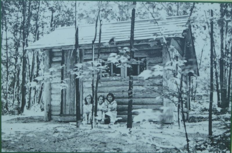
Park Officials began to rent the new cabins soon after they were completed.
Photographed by Bruce Kelly, August 4, 2021
5. Photo on the Marker
This photograph shows the Caretaker's House under construction in October 1935.
A two-car garage was built under the house.
Photographed by Bruce Kelly, August 13, 2021
6. The Caretaker's House
Credits. This page was last revised on April 22, 2025. It was originally submitted on August 13, 2021, by Bruce Kelly of Perry, New York. This page has been viewed 527 times since then and 50 times this year. Photos: 1, 2, 3, 4, 5, 6. submitted on August 13, 2021, by Bruce Kelly of Perry, New York. • Michael Herrick was the editor who published this page.
