
Port Townsend in Jefferson County, Washington — The American West (Northwest)
Preservation
Hidden History
Photographed by William Fischer, Jr., August 1, 2021
1. Preservation Marker
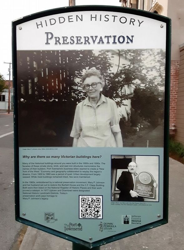
Why are there so many Victorian buildings here?
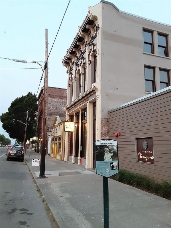
Many of the historical buildings around you were built in the 1880s and 1890s. The facades of these ornate stone, brick, and cast iron structures memorialize the names of their builders. Port Townsend's business elite aspired to create a "New York of the West." Economy and geography collaborated to waylay the region's dreams. From 1900 to 1960 was a period of quiet. Urban development largely ceased. While most buildings remained intact, few were maintained.
In the 1960s, emboldened by a national preservation movement, Mary P. Johnson and her husband set out to restore the Bartlett House and the C.F. Clapp Building. Both were then listed on the National Register of Historic Places and their work proved a catalyst. In 1977 Uptown and Downtown were designated National Historic Landmark Districts. Today's preservation work pays homage to Mary P. Johnson's legacy.
[Photo captions, top to bottom, read]
• Mary P. Johnson, circa 1960s.
• Mayor Joe Steve with City Hall Plaque, circa 1971.
Erected 2021 by Main Street Port Townsend, City of Port Townsend, Olympic Peninsula
this page online
Topics and series. This historical marker is listed in these topic lists: Charity & Public Work • Settlements & Settlers • Women. In addition, it is included in the Washington, Port Townsend, Hidden History series list. A significant historical year for this entry is 1900.
Location. 48° 6.895′ N, 122° 45.307′ W. Marker is in Port Townsend, Washington, in Jefferson County. It is on Water Street just east of Adams Street, on the right when traveling east. Touch for map. Marker is at or near this postal address: 725 Water Street, Port Townsend WA 98368, United States of America. Touch for directions.

Regionally, this marker is in Washington’s Olympic Peninsula. It is also on the American Pacific Coast, in the Pacific Northwest, and in the Lewis & Clark Corridor. Globally, it is in North America, the Pacific Rim, the Western Hemisphere, the Western World, and the Anglosphere.
Other nearby markers. At least 8 other markers are within walking distance of this marker: Fowler Building (within shouting distance of this marker); The Leader Building (within shouting distance
Photographed by William Fischer, Jr., August 1, 2021
2. Preservation Marker
Also see . . .
1. Preservation. PT History website entry (Submitted on August 16, 2021, by William Fischer, Jr. of Reynoldsburg, Ohio.)
2. City of Port Townsend Historic Preservation Committee. City website entry (Submitted on August 15, 2021, by William Fischer, Jr. of Reynoldsburg, Ohio.)
3. Port Townsend Main Street Program. Program website homepage (Submitted on August 15, 2021, by William Fischer, Jr. of Reynoldsburg, Ohio.)
4. Port Townsend's Hidden History. PT History website entry (Submitted on August 15, 2021, by William Fischer, Jr. of Reynoldsburg, Ohio.)
5. Bartlett House National Register Nomination. National Archives Catalogue website entry (Submitted on August 15, 2021, by William Fischer, Jr. of Reynoldsburg, Ohio.)
6. Port Townsend Historic District National Register Nomination. National Archives catalogue website entry (Submitted on August 15, 2021, by William Fischer, Jr. of Reynoldsburg, Ohio.)
Credits. This page was last revised on December 4, 2021. It was originally submitted on August 15, 2021, by William Fischer, Jr. of Reynoldsburg, Ohio. This page has been viewed 270 times since then and 56 times this year. Photos: 1, 2. submitted on August 15, 2021, by William Fischer, Jr. of Reynoldsburg, Ohio.
