
South Boston in Suffolk County, Massachusetts — The American Northeast (New England)
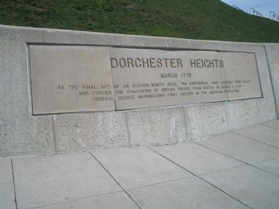
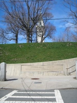
Dorchester Heights
March 1776
Photographed by Bill Coughlin, April 14, 2009
1. Dorchester Heights Marker
As the final act of an eleven month siege, the Continental Army occupied these heights and forced the evacuation of British troops from Boston on March 17, 1776 – General George Washington’s first victory in the American Revolution.
Topics. This historical marker is listed in these topic lists: Notable Events • War, US Revolutionary. A significant historical date for this entry is March 17, 1788.
Location. 42° 20.011′ N, 71° 2.741′ W. Marker is in Boston, Massachusetts, in Suffolk County. It is in South Boston. It can be reached from the intersection of Thomas Park and Pacific Street, on the left when traveling west. Marker is located at the entrance to Dorchester Heights National Historic Site in Thomas Park in South Boston. Touch for map. Marker is at or near this postal address: 15 Pacific St, South Boston MA 02127, United States of America. Touch for directions.

Regionally, this marker is in Massachusetts’ Historic Boston. It is also in the American Northeast and in New England. Globally, it is in the North Atlantic Region, North America, the Western Hemisphere, the Western World, and the Anglosphere. Historically,
this page online
Other nearby markers. At least 8 other markers are within 2 miles of this marker, measured as the crow flies: American Redoubts (within shouting distance of this marker); a different marker also named Dorchester Heights (within shouting distance of this marker); On these Heights (within shouting distance of this marker); Gen. Henry Knox Trail (about 300 feet away, measured in a direct line); Dorchester Heights • Thomas Park (about 500 feet away); Edward J. McCormack, Jr. Bathhouse (approx. half a mile away); Nook Hill (approx. 0.7 miles away); U.S.S. Kearsarge Memorial Rededication (approx. 1.1 miles away). Touch for a list and map of all markers in Boston.
Related markers. Click here for a list of markers that are related to this marker. These related markers are all related to high strategic artillery locations used on Evacuation Day March 17, 1776 to drive the British from Boston Harbor and Back Bay.
Also see . . .
1. Dorchester Heights. Boston National Historical Park website. (Submitted on April 14, 2009, by Bill Coughlin of Woodland Park, New Jersey.)
2. Map of the Siege of Boston.
Photographed by Bill Coughlin, April 14, 2009
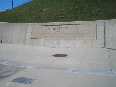
2. Marker at Dorchester Heights Nat'l Historic Site
This map depicts the Boston area in 1775-1776. The main feature is an overlaid version of a 1775-era map. It depicts the much smaller coastline of the Boston Harbor and Charles River areas during that time period. The fortifications built by the Continental and British forces are highlighted.(Submitted on March 18, 2026, by G.W.Bartlett of Hingham, Massachusetts.)
Photographed by Bill Coughlin, April 14, 2009
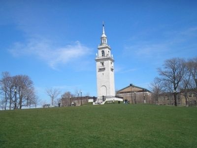
3. Dorchester Heights Monument
This white marble Georgian revival tower located at the summit of Dorchester Heights commemorates the Continental Army's 1776 victory.
Photographed by Bill Coughlin, April 14, 2009
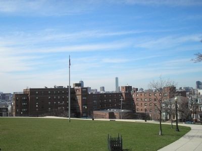
4. View from Dorchester Heights
This photo demonstrates the strategic importance of the placement of artillery on these heights.
Photographed by Bill Coughlin, April 14, 2009
5. Dorchester Heights Marker
This second similar marker is located at the western entrance to Dorchester Heights National Historic Site.

Photographed by G.W.Bartlett, March 14, 2026
6. Gen. Washington at Dorchester Heights
General George Washington at Dorchester Heights above Castle William and the British Fleet. Boston Museum of Fine Arts. Copy also at
Faneuil Hall Congress Hall.
Credits. This page was last revised on March 20, 2026. It was originally submitted on April 14, 2009, by Bill Coughlin of Woodland Park, New Jersey. This page has been viewed 2,035 times since then and 84 times this year. Last updated on March 18, 2026, by G.W.Bartlett of Hingham, Massachusetts. Photos: 1, 2, 3, 4, 5. submitted on April 14, 2009, by Bill Coughlin of Woodland Park, New Jersey. 6. submitted on March 17, 2026, by G.W.Bartlett of Hingham, Massachusetts. • Devry Becker Jones was the editor who published this page.
