Port Townsend in Jefferson County, Washington — The American West (Northwest)
Union Wharf: A Century of Continuous Service
Inscription.
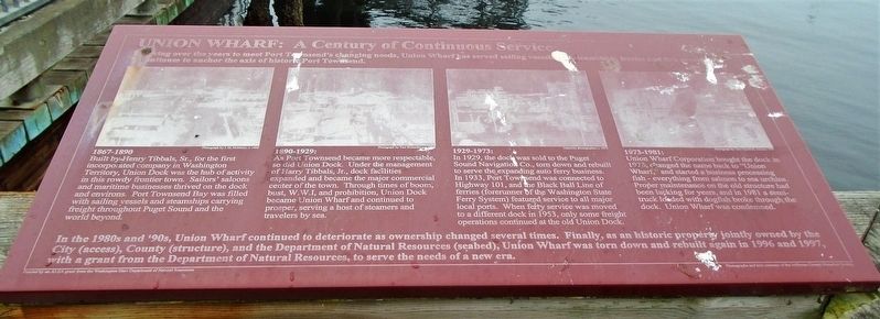
Evolving over the years to meet Port Townsend's changing needs, Union Wharf has served sailing vessels and steamships, ferries and fish processors.
It continues to anchor the axis of historic Port Townsend.
1867-1890:
Built by Henry Tibbals, Sr., for the first incorporated company in Washington Territory, Union Dock was the hub of activity in this rowdy frontier town. Sailors' saloons and maritime businesses thrived on the dock and environs. Port Townsend Bay was filled with sailing vessels and steamships carrying freight throughout Puget Sound and the world beyond.
1890-1929:
As Port Townsend became more respectable, so did Union Dock. Under the management of Harry Tibbals, Jr., dock facilities expanded and became the major commercial center of the town. Through times of boom, bust, W.W.I, and prohibition, Union Dock became Union Wharf and continued to prosper, serving a host of steamers and travelers by sea.
1929-1973:
In 1929, the dock was sold to the Puget Sound Navigation Co., torn down and rebuilt to serve the expanding auto ferry business. In 1933, Port Townsend was connected to Highway 101, and the Black Ball Line of ferries (forerunner of the Washington State Ferry System) featured service to all major local ports. When ferry service was moved to a different dock in 1953, only some freight operations continued at the old Union Dock.
1973-1981:
Union Wharf Corporation bought the dock in 1973, changed the name back to "Union Wharf," and started a business processing fish - everything from salmon to sea urchins. Proper maintenance on the old structure had been lacking for years, and in 1981 a semi-truck loaded with dogfish broke through the dock. Union Wharf was condemned.
In the 1980s and '90s, Union Wharf continued to deteriorate as ownership changed several times. Finally, as an historic property jointly owned by the City (access), County (structure), and the Department of Natural Resources (seabed), Union Wharf was torn down and rebuilt again in 1996 and 1997, with a grant from the Department of Natural Resources, to serve the needs of a new era.
Erected by Washington State Department of Natural Resources.
Topics. This historical marker is listed in this topic list: Man-Made Features. A significant historical year for this entry is 1929.
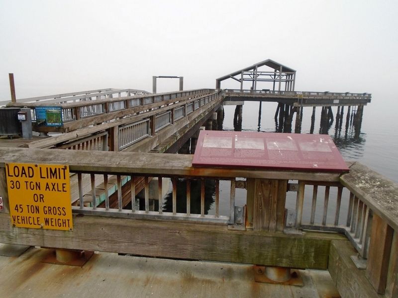
Location. 48° 6.827′ N, 122° 45.362′ W. Marker is in Port Townsend, Washington, in Jefferson County. Marker is on Taylor Street south of Water Street, on the right when traveling south. Marker is at the entrance to Union Wharf. Touch for map. Marker is in this post office area: Port Townsend WA 98368, United States of America. Touch for directions.
Other nearby markers. At least 8 other markers
are within walking distance of this marker. Welcome to Port Townsend: Washington's Victorian Seaport (a few steps from this marker); Port Townsend's Waterfront (within shouting distance of this marker); Bounty of the Bay (within shouting distance of this marker); Union Wharf (within shouting distance of this marker); Union Wharf / Indian Island (within shouting distance of this marker); Hastings Building (within shouting distance of this marker); The Belmont (within shouting distance of this marker); Citizens Independent Telephone Company (about 300 feet away, measured in a direct line). Touch for a list and map of all markers in Port Townsend.
Also see . . . History of Port Townsend WA. (Submitted on August 16, 2021, by William Fischer, Jr. of Scranton, Pennsylvania.)
Credits. This page was last revised on August 16, 2021. It was originally submitted on August 16, 2021, by William Fischer, Jr. of Scranton, Pennsylvania. This page has been viewed 197 times since then and 19 times this year. Photos: 1, 2. submitted on August 16, 2021, by William Fischer, Jr. of Scranton, Pennsylvania.

