Port Townsend in Jefferson County, Washington — The American West (Northwest)
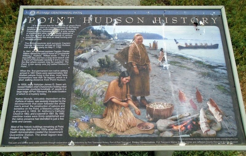
Point Hudson History
Rotary Centennial Path
It is believed that for thousands of years Point Hudson was used as a seasonal home by the Native American tribes, particularly Klallam and Chemakum. Presence of a freshwater lagoon, a wide variety of shellfish and other seafood easily obtained at low tide as well as an abundance of various waterfowl made this area an ideal hunting and foraging ground.
The British explorer and surveyor Captain George Vancouver arrived at Point Hudson with a landing party on May 7, 1792.
In 1841, an American explorer Captain Charles Wilkes named the point of honor of Commander William L. Hudson. Wilkes wrote: "...This is a beautiful Bay and has a long level beach with a Pond of Freshwater backing it and a run into the Bay where vessels may be supplied. The Point, a low sandy one [is] called Hudson's Point..."
When the first permanent non-native settlers arrived in 1851 there were approximately 500 Klallam people living in the area, most likely somewhere near Kah Tai lagoon; which is a short walking distance from Point Hudson.
In 1859, early historian James G. Swan witnessed Klallam chief Chetzemoka holding tribal ceremonies involving hundreds of people in a large lodge in Port Townsend, the exact location of which is a mystery today.
Native lifestyle, intricately dependent on the rhythms of nature, was severely impacted by the developments that soon followed the white man's arrival: the construction of saloons and bordellos on the Point, a Masonic Lodge and a shipyard in 1859, St. Anthony's Catholic Church in 1862, and a sawmill in 1881. By 1890, maritime trades were firmly established and the native presence had dwindled to just a few tents and canoes.
Most of the historic buildings remaining in Port Townsend['s Point Hudson] today date from the 1930s when the U.S. Health Administration created the Government Quarantine Station. The small lagoon was dredged in 1934.
Erected 2006 by Port Townsend Rotary, Port of Port Townsend, Printery Communications, Port Townsend Marine Science Center and Jeff Co Historical Society.
Topics. This historical marker is listed in these topic lists: Environment • Native Americans • Settlements & Settlers. A significant historical date for this entry is May 7, 1792.
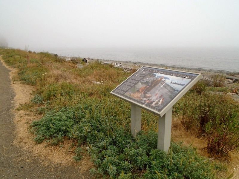
Location. 48° 7.136′ N, 122° 45.077′ W. Marker is in Port Townsend, Washington, in Jefferson County. Marker is on Hudson Street north of Jefferson Street, on the right when traveling north. Marker is along the Rotary Centennial Beach Trail. Touch for map. Marker is in this post office area: Port Townsend WA 98368, United States of America. Touch for directions.
Other nearby markers. At least 8 other markers are within walking distance of this marker. Hudson Beach / Big Heart (within shouting distance of this marker); U.S. Coast Guard Memorial (about 300 feet away, measured in a direct line); Korean War Memorial (about 400 feet away); Point Hudson Shoreline (about 400 feet away); Point Hudson (about 600 feet away); a different marker also named Point Hudson (approx. 0.2 miles away); Sailing Ships (approx. 0.2 miles away); The čičməhán Trail (approx. 0.2 miles away). Touch for a list and map of all markers in Port Townsend.
Also see . . .
1. Point Hudson Preservation Plan (2020). (Submitted on August 18, 2021, by William Fischer, Jr. of Scranton, Pennsylvania.)
2. Point Hudson (Jamestown S'Klallam Tribe). (Submitted on August 18, 2021, by William Fischer, Jr. of Scranton, Pennsylvania.)
Credits. This page was last revised on August 18, 2021. It was originally submitted on August 18, 2021, by William Fischer, Jr. of Scranton, Pennsylvania. This page has been viewed 258 times since then and 76 times this year. Photos: 1, 2. submitted on August 18, 2021, by William Fischer, Jr. of Scranton, Pennsylvania.

