Stratford in Garvin County, Oklahoma — The American South (West South Central)
Ozark Trail Pyramid
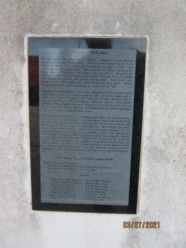
By 1916, plans were underway to promote a network of roads through Oklahoma called the "Ozark Trail". The trails were planned by the Ozark Trail Association. Its mission was to promote a system of better roads connection the surrounding states. These were the first roads to be classed as public supported highways. Early plans were "grandiose". Originally the Ozark Trail was to be a link from ocean to ocean. The route was to be marked with impressive pyramids and concrete mileage posts. These roads were intended to be "above high water, hard surfaced, and later oiled". Routes increased rapidly as towns competed to be included on the Trail.
The Ozark Trail Pyramind was one of many marking the trail for travelers in the early 1920's. Oklahoma trails crossed the state east to west and north to south, they have either become U.S. Highways or follow the same course, such as US 60, US 62, OK 9, the famous "Route 66", and the current Turner Turnpike. This pyramid was one of several placed on the trail from Tulsa to Dallas. Chandler, Meeker, Shawnee, and Sulphur also had identical pyramids marking the trail along this particular route.
Work began on the Stratford Pyramid in December 1921. The buried base was six feet square the next section was four feet square, the top tapered and stood twenty two feet high. The original pyramid stood in the center of Main and Hyden Streets, which is only 1/2 block to the east. Due to traffic and safety reasons, this replica pyramid could not be in the original location. It was constructed close to the original site as possible. "Ozark Trail" appeared on all four sides of the upper part of the pyramid and each side listed the mileage for the next towns along the route. In April 1923, the pyramid was wired and lighted. In the early 1940's it was pushed over and buried where it stood. In the early 1970's, its pieces were exhumed, partially restored, and now stands on a private ranch near Stratford. One other "original" pyramid, which is presumed to be the Chandler pyramid, is located west of Stroud off Highway 66.
This "replica" was erected in the summer of 1997
Research Planning Construction:
Bob Phillips, Dick Castile, Gilbert Boswood, Gene Stone, Mike Mosley, Jess Mosley and Nita Lofton
Donors:
Robert & Evylene Phillips Leonard & Martha Freeman Ken & Anna Wallace Carroll & Nita Lofton Astor & Myrile Jones Deborah Sagebiel W.N. & Lueille Guest BancFirst Jack & Gladys Eldridge Baxter & Patsy Gray Leon & Pearl Morris Evan & Peggy Jones Scott & Lesta Muse Rick & Lisa Griffin Duane & Linda Rosson Southwestern Bell
Erected 1997.
Topics. This historical marker is listed in these topic lists: Charity & Public Work • Roads & Vehicles. A significant historical year for this entry is 1916.
Location. 34° 47.729′ N, 96° 57.789′ W. Marker is in Stratford, Oklahoma, in Garvin County. Marker is on West Main Street east of Maple Avenue, on the left when traveling west. Touch for map. Marker is at or near this postal address: 141 W Main St, Stratford OK 74872, United States of America. Touch for directions.
Credits. This page was last revised on August 30, 2021. It was originally submitted on August 19, 2021, by Jason Armstrong of Talihina, Oklahoma. This page has been viewed 272 times since then and 33 times this year. Photos: 1. submitted on August 19, 2021, by Jason Armstrong of Talihina, Oklahoma. 2. submitted on August 20, 2021, by Jason Armstrong of Talihina, Oklahoma. • Bill Pfingsten was the editor who published this page.

