New Madrid in New Madrid County, Missouri — The American Midwest (Upper Plains)
A Growing State...A Shrinking County
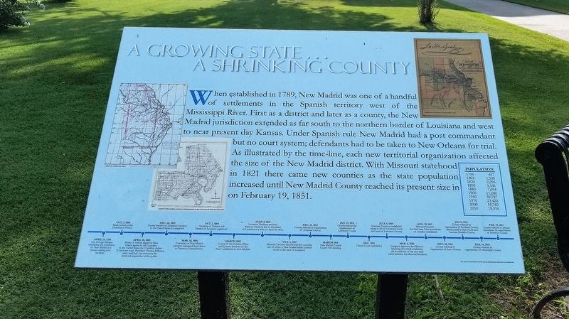
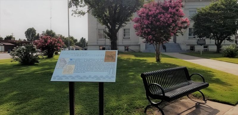
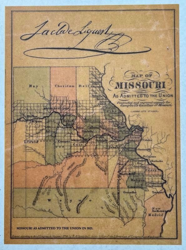
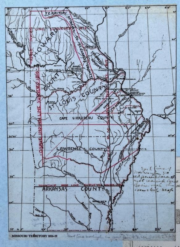
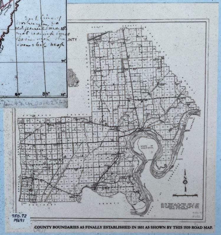
When established in 1789, New Madrid was one of a handful of settlements in the Spanish territory west of the Mississippi River. First as a district and later as a county, the New Madrid jurisdiction extended as far south to the northern border of Louisiana and west to near present day Kansas. Under Spanish rule New Madrid had a post commandant not a court system; defendants had to be taken to New Orleans for trial. As illustrated by the time-line, each new territorial organization affected the size of the New Madrid district. With Missouri statehood in 1821 there came new counties as the state population increased until New Madrid County reached its present size in on February 19, 1851.
April 14, 1798
Col. George Morgan establishes the settlement of New Madrid at a former trading post location.
Oct. 1, 1800
Spain secretly cedes Louisiana to France
April 30, 1803
Treaty of cession signed in Paris. France agrees to sell Louisiana to the United States for 15 million dollars (3 cents per acre). President Thomas Jefferson waits until July 4 to announce the territorial acquisition to the public.
Dec. 20, 1803
Formal transfer of Louisiana Territory to the United States.
Mar, 18, 1804
Ceremony at New Madrid transfers command from Spain to France to United States.
Oct. 1, 1804
Territory of Orleans and District of Louisiana organized.
March 1805
Courts of common Pleas and Quarter-Session of the Peace established at New Madrid.
June 4, 1812
Louisiana Territory renamed Missouri Territory due to admission of Louisiana as a state on April 30, 1812.
Oct.1, 1812
Missouri Territory divided into five counties, one of which extends south to the state of Louisiana.
Dec. 31, 1813
County reduced by organization of Arkansas County
March 1814
New Madrid County Court's first meeting
Jan. 15, 1815
County reduced by organization of Lawrence County
Dec. 1815
Circuit Court established
July 4, 1819
Arkansas Territory established taking in all of Arkansas County and most of Lawrence County.
Mar. 6, 1820
Congress approves the Missouri Enabling Act which establishes the boundaries of the new state which includes the Missouri Bootheel.
Aug. 10, 1821
Missouri becomes the 24th state. New boundaries of counties established.
Dec. 28, 1827
County reduced by organization of Scott County.
Jan. 2, 1835
County reduced by organization of Stoddard County, which includes what would later become Dunklin County.
Feb. 14, 1845
County reduced by organization of Mississippi County
Feb. 18, 1851
County reduced to present boundaries by organization of Pemiscot County.
Topics. This historical marker is listed in this topic list: Political Subdivisions.
Location. 36° 35.263′ N, 89° 31.633′ W. Marker is in New Madrid, Missouri, in New Madrid County. Marker is on Main Street south of Virginia Avenue, on the right when traveling south. Touch for map. Marker is in this post office area: New Madrid MO 63869, United States of America. Touch for directions.
Other nearby markers. At least 8 other markers are within walking distance of this marker. 1854 Courthouse (a few steps from this marker); Harry S. Truman (within shouting distance of this marker); a different marker also named Harry S. Truman (within shouting distance of this marker); Higgerson School (approx. 0.2 miles away); Battle of Island No. 10 (approx. ¼ mile away); Bissell's Submergible Saw (approx. ¼ mile away); Fort Bankhead (approx. ¼ mile away); New Madrid (approx. 0.3 miles away). Touch for a list and map of all markers in New Madrid.
Credits. This page was last revised on March 20, 2024. It was originally submitted on August 21, 2021, by Cajun Scrambler of Assumption, Louisiana. This page has been viewed 200 times since then and 21 times this year. Photos: 1, 2. submitted on August 21, 2021, by Cajun Scrambler of Assumption, Louisiana. 3, 4, 5, 6. submitted on March 20, 2024, by Craig Swain of Leesburg, Virginia.
