Pacific Palisades in Los Angeles in Los Angeles County, California — The American West (Pacific Coastal)
Rustic Canyon Eucalyptus Grove
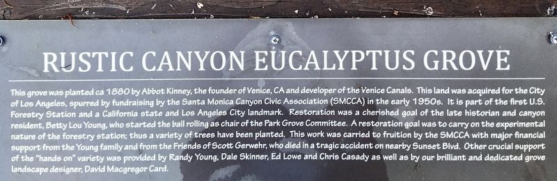
Photographed by Craig Baker, July 28, 2021
1. Rustic Canyon Eucalyptus Grove Marker
Erected 2014 by City of Los Angeles.
Topics. This historical marker is listed in
this page online
Location. 34° 2.244′ N, 118° 30.916′ W. Marker is in Los Angeles, California, in Los Angeles County. It is in Pacific Palisades. It can be reached from Latimer Road north of Hilltree Road, on the left when traveling north. Located near the parking lot of Rustic Canyon Recreation Center. Touch for map. Marker is at or near this postal address: 601 Latimer Rd, Santa Monica CA 90402, United States of America. Touch for directions.

Regionally, this marker is in California’s Transverse Ranges. It is also on the American Pacific Coast. Globally, it is in North America, on the Ring of Fire, on the Pacific Rim, in the Western Hemisphere, in the Western World, and in the Anglosphere. Historically, it finds itself in what was once New Spain and also Mexico’s Alta California.
Other nearby markers. At least 8 other markers are within walking distance of this marker: Santa Monica Forestry Station (within shouting distance of this marker); Uplifters Clubhouse (within shouting distance of this marker); Ysidro Reyes Adobe

Photographed by Craig Baker, July 28, 2021
2. Rustic Canyon Eucalyptus Grove
Credits. This page was last revised on April 5, 2023. It was originally submitted on August 21, 2021, by Craig Baker of Sylmar, California. This page has been viewed 1,072 times since then and 64 times this year. Photos: 1, 2. submitted on August 21, 2021, by Craig Baker of Sylmar, California.
