Near Church Road in Dinwiddie County, Virginia — The American South (Mid-Atlantic)
Five Forks Battlefield
Photographed by Bill Coughlin, April 24, 2007
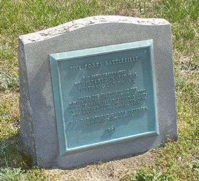
1. Five Forks Battlefield Marker
National Register of Historic Places Nomination Form
Click for more information.
Click for more information.
Registered National
Historic Landmark
under the provisions of the
Historic Sites Act of August 21, 1935.
This site possesses exceptional value
in commemorating and illustrating
the history of the United States.
Erected 1961 by U.S. Department of the Interior National Park Service.
Topics and series. This historical marker is listed in this topic list: War, US Civil. In addition, it is included in the National Historic Landmarks series list. A significant historical year for this entry is 1935.
Location. 37° 8.354′ N, 77° 37.369′ W. Marker is near Church Road, Virginia, in Dinwiddie County. It is on White Oak Road (Virginia Route 613), on the left when traveling west. Marker is in the Five Forks Unit of the Petersburg National Battlefield, at the Five Forks intersection. Touch for map. Marker is at or near this postal address: 645 Wheelers Pond Rd, Church Road VA 23833, United States of America. Touch for directions.

Regionally, this marker is in the Piedmont, in Southside Virginia, and specifically in Central Virginia. It is also in the American South and specifically in the Upper South. Globally,
this page online
Other nearby markers. At least 8 other markers are within walking distance of this marker: The Battle of Five Forks (within shouting distance of this marker); a different marker also named Battle of Five Forks (within shouting distance of this marker); "Hold Five Forks at all hazards…" (within shouting distance of this marker); Death of Pegram (within shouting distance of this marker); "We had moved up to the edge of the timber..." (about 300 feet away, measured in a direct line); "While dashing forward..." (approx. 0.2 miles away); "The woods were quite heavy..." (approx. ¼ mile away); "Advanced…repulsed…charged again…" (approx. 0.3 miles away). Touch for a list and map of all markers in Church Road.
Another marker is no longer nearby. Digging In (was within shouting distance of this marker but has been replaced with another marker now
Photographed by Bill Coughlin, April 24, 2007
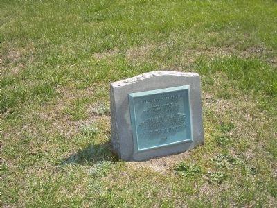
2. National Historic Landmark
The marker is on the southeast corner of the Five Forks intersection.
Also see . . .
1. Five Forks Battlefield. Wikipedia entry (Submitted on January 26, 2024, by Larry Gertner of New York, New York.)
2. Battle of Five Forks (Petersburg National Battlefield). National Park Service website entry (Submitted on March 15, 2008, by Bill Coughlin of Woodland Park, New Jersey.)
Photographed by Bill Coughlin, April 24, 2007
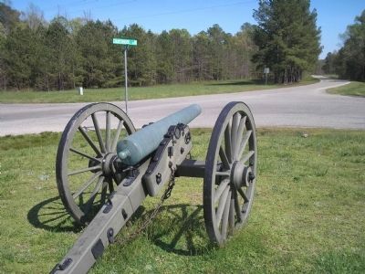
3. Five Forks Battlefield Marker
The marker that commerates the Five Forks Battlefield as a National Historic Landmark is located at the Five Forks intersection where Gen. Sheridan's troops attacked the entrenched Confederates. It is seen here to the left.
Photographed by Craig Swain, circa 1996
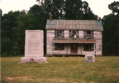
4. The Five Forks Markers and Surrounding Vicinity
The old house was torn down in recent years.
Credits. This page was last revised on January 26, 2024. It was originally submitted on March 15, 2008, by Bill Coughlin of Woodland Park, New Jersey. This page has been viewed 2,124 times since then and 62 times this year. Last updated on August 22, 2021, by Bradley Owen of Morgantown, West Virginia. Photos: 1, 2, 3. submitted on March 15, 2008, by Bill Coughlin of Woodland Park, New Jersey. 4. submitted on March 24, 2008, by Craig Swain of Leesburg, Virginia. • Devry Becker Jones was the editor who published this page.
