Near Dinwiddie in Dinwiddie County, Virginia — The American South (Mid-Atlantic)
Death of Pegram
Petersburg National Battlefield
| — | National Park Service, U.S. Department of the Interior | — |
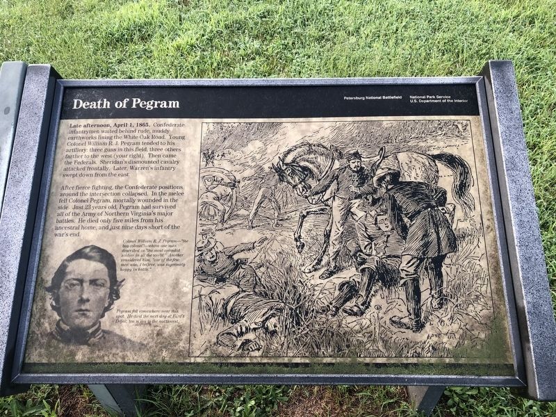
Late afternoon, April 1, 1865. Confederate infantrymen waited behind rude, muddy earthworks lining the White Oak Road. Young Colonel William R.J. Pegram tended to his artillery: three guns in this field, three others farther to the west (your right). Then came the Federals. Sheridan’s dismounted cavalry attacked frontally. Later, Warren’s infantry swept down from the east.
After fierce fighting, the Confederate positions around the intersection collapsed. In the melee fell Colonel Pegram, mortally wounded in the side. Just 23 years old, Pegram had survived all of the Army of Northern Virginia’s major battles. He died only five miles from his ancestral home and just nine days short of the war’s end.
Erected by National Park Service, U.S. Department of the Interior.
Topics. This historical marker is listed in this topic list: War, US Civil. A significant historical date for this entry is April 1, 1935.
Location. 37° 8.372′ N, 77° 37.403′ W. Marker is near Dinwiddie, Virginia, in Dinwiddie County. It is on White Oak Road (Virginia Route 613), on the right when traveling west. The marker stands in the Five Forks Unit of the Petersburg
this page online

Regionally, this marker is in the Piedmont, in Southside Virginia, and specifically in Central Virginia. It is also in the American South and specifically in the Upper South. Globally, it is in North America, the Western Hemisphere, the Western World, and the Anglosphere. Historically, it finds itself in what was once the territory of the Mississippian Culture, one of the original Thirteen Colonies, one of the Confederate States of America, and the Antebellum South.
Other nearby markers. At least 8 other markers are within walking distance of this marker: "Hold Five Forks at all hazards…" (here, next to this marker); Battle of Five Forks (within shouting distance of this marker); Five Forks Battlefield (within shouting distance of this marker); a different marker also named The Battle of Five Forks (within shouting distance of this marker); "We had moved up to the edge of the timber..."
Photographed by Bill Coughlin, April 24, 2007
2. Death of Pegram Marker
The marker before it was replaced by the current iteration. It is identical to the current marker, except that this version had suffered weather damage.
Another marker is no longer nearby. Digging In (was within shouting distance of this marker but has been replaced with another marker now near it).
More about this marker. The lower left of the marker features a photo of Willie Pegram, with the caption Colonel William R.J. Pegram – “the boy colonel” – whom one man described as “the most splendid soldier in all the world.” Another considered him, “one of the few men who, I believe, was supremely happy in battle.”
The right of the marker has a sketch of a wounded Pegram being tended to by some of his men. It has the caption “Pegram fell somewhere near this spot. He died the next day at Ford’s Depot, ten miles to the northwest.”
Also see . . .
1. Five Forks Battlefield. Wikipedia entry (Submitted on February 1, 2024, by Larry Gertner of New York, New York.)
2. Battle of Five Forks (Petersburg National Battlefield).
Photographed by Bill Coughlin, April 24, 2007
4. Markers at the Five Forks Intersection
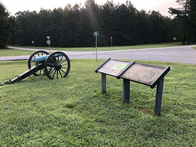
The Death of Pegram marker is, fittingly, located next to a cannon at the Five Forks intersection.
Credits. This page was last revised on February 1, 2024. It was originally submitted on March 15, 2008, by Bill Coughlin of Woodland Park, New Jersey. This page has been viewed 2,333 times since then and 63 times this year. Last updated on August 22, 2021, by Bradley Owen of Morgantown, West Virginia. Photos: 1. submitted on August 22, 2021, by Devry Becker Jones of Washington, District of Columbia. 2. submitted on March 15, 2008, by Bill Coughlin of Woodland Park, New Jersey. 3. submitted on August 22, 2021, by Devry Becker Jones of Washington, District of Columbia. 4. submitted on March 15, 2008, by Bill Coughlin of Woodland Park, New Jersey. • Devry Becker Jones was the editor who published this page.
