Sutherland in Dinwiddie County, Virginia — The American South (Mid-Atlantic)
Rocky Branch School
Sutherland, Virginia
| — | Dinwiddie County | — |
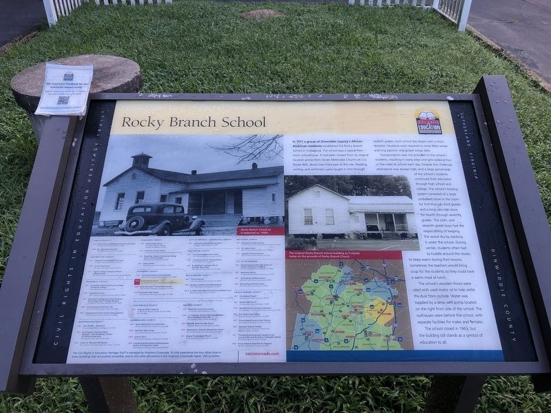
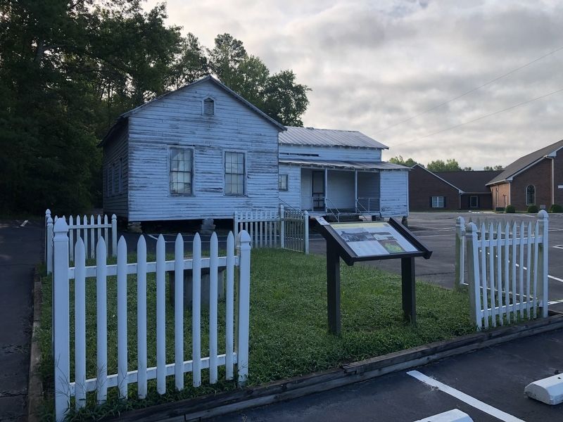
In 1911 a group of Dinwiddie County's African American residents established the Rocky Branch School in Sutherland. The school was a typical two-room schoolhouse. It had been moved from its original location across the Ocran Methodist Church on U.S. Route 460, about two miles east of this site. Reading, writing, and arithmetic were taught in first through seventh grades. Each school day began with a short devotion. Students were required to recite Bible verses and sing patriotic and gospel songs daily.
Transportation was not provided to the school's students, resulting in many boys and girls walking four or five miles to school each day. Despite this challenge, attendance was always high, and a large percentage of the school's students continued their education through high school and college. The school's heating system consisted of a large potbellied stove in the room for first through third grades and a long cast-iron stove for fourth through seventh grades. The sixth- and seventh-grade boys had the responsibility of keeping the wood dry by stacking it under the school. During winter, students often had to huddle
this page online
The school's wooden floors were oiled with used motor oil to help settle the dust from outside. Water was supplied by a deep well pump located on the right front side of the school, with separate facilities for males and females.
The school closed in 1963, but the building stands as a symbol of education to all.
Erected by Civil Rights in Education Heritage Trail. (Marker Number DN2.)
Topics and series. This historical marker is listed in these topic lists: African Americans • Civil Rights • Education • Religion & Religious Structures. In addition, it is included in the Civil Rights in Education Heritage Trail series list. A significant historical year for this entry is 1911.
Location. 37° 11.379′ N, 77° 34.424′ W. Marker is in Sutherland, Virginia, in Dinwiddie County. It is on Rocky Branch Road (Virginia Route 636) 0.3 miles south of Cox Road (U.S. 460), on the left when traveling south. Touch for map. Marker is at or near this postal address: 6009 Rocky Branch

Regionally, this marker is in the Piedmont, in Southside Virginia, and specifically in Central Virginia. It is also in the American South and specifically in the Upper South. Globally, it is in North America, the Western Hemisphere, the Western World, and the Anglosphere. Historically, it finds itself in what was once the territory of the Mississippian Culture, one of the original Thirteen Colonies, one of the Confederate States of America, and the Antebellum South.
Other nearby markers. At least 7 other markers are within 3 miles of this marker, measured as the crow flies: The Battle of Sutherland (approx. 0.7 miles away); Sutherland Station (approx. 0.7 miles away); a different marker also named Sutherland Station (approx. 0.7 miles away); Appomattox Campaign (Sutherland Station) (approx. 0.8 miles away); Col. John Banister (approx. 0.8 miles away); Engagement at Sutherland Station (approx. 1.2 miles away); White Oak Road Engagement (approx. 2.9 miles away). Touch for a list and map of all markers in Sutherland.
Other markers no longer nearby. Rocky Branch School (has been replaced with this marker); Fork Inn (was approx. 0.7 miles away but has been permanently removed); Colonel John Banister (was approx. 0.8 miles away but has been reported to have been replaced with another marker now near it); The Battle of White Oak Road (was approx. 2.9 miles away but has been permanently removed); a different marker also named The Battle of White Oak Road (was approx. 2.9 miles away but has been confirmed missing); a different marker also named The Battle of White Oak Road (was approx. 2.9 miles away but has been confirmed missing); a different marker also named The Battle of White Oak Road (was approx. 3 miles away but has been confirmed missing); a different marker also named The Battle of White Oak Road (was approx. 3 miles away but has been confirmed missing); a different marker also named The Battle of White Oak Road (was approx. 3.1 miles away but has been confirmed missing).
Related marker. Click here for another marker that is related to this marker. Old Marker At This Location also titled "Rocky Branch School".
Credits. This page was last revised on November 5, 2021. It was originally submitted on August 22, 2021, by Devry Becker Jones of Washington, District of Columbia. This page has been viewed 502 times since then and 30 times this year. Photos: 1, 2. submitted on August 22, 2021, by Devry Becker Jones of Washington, District of Columbia.
