Near Petersburg in Dinwiddie County, Virginia — The American South (Mid-Atlantic)
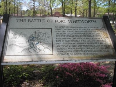
The Battle of Fort Whitworth
Photographed by Bill Coughlin, April 23, 2007
1. The Battle of Fort Whitworth Marker
Topics. This historical marker is listed in this topic list: War, US Civil. A significant historical month for this entry is April 1865.
Location. 37° 12.173′ N, 77° 27.219′ W. Marker is near Petersburg, Virginia, in Dinwiddie County. It is at the intersection of 7th Avenue and Accomack Street, on the right when traveling north on 7th Avenue. The marker is located in a playground on the southeast corner of 7th Avenue and Accomack Street.
this page online

Regionally, this marker is in the Piedmont, in Southside Virginia, and specifically in Central Virginia. It is also in the American South and specifically in the Upper South. Globally, it is in North America, the Western Hemisphere, the Western World, and the Anglosphere. Historically, it finds itself in what was once the territory of the Mississippian Culture, one of the original Thirteen Colonies, one of the Confederate States of America, and the Antebellum South.
Other nearby markers. At least 8 other markers are within walking distance of this marker: Central State Hospital Cemetery (about 600 feet away, measured in a direct line); Siege of Petersburg—Grant's Eighth Offensive (approx. 0.3 miles away); Confederate Fort Whitworth (approx. 0.4 miles away); Confederate Fort Gregg (approx. 0.4 miles away); Fort Gregg (approx. 0.4 miles away); Southside Virginia Training Center (approx. half a mile away); Rohoic Dam (approx. 0.7 miles away); Edge Hill (approx. 0.8 miles away). Touch for a list and map
Photographed by Craig Swain, March 28, 2015
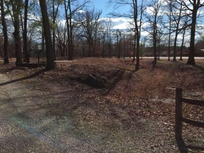
2. The Battle of Fort Whitworth Marker
Marker is between the trees on the left.
Another marker is no longer nearby. Petersburg State Colony for the Negro Insane (was approx. half a mile away but has been replaced with another marker now near it).
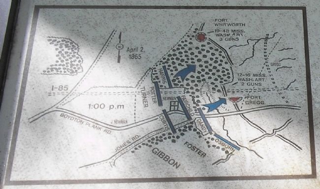
More about this marker. The left of the marker contains a battle map of the April 2, 1865 assault on Forts Gregg and Whitworth.
Photographed by Bill Coughlin, April 23, 2007
3. Battle Map of from Marker
This map shows Union troop movements during the April 2, 1865 attack on Forts Whitworth and Gregg.
Photographed by Craig Swain, March 28, 2015
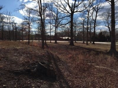
4. Right bastion of Fort Whitworth
Photographed by Craig Swain, March 28, 2015
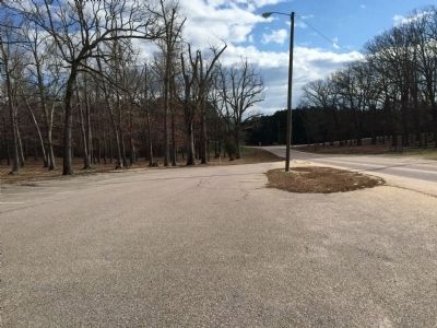
5. The Battle of Fort Whitworth Marker
During the assault of Gibbon's Corps on this section of the Confederate lines, Harris' brigade attacked over the ground between Fort Whitworth and what is today Interstate-85. In this view, looking south down 7th Avenue, the Federal advance went from right to left, through the far tree line screening I-85.
Photographed by Bill Coughlin, April 23, 2007
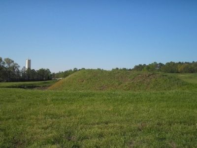
6. Fort Gregg
Confederate Fort Gregg, pictured here, was attacked along with Fort Whitworth by Union forces on April 2, 1865. It is located about ½ mile from the marker.
Credits. This page was last revised on February 2, 2023. It was originally submitted on December 30, 2008, by Bill Coughlin of Woodland Park, New Jersey. This page has been viewed 3,771 times since then and 112 times this year. Last updated on August 22, 2021, by Bradley Owen of Morgantown, West Virginia. Photos: 1. submitted on December 30, 2008, by Bill Coughlin of Woodland Park, New Jersey. 2. submitted on March 31, 2015, by Craig Swain of Leesburg, Virginia. 3. submitted on December 30, 2008, by Bill Coughlin of Woodland Park, New Jersey. 4, 5. submitted on March 31, 2015, by Craig Swain of Leesburg, Virginia. 6. submitted on December 30, 2008, by Bill Coughlin of Woodland Park, New Jersey. • Devry Becker Jones was the editor who published this page.
