Marker Logo
THE HISTORICAL
MARKER DATABASE
“Bite-Size Bits of Local, National, and Global History”
Church Hill in Richmond, Virginia — The American South (Mid-Atlantic)
 

605 N. 25th Street

Pre-1889

— Historic Richmond —


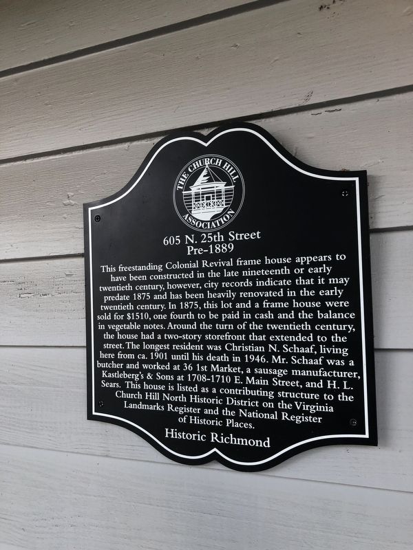
605 N. 25th Street Marker image. Click for full size.
Photographed by Devry Becker Jones (CC0), August 21, 2021
1. 605 N. 25th Street Marker
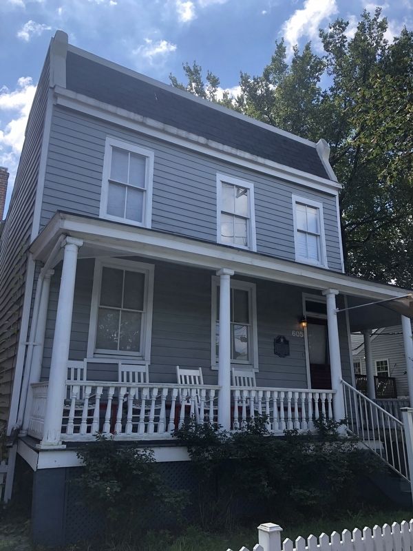
Inscription. This freestanding Colonial Revival frame house appears to have been constructed in the late nineteenth or early twentieth century, however, city records indicate that it may predate 1875 and has been heavily renovated in the early twentieth century. In 1875, this lot and a frame house were sold for $1510, one fourth to be paid in cash and the balance in vegetable notes. Around the turn of the twentieth century, the house had a two-story storefront that extended to the street. The longest resident was Christian N. Schaaf, living here from ca. 1901 until his death in 1946. Mr. Schaaf was a butcher and worked at 36 1st Market, a sausage manufacturer, Kastleberg's & Sons at 1708-1710 E. Main Street, and H.L. Sears. This house is listed as a contributing structure to the Church Hill North Historic District on the Virginia Landmarks Register and the National Register of Historic Places.
 
Erected by The Church Hill Association.
 
Topics. This historical marker is listed in these topic lists: ArchitectureIndustry & Commerce. A significant historical year for this entry is 1875.
 
Location. 37° 32.069′ N, 77° 24.957′ W. Marker
Paid Advertisement
Click or scan to see
this page online
is in Richmond, Virginia. It is in Church Hill. It is on North 25th Street just north of East Leigh Street, on the right when traveling north. Touch for map. Marker is at or near this postal address: 605 N 25th St, Richmond VA 23223, United States of America. Touch for directions.

Regionally, this marker is in Central Virginia. It is also in the American South and specifically in the Upper South. Globally, it is in the North Atlantic Region, North America, the Western Hemisphere, the Western World, and the Anglosphere. Historically, it finds itself in what was once the territory of the Mississippian Culture, one of the original Thirteen Colonies, one of the Confederate States of America, and the Antebellum South.

Other nearby markers. At least 8 other markers are within walking distance of this marker: The J.M. Carter House (a few steps from this marker); a different marker also named The J.M. Carter House (a few steps from this marker); Elliott House (about 500 feet away, measured in a direct line); 2401 E. Clay Street (about 600 feet away); 411 N. 25th Street (about 800 feet away); 2508 E. Marshall Street (approx.
605 North 25th Street image. Click for full size.
Photographed by Devry Becker Jones (CC0), August 21, 2021
2. 605 North 25th Street
0.2 miles away); 420 N. 23rd Street (approx. 0.2 miles away); 411 N. 23rd Street (approx. 0.2 miles away). Touch for a list and map of all markers in Richmond.
 
 
Credits. This page was last revised on February 1, 2023. It was originally submitted on August 23, 2021, by Devry Becker Jones of Washington, District of Columbia. This page has been viewed 246 times since then and 14 times this year. Photos:   1, 2. submitted on August 23, 2021, by Devry Becker Jones of Washington, District of Columbia.

m=180203

CeraNet Cloud Computing sponsors the Historical Marker Database.
This website earns income from purchases you make after using our links to Amazon.com. We appreciate your support.
Paid Advertisement
Jul. 6, 2026