Near Adairsville in Gordon County, Georgia — The American South (South Atlantic)
Oothcaloga Valley
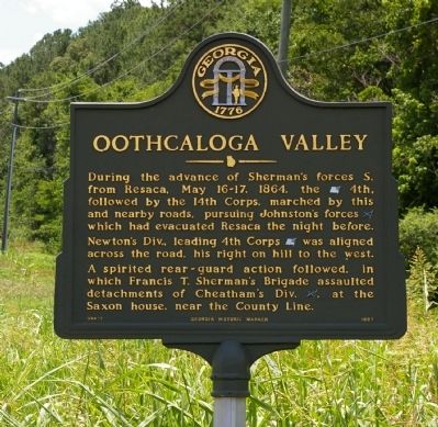
Photographed by David Seibert, June 30, 2008
1. Oothcaloga Valley Marker
During the advance of Sherman's forces S. from Resaca, May 16-17, 1864, the (US) 4th, followed by the 14th Corps, marched by this and nearby roads, pursuing Johnston`s forces (CS) which had evacuated Resaca the night before. Newton's Div., leading 4th Corps (US) was aligned across the road, his right on hill to the west. A spirited rear-guard action followed, in which Francis T. Sherman's Brigade assaulted detachments of Cheatham's Div. (CS) at the Saxon house, near the County Line.
Erected 1997 by Georgia Department of Natural Resources. (Marker Number 064-1.)
Topics and series. This historical marker is listed in this topic list: War, US Civil. In addition, it is included in the Georgia Historical Society series list. A significant historical date for this entry is May 16, 1638.
Location. Marker is missing. It was located near 34° 25.015′ N, 84° 56.148′ W. Marker was near Adairsville, Georgia, in Gordon County. It was at the intersection of Joe Frank Harris Parkway SE (U.S. 41) and Taylor Bridge Road, on the right when traveling south on Joe Frank Harris Parkway SE. Touch for map. Marker was in this post office area: Adairsville
this page online

Regionally, this marker was in Georgia’s Mountains. It was also in the American South, specifically in the Deep South, in Appalachia, and specifically in Southern Appalachia. Globally, it was in North America, the Western Hemisphere, the Western World, and the Anglosphere. Historically, it found itself in what was once the original Cherokee Nation, the territory of the Mississippian Culture, one of the original Thirteen Colonies, one of the Confederate States of America, and the Antebellum South.
Other nearby markers. At least 8 other markers are within 4 miles of this location, measured as the crow flies: Cherokee Nation (approx. 1.2 miles away); Original Site Adairsville — 1830’s (approx. 1.3 miles away); Major John Lewis (approx. 2.3 miles away); Historic Trimble House (approx. 3 miles away); Joe P. Bowdoin, M.D. (approx. 3.4 miles away); Adairsville, Georgia (approx. 3.4 miles away); The Great Locomotive Chase (approx. 3.4 miles away); Mosteller's Mills (approx. 3½ miles away). Touch for a list and map of all markers in Adairsville.
Other markers
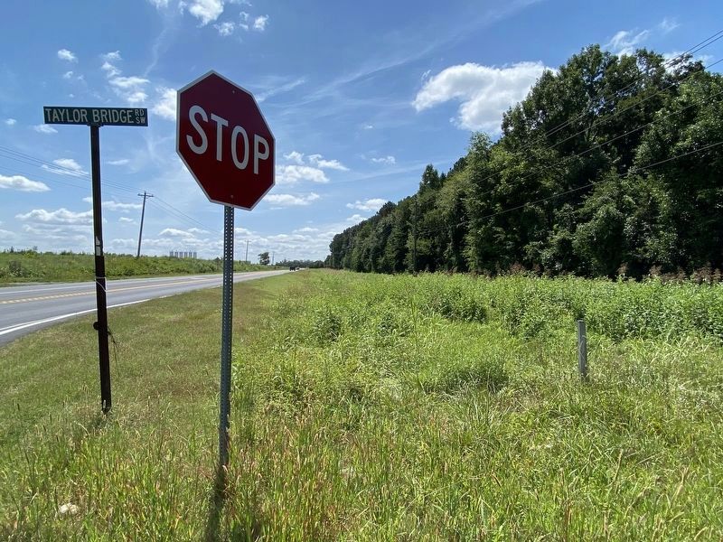
Photographed by Darren Jefferson Clay, August 26, 2021
2. Oothcaloga Valley Marker (missing)
Credits. This page was last revised on August 28, 2021. It was originally submitted on September 2, 2008, by David Seibert of Sandy Springs, Georgia. This page has been viewed 1,973 times since then and 48 times this year. Last updated on August 26, 2021, by Darren Jefferson Clay of Duluth, Georgia. Photos: 1. submitted on September 2, 2008, by David Seibert of Sandy Springs, Georgia. 2. submitted on August 26, 2021, by Darren Jefferson Clay of Duluth, Georgia. • Bernard Fisher was the editor who published this page.
