Emporia, Virginia — The American South (Mid-Atlantic)
Greensville County Training School
Emporia, Virginia
— Greensville County —

Photographed By Devry Becker Jones (CC0), August 27, 2021
1. Greensville County Training School Marker
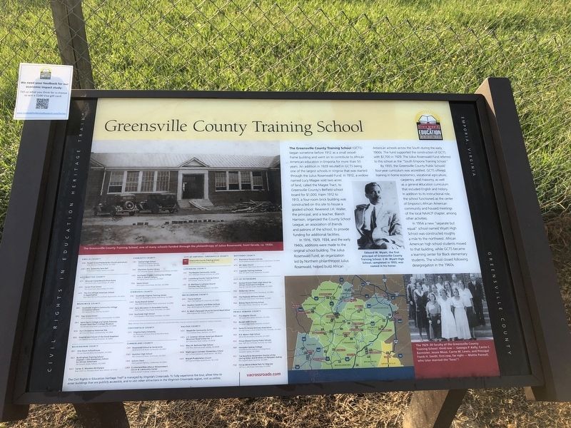
The Greensville County Training School (GCTS) began sometime before 1912 as a small wood-frame building and went on to contribute to African American education in Emporia for more than 50 years. An addition in 1929 resulted in GCTS being one of the largest schools in Virginia that was started through the Julius Rosenwald Fund. In 1912, a widow named Lucy Magee sold two acres of land, called the Magee Tract, to Greensville County's Belfield school board for $1,000. From 1912 to 1913, a four-room brick building was constructed on this site to house a graded school. Reverend J.H. Waller, the principal, and a teacher, Blanch Harrison, organized the County School League, an association of friends and patrons of the school, to provide funding for additional facilities.
In 1916, 1929, 1934, and the early 1940s, additions were made to the original school building. The Julius Rosenwald Fund, an organization led by Northern philanthropist Julius Rosenwald, helped build African American schools across the South during the early 1900s. The fund supported the construction of GCTS with $1,700 in 1929. The Julius Rosenwald Fund referred to this school as the "South Emporia Training School."
By 1933, the Greensville County Public Schools' four-year curriculum was accredited. GCTS offered training in home economics, vocational agriculture, carpentry, and masonry, as well as a general education curriculum that included English and history. In addition to its instructional role, the school functioned as the center of Emporia's African American community and housed meetings of the local NAACP chapter, among other activities.
In 1954 a new "separate but equal" school named Wyatt High School was constructed roughly a mile to the northwest. African American high school students moved to that building, while GCTS became a learning center for Black elementary students. The school closed following desegregation in the 1960s.
[Captions:]
The Greensville County Training School, one of many schools funded through the philanthropy of Julius Rosenwald, front facade, ca. 1930s.
Edward W. Wyatt, the first principal of Greensville County Training School. E.W. Wyatt High School, completed in 1953, was named in his honor.
The 1929-30 faculty of the Greensville County Training School: third row — Georgia P. Kelly, Carrie C. Bannister, Jessie Muse, Carrie M. Lewis, and Principal Frank H. Smith; first row, far right — Mattie Pannell, who later married the "boss"!
Erected by Civil Rights in Education Heritage Trail. (Marker Number GR1.)
Topics and series. This historical marker is listed

Photographed By Devry Becker Jones (CC0), August 27, 2021
2. Greensville County Training School Marker
Location. 36° 41.944′ N, 77° 32.134′ W. Marker is in Emporia, Virginia. Marker is on Ruffin Street just east of North Main Street (U.S. 301), on the left when traveling east. Touch for map. Marker is at or near this postal address: 106 Ruffin St, Emporia VA 23847, United States of America. Touch for directions.
Other nearby markers. At least 8 other markers are within walking distance of this marker. Memorial League WWI Memorial (about 600 feet away, measured in a direct line); Emporia Railroad History (approx. 0.4 miles away); John Day (approx. half a mile away); Fearnought (approx. half a mile away); Hicksford Raid (approx. 0.6 miles away); Tarleton's Movements (approx. ¾ mile away); Meherrin River Trail (approx. ¾ mile away); Hicksford Raid Monument (approx. ¾ mile away). Touch for a list and map of all markers in Emporia.
Credits. This page was last revised on August 28, 2021. It was originally submitted on August 28, 2021, by Devry Becker Jones of Washington, District of Columbia. This page has been viewed 610 times since then and 340 times this year. Photos: 1, 2. submitted on August 28, 2021, by Devry Becker Jones of Washington, District of Columbia.