Roanoke Rapids in Halifax County, North Carolina — The American South (South Atlantic)
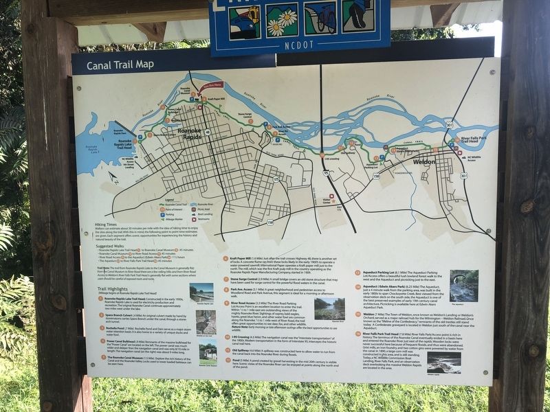
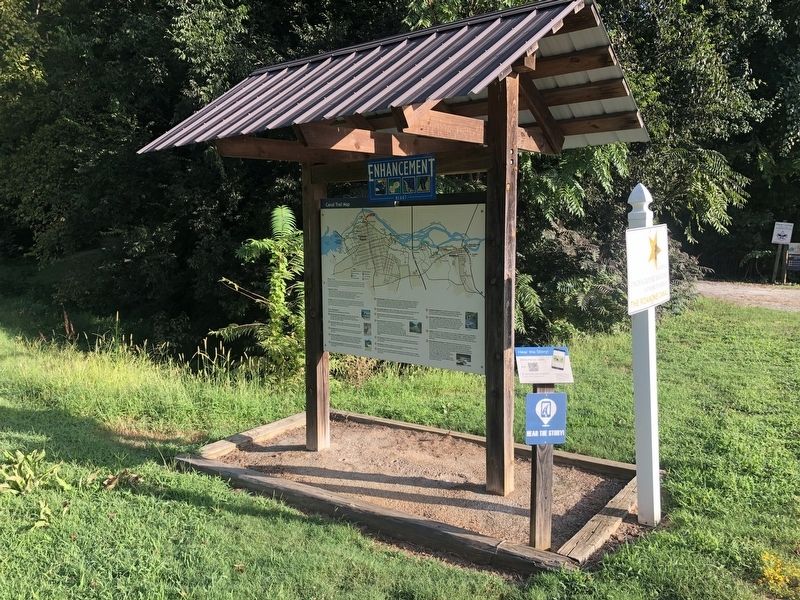
Canal Trail Map
Trail Highlights
(Mileage begins at Roanoke Rapids Lake Trail Head)
1. Roanoke Rapids Lake Trail Head; Constructed in the early 1950s, Roanoke Rapids Lake is used for electricity production and recreation. The original Roanoke Canal continues approximately two miles west under the lake.
2. Spans Branch Culvert (.4 Mile) An original culvert made by hand by stonemasons carries Spans Branch under the canal, through a stone-arch tunnel.
3. Rochelle Pond (.7 Mile) Rochelle Pond and Dam serve as a major storm water retention basin. It is also home to a variety of unique ducks and water fowl.
4. Power Canal Bulkhead (.9 Mile) Remnants of the massive bulkhead for the "Power Canal" are located on the left. The power canal was much wider and deeper than the navigation canal and was only 8/10 mile in length. The navigation canal (on the right) was about 9 miles long.
5. The Roanoke Canal Museum (1.5 Mile) Explore the rich history of the Canal and the Roanoke Valley. Locks used to lower loaded batteaux can be seen here.
6. Kraft Paper Mill (1.6 Mile) Just after the trail crosses Highway 48, there is another set of locks. A concrete flume ran from these locks likely in the early 1900's to operate a water-powered sawmill. International Paper operates a Kraft paper mill just to the north. The mill, which was the first Kraft pulp mill in the country operating as the Roanoke Rapids Paper Manufacturing Company, started in 1909.
7. Stone Surge Control (2.9 Mile) A small bridge covers an old stone structure that may have been used for surge control for the powerful flood waters in the canal.
8. Park Ave. Access (3.1 Mile) A great neighborhood and pedestrian access to Woodland Road and Park Avenue, this segment is ideal for a morning or afternoon walk.
9. River Road Access (3.3 Mile) The River Road Parking Lot/Access Point is an excellent location to enter the trail. Within ½ to 1 mile west of River Road, the trail offers great opportunities to see deer, fox, and other wildlife.
Nature Note: Early morning or late afternoon outings offer the best opportunities to see wildlife.
10. I-95 Crossing (4.3 Mile) The navigation canal was the "interstate transportation" of the 1800s. Modern transportation in the form of Interstate 95, intercepts the historic canal trail here.
11. Old Spillway (4.6 Mile) A spillway was constructed here to allow water to run from the canal back into the Roanoke River during floods.
12. Pond (5 Mile) A pond created by gravel harvesting in the mid 20th
13. Aqueduct Parking Lot (6.1 Mile) The Aqueduct Parking Lot/Access offers a beautiful lush lowland forest walk to the west and the Aqueduct and picnicking just to the east.
14. Aqueduct (Edwin Akers Park) (6.25 Mile) The Aqueduct, just a 4 minute walk from the parking area, was built in the early 1800s to span Chockoyette Creek. Best viewed from observation deck on the south side, the Aqueduct is one of the best preserved examples of early 19th century canal architecture.
15. Weldon (7 Mile) The Town of Weldon, once known as Weldon's Landing or Weldon's Orchard, served as a major railroad hub for the Wilmington-Weldon Railroad. Once known as the "lifeline of the Confederacy," remnants of the old trestles still stand today. A Confederate graveyard is located in Weldon just south of the canal near the Aqueduct.
16. River Falls Park Trail Head (7.8 Mile) River Falls Park/Access point is rich in history. The terminus of the Roanoke Canal eventually ended in a basin here and entered the Roanoke River just east of the rapids. Wooden locks were never successful here because of frequent floods, and thus were abandoned. Grist mills, an iron foundry, and two cotton gins were powered by water from the canal. In 1890, a large corn mill was constructed in this area, and is still standing. Today, a NC Wildlife Commission Boat Landing, River Falls Park, and an observation deck overlooking the massive Weldon Rapids area located in the area.
Erected by North Carolina Department of Transportation.
Topics. This historical marker is listed in these topic lists: Industry & Commerce • Railroads & Streetcars • War, US Civil • Waterways & Vessels. A significant historical year for this entry is 1909.
Location. 36° 28.485′ N, 77° 38.913′ W. Marker is in Roanoke Rapids, North Carolina, in Halifax County. Marker is on Jackson Street Extended (County Road 1464) just west of Roanoke Avenue (State Highway 48). Touch for map. Marker is at or near this postal address: 15 Jackson St, Roanoke Rapids NC 27870, United States of America. Touch for directions.
Other nearby markers. At least 8 other markers are within walking distance of this marker. Roanoke Canal (a few steps from this marker); Bike Trail Map (a few steps from this marker); The Batteauxmen (a few steps from this marker); A Lock in Action – Step By Step (within shouting distance of this marker); The Batteaux (within shouting distance of this marker); Batteaux and Batteauxmen (about 300 feet away, measured in a direct line); a different marker also named Roanoke Canal (about 400 feet away); First Kraft Pulp in United States (approx. ¼ mile away). Touch for a list and map of all markers in Roanoke Rapids.
Credits. This page was last revised on August 28, 2021. It was originally submitted on August 28, 2021, by Devry Becker Jones of Washington, District of Columbia. This page has been viewed 149 times since then and 12 times this year. Photos: 1, 2. submitted on August 28, 2021, by Devry Becker Jones of Washington, District of Columbia.
Editor’s want-list for this marker. A photo of the reverse side of the marker. • Can you help?

