Mifflinburg in Union County, Pennsylvania — The American Northeast (Mid-Atlantic)
Buffalo Valley Rail Trail
"I do not think there can be in any part of the world a situation more beautiful than this."
-Joseph Priestly, 1733-1804
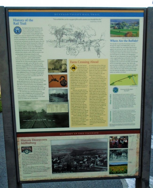
History of the Rail Trail
The Buffalo Valley Rail Trail follows the route of a railroad right of way that once ran from Montandon to Bellefonte in Centre County, crossing through Union County on an east-west alignment. The Lewisburg, Centre & Spruce Creek Railroad was incorporated in 1853, but the line immediately met with difficulties. The Civil War diverted men and material away from the project; then the St. Patrick's Day Flood of 1865 destroyed the bridge over the Susquehanna River. Without the bridge, the branch line would be unable to connect to the Philadelphia & Erie main line, which lay on the eastern side of the river. Nonetheless, the branch line through Union County overcame these obstacles, and by 1869 locomotives were carrying freight and passengers along the tracks.
In 1879 the branch was renamed the Lewisburg & Tyrone Railroad Co., and for another hundred years it was a key part of the valley's transportation network. The rise of the interstate highway system led to a reduction in rail traffic, and in 1982 the line ceased operations west of Mifflinburg. The following year, the tracks from Mifflinburg east were acquired by the West Shore Railroad Co., which was formed by a group of local investors, including the larger rail freight customers such as the Mifflinburg Farmers Exchange and Pennsylvania House Furniture. In addition to freight, the West Shore operated an excursion train on the line until 1997, at which point all traffic ended.
By the late 1990s the rails-to-trails movement was already gathering steam in other parts of the country. After the federal Surface Transportation Board granted the West Shore's request for the line to be rail-banked in 2008, the way was clear for the Lewisburg Area Recreation Authority to acquire the 60-foot-wide right-of-way and to begin the process of converting the rail line to a trail.
The trail restores the connection between the historic towns of Mifflinburg and Lewisburg and offers users a healthy way to enjoy the natural beauty and fascinating history of the Buffalo Valley in every season of the year without the use of fossil fuels.
[Related photo captions, top to bottom, read]
• Vicksburg Station, circa 1910
• Official mailbag lock used on the line
• 4-4-0 locomotive and train in Vicksburg, undated
• Early train schedule, showing range of services along the line
• Entering Mifflinburg From East on P.R.R., early 1917.
Farm Crossing Ahead
The active agricultural landscape has a distinctive
beauty and is one of the unique attractions of the Buffalo Valley Rail Trail, but it also presents hazards. Because of this, LARA has developed a supplemental set of Ag Area Cautions posted as the trail enters farmland. Please take special note of the dangers and concerns reflected in those signs—it is likely they contain information new to you or to someone you may introduce to the trail.
[balance of this section is informational and not transcribed]
[Top right photo caption reads] Buffalo Valley Agricultural Landscape, circa 2008
Where Are the Buffalo?
The trail takes its name from the landscape it moves through. The origins of the Buffalo Valley's name are somewhat in dispute. The name Buffalo Valley has been applied to the area since the early 1800s. There are tales of buffalo and bison in the region and yet there is no archaeological evidence that such animals ever lived in or passed through the area. Did they pour through these valleys by the tens of thousands in days gone by? Was there a final, vengeful buffalo hunt on December 31st, 1799, outside of Weikert, in which the remaining herd was slaughtered as they stood in the snow? Was a last, lone bull shot by Col. John Kelly on January 18th, 1802 on the spot now known as Buffalo Cross Roads, just a mile north of the trail? Ask an archaeologist and he'll say there's no evidence. But the story is there. And the name is written acorss [sic] the landscape and folklore even if the bones and artifacts are nowhere to be found.
Lewisburg Area Recreation Authority
"A Community That Plays Together... Stays Together"
About LARA
The Lewisburg Area Recreation Authority (LARA) built and maintains the trail as part of its ongoing mission to provide a comprehensive, year-round, varied and stimulating recreation program with adequate, functional, and attractive facilities and play areas for people of all ages and abilities. LARA offers this trail to the public as a resource and benefit to individuals and to the region. The trail is intended to serve a wide variety of users and uses, from farmers to borough residents, from commuting to recreation, from athletic training to strolling. For more information on LARA, please visit the website www.golara.org.
Appreciations
[not transcribed]
Historic Downtown Mifflinburg
[informational and not transcribed]
[Photo caption reads] Photopostcard view of Mifflinburg from southeast, looking northwest, circa 1908
Erected by Lewisburg Area Recreation Authority.
Topics. This historical marker is listed in these topic lists: Parks & Recreational Areas • Railroads & Streetcars. A significant historical year for this entry is 1853.
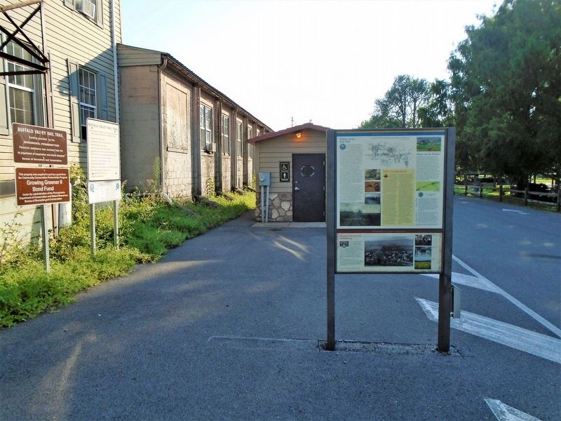
Location. 40° 55.096′ N, 77° 3.029′ W. Marker is in Mifflinburg, Pennsylvania, in Union County. Marker is at the intersection of 5th Street and Mill Street, on the left when traveling north on 5th Street. Marker is near the southeast corner of Mifflinburg Community Park. Touch for map. Marker is at or near this postal address: 514 Mulberry Street, Mifflinburg PA 17844, United States of America. Touch for directions.
Other nearby markers. At least 8 other markers are within walking distance of this marker. A different marker also named Buffalo Valley Rail Trail (here, next to this marker); Vietnam (about 400 feet away, measured in a direct line); USS Cole... (about 400 feet away); Union County World War II Honor Roll (about 400 feet away); Original Site of the Union County W.W. II Draft Board (about 400 feet away); Sept. 11, 2001... (about 400 feet away); Korea (about 400 feet away); First Lutheran Church War Memorial (approx. 0.2 miles away). Touch for a list and map of all markers in Mifflinburg.
Also see . . . Buffalo Valley Rail Trail. (Submitted on August 31, 2021, by William Fischer, Jr. of Scranton, Pennsylvania.)
Credits. This page was last revised on August 31, 2021. It was originally submitted on August 31, 2021, by William Fischer, Jr. of Scranton, Pennsylvania. This page has been viewed 144 times since then and 17 times this year. Photos: 1, 2. submitted on August 31, 2021, by William Fischer, Jr. of Scranton, Pennsylvania.

