Near Hasty in Bent County, Colorado — The American Mountains (Southwest)
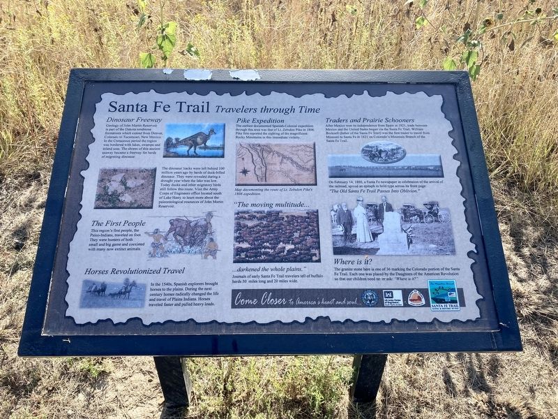
Santa Fe Trail
Travelers through Time
Dinosaur Freeway
Geology of John Martin Reservoir is part of the Dakota sandstone formations which extend from Denver, Colorado to Tucumcari, New Mexico. In the Cretaceous period the region was bordered with lakes, swamps and inland seas. The shores of this ancient seaway became a freeway for herds of migrating dinosaur.
The dinosaur tracks were left behind 100 million years ago by herds of duck-billed dinosaur. They were revealed during a drought year when the lake was low. Today ducks and other migratory birds still follow this route. Visit the Army Corps of Engineers office located south of Lake Hasty to learn more about the paleontological resources of John Martin Reservoir.
The First People
This region's first people, the Paleo-Indians, traveled on foot. They were hunters of both small and big game and coexisted with many now extinct animals.
Horses Revolutionized Travel
In the 1540s, Spanish explorers brought horses to the plains. During the next century horses radically changed the life and travel of Plains Indians. Horses traveled faster and pulled heavy loads.
Pike Expedition
The earliest documented Spanish-Colonial expedition through this area was that of Lt. Zebulon Pike in 1806. Pike first reported the sighting of the magnificent Rocky Mountains in this immediate vicinity.
“The moving multitude…darkened the whole plains.”
Journals of early Santa Fe Trail travelers tell of buffalo herds 50 miles long and 20 miles wide.
Traders and Prairie Schooners
After Mexico won its independence from Spain in 1821, trade between Mexico and the United States began via the Santa Fe Trail. William Becknell (father of the Santa Fe Trail) was the first trader to travel from Missouri to Santa Fe in 1821 on Colorado's Mountain Branch of the Santa Fe Trail.
On February 14, 1880, a Santa Fe newspaper in celebration of the arrival of the railroad, spread an epitaph in bold type across its front page:
"The Old Santa Fe Trail Passes Into Oblivion."
Where is it?
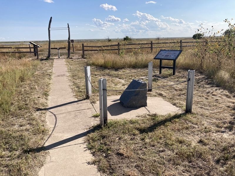
The granite stone here is one of 36 marking the Colorado portion of the Santa Fe Trail. Each one was placed by the Daughters of the American Revolution so that our children need never ask: "Where is it?"
Come Closer to America’s heart and soul…
Erected by Colorado Parks and Wildlife; US Corp of Engineers; Santa Fe Trail Association.
Topics and series. This historical marker is listed in these topic lists: Native Americans • Paleontology • Roads & Vehicles. In addition, it is included in the Santa Fe Trail series list. A significant historical year for this entry is 1806.
Location. 38° 4.972′ N, 102° 57.732′ W. Marker is near Hasty, Colorado, in Bent County. Marker can be reached from County Highway HH near County Highway 24. Touch for map. Marker is at or near this postal address: 30703 County Hwy 24, Hasty CO 81044, United States of America. Touch for directions.
Other nearby markers. At least 7 other markers are within 12 miles of this marker, measured as the crow flies. A different marker also named Santa Fe Trail (here, next to this marker); His Final Fort (approx. 11 miles away); Why a Massacre? (approx. 11 miles away); Bent’s New Fort (approx. 11 miles away); A Vital Link (approx. 11 miles away); Bent’s Trading Post at Big Timbers (approx. 11.1 miles away); Tragedy and Restoration (approx. 11.2 miles away).
Credits. This page was last revised on September 13, 2021. It was originally submitted on September 5, 2021, by Connor Olson of Kewaskum, Wisconsin. This page has been viewed 277 times since then and 30 times this year. Photos: 1, 2. submitted on September 5, 2021, by Connor Olson of Kewaskum, Wisconsin. • Andrew Ruppenstein was the editor who published this page.

