Near Park Rapids in Clearwater County, Minnesota — The American Midwest (Upper Plains)
From a Day When Trees Were Trees
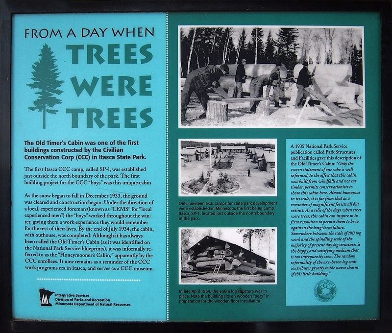
The first Itasca CCC camp, called SP-1, was established just outside the north boundary of the park. The first building project for the CCC "boys" was this unique cabin.
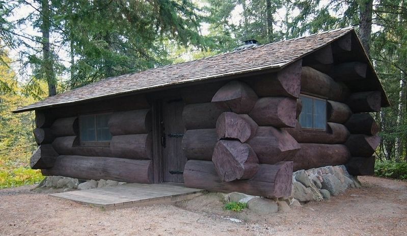
As the snow began to fall in December 1933, the ground was cleared and construction began. Under the direction of a local, experienced foreman (known as "LEMS" for "local experienced men") the "boys" worked throughout the winter, giving them a work experience they would remember for the rest of their lives. By the end of July 1934, the cabin, with outhouse, was completed. Although it has always been called the Old Timer's Cabin (as it was identified on the National Park Service blueprints), it was informally referred to as the "Honeymooner's Cabin," apparently by the CCC enrollees. It now remains as a reminder of the CCC work programs era in Itasca, and serves as a CCC museum.
A 1935 National Park Service publication called Park Structures and Facilities gave this description of the Old Timer's Cabin: "Only the sworn statement of one who is well informed, to the effect that this cabin was built from windfalls and not cut timber, permits conservationists to show this cabin here. Almost humorous in its scale, it is far from that as a reminder of magnificent forests all but extinct. As a relic of the days when trees were trees, this cabin can inspire us to firm resolution to permit them to be so again in the long-term future. Somewhere between the scale of this log work and the spindling scale of the majority of present day log structures is the happy and satisfying medium that is too infrequently seen. The random informality of the axe-hewn log ends contributes greatly to the naive charm of this little building."
Caption: Only nineteen CCC camps for state park development were established in Minnesota, the first being Camp Itasca, SP-1, located just outside the north boundary of the park.
Caption: In late April 1934, the entire log structure was in place. Not the building sits on wooden "pegs" in preparation for the wooden floor installation.
Erected by Minnesota Department of Natural Resources.
Topics and series. This historical marker is listed in these topic lists: Architecture • Parks & Recreational Areas. In addition, it is included in the Civilian Conservation Corps (CCC) series list. A significant historical year for this entry is 1934.
Location. 47° 11.65′ N, 95° 10.405′ W. Marker is near Park Rapids, Minnesota
, in Clearwater County. Marker can be reached from Douglas Lodge Drive. Located in Itasca State Park (vehicle permit required) at the Old Timer's Cabin on the southwest shore of Lake Itasca. Site can be accessed on the Dr. Roberts Trail. Touch for map. Marker is in this post office area: Park Rapids MN 56470, United States of America. Touch for directions.
Other nearby markers. At least 8 other markers are within 4 miles of this marker, measured as the crow flies. Itasca Lake (approx. 0.2 miles away); Douglas Lodge (approx. ¼ mile away); Geology of Minnesota (approx. 1.2 miles away); Theodore and Johanna Wegmann (approx. 3.4 miles away); Wegmann Store Replica (approx. 3.4 miles away); Old Northwest Territory (approx. 3½ miles away); Search for the Mississippi's Source (approx. 3.6 miles away); Patterson's Homestead (approx. 3.6 miles away).
Credits. This page was last revised on September 9, 2021. It was originally submitted on September 5, 2021, by McGhiever of Minneapolis, Minnesota. This page has been viewed 210 times since then and 39 times this year. Photos: 1, 2. submitted on September 5, 2021, by McGhiever of Minneapolis, Minnesota. • Mark Hilton was the editor who published this page.

