Wakefield in Sussex County, Virginia — The American South (Mid-Atlantic)
Sussex County / Southampton County
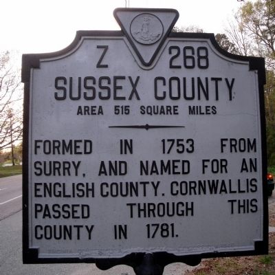
Sussex County. Area 515 Square Miles. Formed in 1753 from Surry, and named for an English county. Cornwallis passed through this county in 1781.
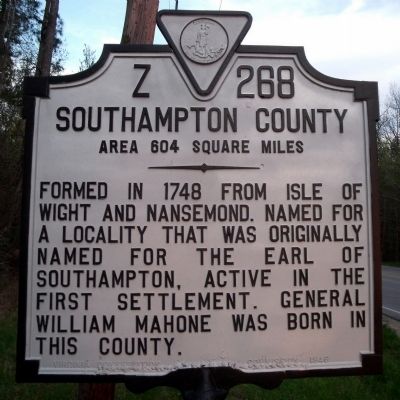
Southampton County. Area 604 Square Miles. Formed in 1748 from Isle of Wight and Nansemond. Named for a locality that was originally named for the Earl of Southampton, active in the first settlement. General William Mahone was born in this county.
Erected 1946 by Virginia Conservation Commission. (Marker Number Z-268.)
Topics and series. This historical marker is listed in these topic lists: Colonial Era • Political Subdivisions. In addition, it is included in the Virginia Department of Historic Resources (DHR) series list. A significant historical year for this entry is 1753.
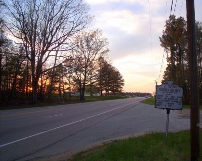
Location. 36° 56.905′ N, 76° 57.427′ W. Marker is in Wakefield, Virginia, in Sussex County. Marker is at the intersection of General Mahone Highway (U.S. 460) and Skeet lane, on the right when traveling west on General Mahone Highway. Touch for map. Marker is in this post office area: Wakefield VA 23888, United States of America. Touch for directions.
Other nearby markers. At least 8 other markers are within 8 miles of this marker, measured as the crow flies. Colonel Michael Blow (approx. 1.4 miles away); Wakefield Fountain Corner (approx. 2.4 miles away); Roadside Commerce (approx. 2˝ miles away); Early Peanut Crop (approx. 6.2 miles away); Surry Lumber Company (approx. 6.9 miles away); Surry, Sussex & Southampton Railway (approx. 6.9 miles away); Ellis Preaching House (approx. 7.4 miles away); Cypress Church (approx. 8.1 miles away). Touch for a list and map of all markers in Wakefield.
Also see . . .
1. Sussex County, Virginia. (Submitted on March 30, 2010.)
2. Southampton County, Virginia. (Submitted on March 30, 2010.)
Credits. This page was last revised on November 14, 2021. It was originally submitted on April 20, 2009, by Bernard Fisher of Richmond, Virginia. This page has been viewed 976 times since then and 26 times this year. Photos: 1, 2, 3. submitted on April 20, 2009, by Bernard Fisher of Richmond, Virginia.


