Near Baltic in Minnehaha County, South Dakota — The American Midwest (Upper Plains)
John Thompson, Pioneer
⎯⎯⎯
Early Settlers' Association
September 5, 2021
1. John Thompson, Pioneer / Early Settlers' Association Marker
(1841-1913)
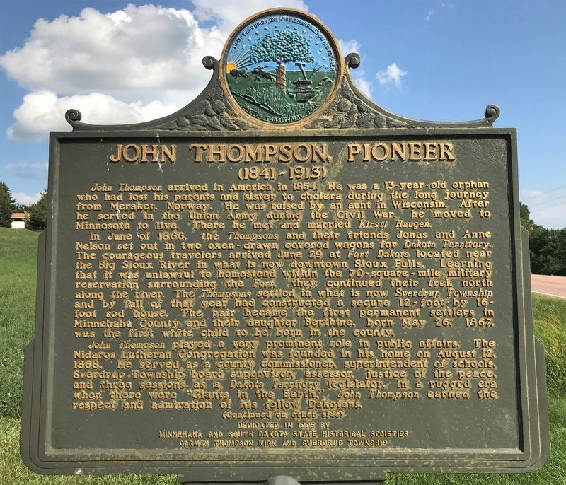
John Thompson arrived in America in 1854. He was a 13-year-old orphan who had lost his parents and sister to cholera during the long journey from Meraker, Norway. He was raised by an aunt in Wisconsin. After he served in the Union Army during the Civil War, he moved to Minnesota to live. There he met and married Kirsti Haugen.
In June of 1866, the Thompsons and their friends Jonas and Anne Nelson set out in two oxen-drawn covered wagons for Dakota Territory. The courageous travelers arrived June 29 at Fort Dakota located near the Big Sioux River in what is now downtown Sioux Falls. Learning that it was unlawful to homestead within the 70-square-mile military reservation surrounding the Fort, they continued their trek north along the river. The Thompsons settled in what is now Sverdrup Township and by fall of that year had constructed a secure 12-foot by 16-foot sod house. The pair became the first permanent settlers in Minnehaha County and their daughter Berthine, born May 26, 1867, was the first white child to be born in the county.
John Thompson played a very prominent role
this page online
Early Settlers' Association
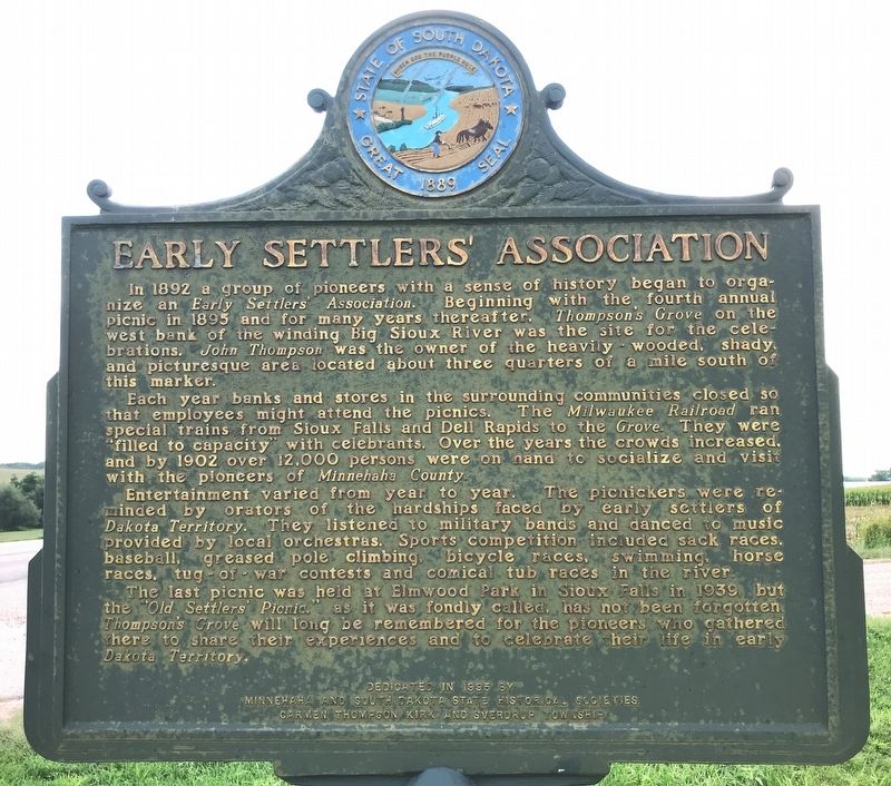
In 1892 a group of pioneers with a sense of history began to organize an Early Settlers' Association. Beginning with the fourth annual picnic in 1895 and for many years thereafter, Thompson's Grove on the west bank of the winding Big Sioux River was the site for the celebrations. John Thompson was the owner of the heavily-wooded, shady, and picturesque area located about three quarters of a mile south of this marker.
Each year banks and stores in the surrounding communities closed so that employees might attend the picnics. The Milwaukee Railroad ran special trains from Sioux Falls and Dell Rapids to the Grove. They were "filled to capacity" with celebrants. Over the years
September 5, 2021
2. John Thompson, Pioneer / Early Settlers' Association Marker
Entertainment varied from year to year. The picnickers were reminded by orators of the hardships faced by early settlers of Dakota Territory. They listened to military bands and danced to music provided by local orchestras. Sports competition included sack races, baseball, greased pole climbing, bicycle races, swimming, horse races, tug-of-war contests and comical tub races in the river.
The last picnic was held at Elmwood Park in Sioux Falls in 1939, but the "Old Settlers' Picnic," as it was fondly called, has not been forgotten. Thompson's Grove will long be remembered for the pioneers who gathered there to share their experiences and to celebrate their life in early Dakota Territory.
Erected 1995 by Minnehaha and South Dakota State Historical Societies, Carmen Thompson Kirk, and Sverdrup Township. (Marker Number 655.)
Topics and series. This historical marker is listed in these topic lists: Parks & Recreational Areas • Settlements & Settlers. In addition, it is included in the Norwegian-Americans,
September 5, 2021
3. John Thompson, Pioneer / Early Settlers' Association Marker, from the west
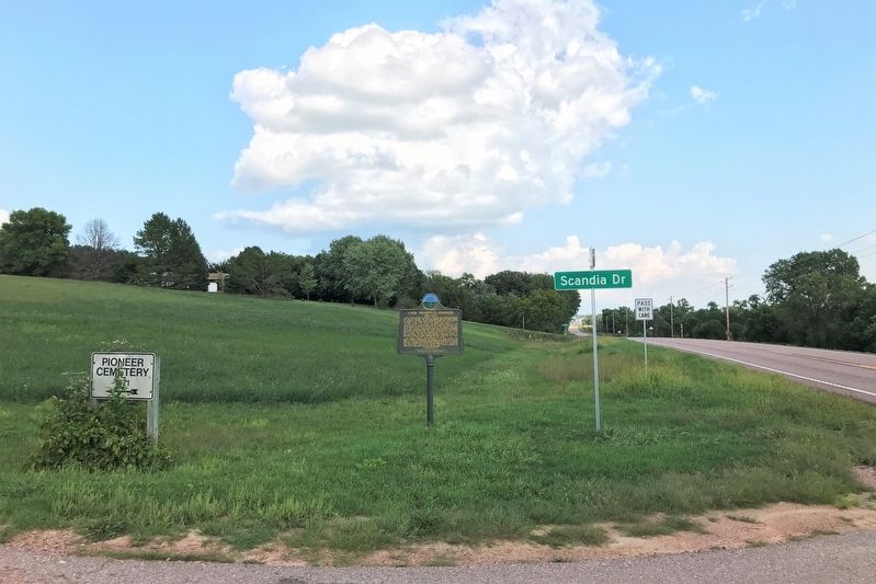
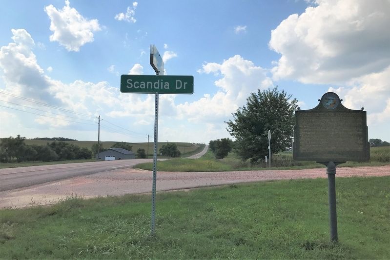
Location. 43° 42.199′ N, 96° 44.469′ W. Marker is near Baltic, South Dakota, in Minnehaha County. It is at the intersection of 254th Street (County Road 122) and Scandia Drive, on the left when traveling east on 254th Street. Located at the turn-off to Pioneer Cemetery. Touch for map. Marker is in this post office area: Baltic SD 57003, United States of America. Touch for directions.

Regionally, this marker is in East River and in Greater Sioux Falls. It is also in the American Midwest, in the Lewis & Clark Corridor, in the Corn Belt, on the prairies, and on the Northern Plains. Globally, it is in North America, the Western Hemisphere, the Western World, and the Anglosphere. Historically, it finds itself in what was once Rupert’s Land and also the Louisiana Purchase.
Other nearby markers. At least 8 other markers are within 5 miles of this marker, measured as the crow flies: Oyen-Person Log Cabin (approx. 2½ miles away); Old Nidaros Replica Church (approx. 2½ miles away); Old Nidaros Church Replica (approx.
September 5, 2021
4. John Thompson, Pioneer / Early Settlers' Association Marker, from the east
September 5, 2021
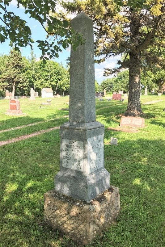
5. John Thompson Family Gravestone, at nearby Pioneer Cemetery
June 29, 1841
July 2, 1913
Kirsti his wife
Dec. 12, 1845
Apr. 11, 1918
Credits. This page was last revised on September 9, 2021. It was originally submitted on September 7, 2021. This page has been viewed 2,145 times since then and 228 times this year. Photos: 1, 2, 3, 4, 5. submitted on September 7, 2021. • Mark Hilton was the editor who published this page.
