North Newport News , Virginia — The American South (Mid-Atlantic)
Endview
Home of the Warwick Beauregards
| — | 1862 Peninsula Campaign | — |
Photographed by Bill Coughlin, August 11, 2008
1. Endview Marker
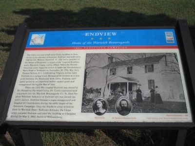
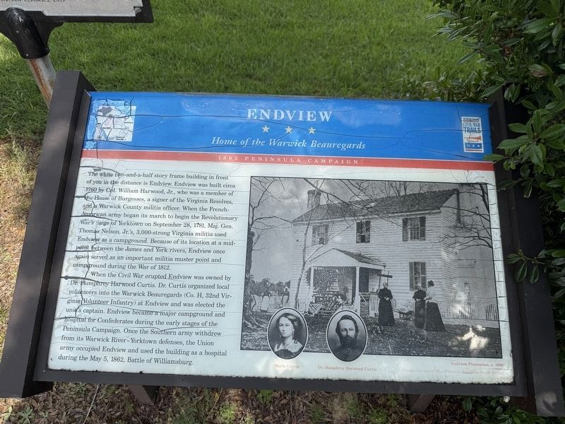
The white two-and-a-half story frame building in front of you in the distance is Endview. Endview was built circa 1760 by Col. William Harwood, Jr., who was a member of the House of Burgesses, a signer of the Virginia Resolves, and a Warwick County militia officer. When the French-American army began its march to begin the Revolutionary War’s Siege of Yorktown on September 28, 1781, Maj. Gen. Thomas Nelson, Jr.’s, 3,000-strong Virginia militia used Endview as a campground. Because of its location at a midpoint between the James and York rivers, Endview once again served as an important militia muster point and campground during the War of 1812.
When the Civil War erupted Endview was owned by Dr. Humphrey Harwood Curtis. Dr. Curtis organized local volunteers into the Warwick Beauregards (Co. H, 32rd Virginia Volunteer Infantry) at Endview and was elected the unit’s captain. Endview became a major campground and hospital for Confederates during the early stages of the Peninsula Campaign. Once the Southern army withdrew from its Warwick River – Yorktown defenses, the Union army occupied Endview and used the building as a
this page online
Erected by Virginia Civil War Trails.
Topics and series. This historical marker is listed in these topic lists: War of 1812 • War, US Civil • War, US Revolutionary. In addition, it is included in the Virginia Civil War Trails series list. A significant historical date for this entry is May 5, 1862.
Location. 37° 12.765′ N, 76° 34.263′ W. Marker is in Newport News, Virginia. It is in North Newport News. It is on Yorktown Road (Virginia Route 238), on the right when traveling north. Touch for map. Marker is at or near this postal address: 362 Yorktown Road, Newport News VA 23603, United States of America. Touch for directions.

Regionally, this marker is on Virginia’s Peninsula, in Hampton Roads, in Coastal Virginia, and in the Hampton Roads Metropolitan Area. It is also in the American South, specifically in the Upper South, in the Tidewater, and on the Eastern Seaboard. Globally, it is in the North Atlantic Region, North America, the Western Hemisphere, the Western World, and the Anglosphere. Historically, it finds itself in what was once the territory of
Photographed by Devry Becker Jones (CC0), June 10, 2025
2. Endview Marker
The marker has weathered but remains generally legible.
Other nearby markers. At least 8 other markers are within walking distance of this marker: A different marker also named Endview (here, next to this marker); Lebanon Church (here, next to this marker); Aviation Field Yorktown (a few steps from this marker); a different marker also named Lebanon Church (a few steps from this marker); Endview Plantation (about 700 feet away, measured in a direct line); a different marker also named Endview (about 700 feet away); The Dairy House (approx. 0.2 miles away); Virginia Indians (approx. 0.2 miles away). Touch for a list and map of all markers in Newport News.
Other markers no longer nearby. The Endview Landscape (was about 700 feet away but has been permanently removed); The Dairy Building (was approx. 0.2 miles away but has been replaced with another marker now near it); The Endview Spring (was approx. 0.2 miles away but has been permanently removed).
More about this marker. The right side of the marker contains a photograph of the Endview
Photographed by Bill Coughlin, August 11, 2008
3. Marker at Endview Plantation
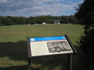
The Endview Plantation House can be seen behind the marker in this photo.
Related markers. Click here for a list of markers that are related to this marker. Markers found at the Endview Plantation.
Also see . . .
1. History of Endview Plantation. Endview Plantation website. (Submitted on August 17, 2008, by Bill Coughlin of Woodland Park, New Jersey.)
2. The Peninsula Campaign. (Submitted on August 17, 2008, by Bill Coughlin of Woodland Park, New Jersey.)
Photographed by Bill Coughlin, August 11, 2008
4. Markers on Yorktown Road
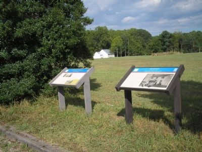
Two Virginia Civil War Trails markers are found at this location. The Endview marker is the one on the right in the photo.
Photographed by Bradley Owen, October 17, 2021
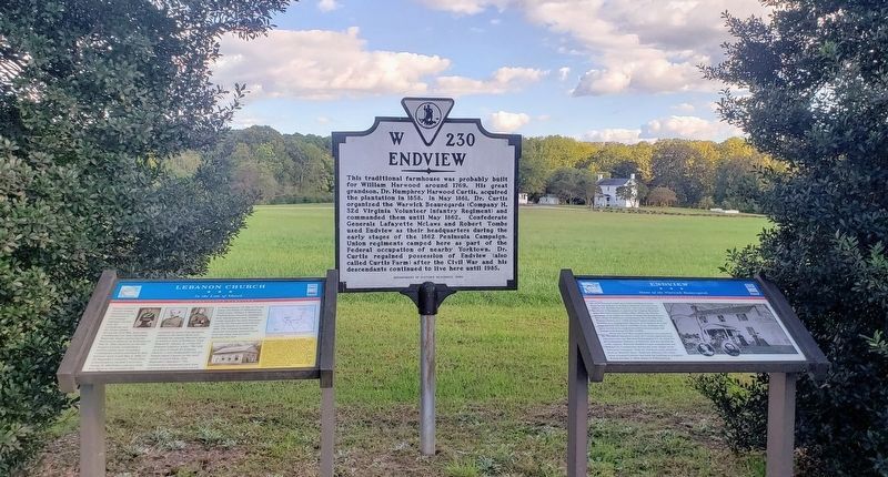
5. Markers On Yorktown Road
Three markers are found at this location. The Endview marker is the one on the right in the photo.
Photographed by Bill Coughlin, August 13, 2008
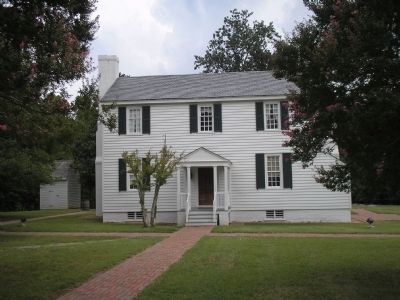
6. Endview Plantation
The Endview Plantation house was used as a hospital during the Peninsula Campaign by both the Union and Confederate armies.
Credits. This page was last revised on June 19, 2025. It was originally submitted on August 17, 2008, by Bill Coughlin of Woodland Park, New Jersey. This page has been viewed 2,224 times since then and 83 times this year. Last updated on September 8, 2021, by Bradley Owen of Morgantown, West Virginia. Photos: 1. submitted on August 17, 2008, by Bill Coughlin of Woodland Park, New Jersey. 2. submitted on June 19, 2025, by Devry Becker Jones of Washington, District of Columbia. 3, 4. submitted on August 17, 2008, by Bill Coughlin of Woodland Park, New Jersey. 5. submitted on October 17, 2021, by Bradley Owen of Morgantown, West Virginia. 6. submitted on August 17, 2008, by Bill Coughlin of Woodland Park, New Jersey. • J. Makali Bruton was the editor who published this page.
