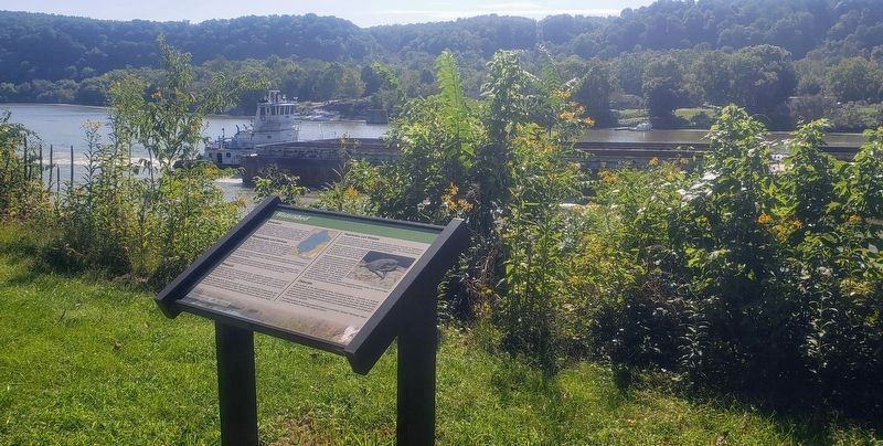
Jefferson Township near East Millsboro in Greene County, Pennsylvania — The American Northeast (Mid-Atlantic)
Watershed
Watershed
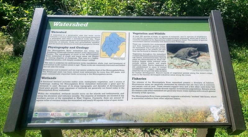
A watershed is a geographic area that water moves towards a common water body. Several things determine a watershed and what a watershed looks like. These include the unique geography and topography of an area, networks of streams, rivers and groundwater aquifers, and the land use decisions of individual property owners.
Physiography and Geology
The Monongahela River watershed lies within the Allegheny/Pittsburgh Plateau section of the Appalachian Plateau. The topography of much of the Monongahela River watershed is rough and many areas are sloped at varying degrees of steepness. This area is a highly dissected plateau with deeply eroded stream vallèys.
The area is underlain by sedimentary rocks (sandstone, shale, coal, and limestone) of 416 million to 251 million years in age. These rocks are commonly fractured and folded but are also flat-lying.
Bituminous coal is present and six coal seams underlie most of the Monongahela River. The Pittsburgh seam has been mined most extensively for more than 200 years, with most commercially important beds occurring in the Monongahela series.
Wetlands
A functional wetland includes hydric soils, hydrophytic vegetation, and a source of hydrology, making the Monongahela River watershed historically a great spot for wetlands to exist. Because of its steep topography and decades of developmental flood plain growth, large expanses of wetlands are generally not found today in the Monongahela River watershed.
Within the watershed, wetlands usually occur on the islands and embayments, and along the shoreline and tributary mouths. The majority of wetlands are located in the southern portion of the watershed in West Virginia. Currently, there are around 37 square miles of wetland within the watershed and nearly 60 square miles of open water.
Vegetation and Wildlife
At least 250 species of birds, 47 species of mammals, and 51 species of amphibians and reptiles are present within the Monongahela River watershed, which lies in what is currently classified as the Appalachian mixed mesophytic forest. The number of species and suitable habitats increases with distance from Pittsburgh.
There are currently four endangered and three threatened species within the watershed. One of the species that is endangered is the Indiana bat and they can be found in Greene County.
Vegetation throughout the watershed consists of forested areas dominated by oak, beech, and hemlock trees. Upland areas are characterized by white oak- hickory forests while lowland areas include willow, beech, and maple hardwood trees. Native
vegetation is
still predominant in areas of limited
accessibility or rugged topographic
relief that do not provide sites suitable for human development. Narrow bands of vegetation persist along the water's edge, even in the heavily developed industrial areas along the rivers.
Fisheries
The streams of the Monongahela River watershed present a diversity of habitats. Mountainous areas are generally dominated by streams that are very low in nutrients and remain cold all year. These streams support trout and a few other cold-water fish species but commonly include diverse aquatic-invertebrate populations. Streams along the western side of the watershed are generally warm-water systems with a much greater diversity of fish species.
The Monongahela River basin presently supports a relatively "modest” fish fauna, which is somewhat indistinct from other adjacent basins.
(Captions):
Monongahela River Watershed.
U.S. Army Carps of Engineers
The Indiana bat is listed as endangered and protected under the state Game and Wildlife Code.
Erected 2020 by Pennsylvania Department of Conservation and Natural Resources, Rivers of Steel, Greene County Museum, Greene County Tourist Promotion Agency.
Topics. This historical marker is listed in these topic lists: Environment • Industry & Commerce • Waterways & Vessels.
Location. 39° 58.949′ N, 80° 0.205′ W. Marker is near East Millsboro, Pennsylvania, in Greene County. It is in Jefferson Township. Marker can be reached from Main Street west of Rices Landing Road (County Route 1010), on the left when traveling north. Marker is located near the northern terminus of the Greene River Trail. The parking lot for the Rices Landing Trailhead is located on Main Street across from Rices Landing United Methodist Church. Touch for map. Marker is at or near this postal address: 125 Main Street, Rices Landing PA 15357, United States of America. Touch for directions.
Other nearby markers. At least 8 other markers are within 2 miles of this marker, measured as the crow flies. A Revolutionary War Soldier (approx. 0.6 miles away); The Abraham Tegarden Family (approx. 0.7 miles away); East Bethlehem Township Honor Roll (approx. 0.8 miles away); River Barges (approx. one mile away); Fredericktown (approx. 1.1 miles away); Fredericktown and Community War Memorial (approx. 1.3 miles away); Honor Roll East Bethlehem Township World War II (approx. 1.4 miles away); A Revolutionary Soldier (approx. 1.4 miles away).
Credits. This page was last revised on February 7, 2023. It was originally submitted on September 8, 2021, by Bradley Owen of Morgantown, West Virginia. This page has been viewed 86 times since then and 7 times this year. Photos: 1, 2. submitted on September 8, 2021, by Bradley Owen of Morgantown, West Virginia. • Bill Pfingsten was the editor who published this page.

