St. Edward in Boone County, Nebraska — The American Midwest (Upper Plains)
St. Edward
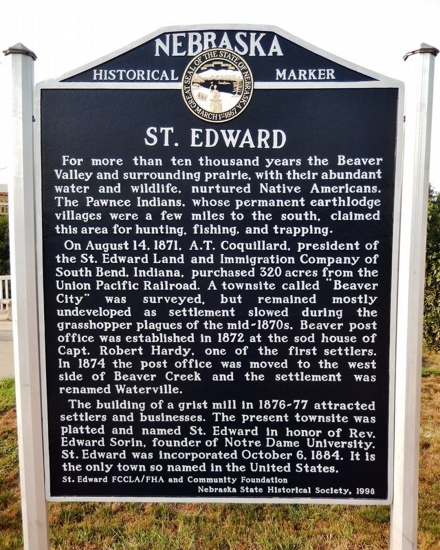
For more than ten thousand years the Beaver Valley and surrounding prairie, with their abundant water and wildlife, nurtured Native Americans. The Pawnee Indians, whose permanent earthlodge villages were a few miles to the south, claimed this area for hunting, fishing, and trapping.
On August 14, 1871, A. T. Coquillard, president of the St. Edward Land and Immigration Company of South Bend, Indiana, purchased 320 acres from the Union Pacific Railroad. A townsite called “Beaver City” was surveyed, but remained mostly undeveloped as settlement slowed during the grasshopper plagues of the mid-1870s. Beaver post office was established in 1872 at the sod house of Capt. Robert Hardy, one of the first settlers. In 1874 the post office was moved to the west side of Beaver Creek and the settlement was renamed Waterville.
The building of a grist mill in 1876-77 attracted settlers and businesses. The present townsite was platted and named St. Edward in honor of Rev. Edward Sorin, founder of Notre Dame University. St. Edward was incorporated October 6, 1884. It is the only town so named in the United States.
Erected 1998 by St. Edward FCCLA/FHA and Community Foundation; and Nebraska State Historical Society. (Marker Number 398.)
Topics and series. This historical marker is listed in these topic lists: Industry & Commerce • Native Americans • Settlements & Settlers. In addition, it is included in the Nebraska State Historical Society series list. A significant historical date for this entry is October 6, 1884.
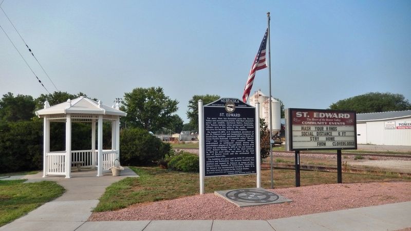
Location. 41° 34.2′ N, 97° 51.858′ W. Marker is in St. Edward, Nebraska, in Boone County. Marker is at the intersection of Beaver Street (State Highway 39) and 4th Street, on the right when traveling west on Beaver Street. Touch for map. Marker is in this post office area: Saint Edward NE 68660, United States of America. Touch for directions.
Other nearby markers. At least 6 other markers are within 13 miles of this marker, measured as the crow flies. West Hill Community (approx. 7.7 miles away); U. S. Indian Industrial School Building (approx. 11.1 miles away); Pawnee (approx. 11.1 miles away); Genoa: 1857-1859 (approx. 11.1 miles away); The Zimmerers — Irrigation Innovators (approx. 12½ miles away); Dedicated to the Irish Settlers (approx. 12½ miles away).
Also see . . . City of St. Edward History. City website entry:
In 1871 a homesteader chose the verdant land along the Beaver Valley on which to stake his claim. Soon other followed and built their homes of sod. A post office called “Beaver”
was established; the name was later changed to “Waterville.” As the settlement developed, the population was mostly of German, Swedish, Irish, and Polish descent. (Submitted on September 8, 2021, by Cosmos Mariner of Cape Canaveral, Florida.)
Credits. This page was last revised on February 27, 2022. It was originally submitted on September 8, 2021, by Cosmos Mariner of Cape Canaveral, Florida. This page has been viewed 222 times since then and 20 times this year. Photos: 1, 2, 3. submitted on September 8, 2021, by Cosmos Mariner of Cape Canaveral, Florida.


