Lincoln Park in San Francisco City and County, California — The American West (Pacific Coastal)
Western Terminus of the Lincoln Highway
Inscription.
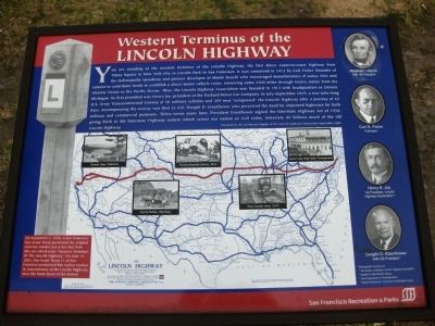
You are standing at the western terminus of the Lincoln Highway, the first direct coast-to-coast highway from Times Square in New York City to Lincoln Park in San Francisco. It was conceived in 1912 by Carl Fisher (founder of the Indianapolis Speedway and pioneer developer of Miami Beach) who encouraged manufacturers of autos, tires and cement to contribute funds to establish a direct motor-vehicle route, traversing 3,300 miles through 12 states, from the Atlantic Ocean to the Pacific Ocean. Thus, the Lincoln Highway Association was founded in 1913 with headquarters in Detroit, Michigan. Its first president was Henry Joy, president of the Packard Motor Company. In July, 1919, a two-mile-long U.S. Army Transcontinental Convoy of 56 vehicles and 209 men "conquered" the Lincoln Highway after a journey of 62 days. Accompanying the convoy was then Lt. Colonel Dwight David Eisenhower who perceived the need for improved highways for both military and commercial purposes. Thirty-seven years later, President Eisenhower signed the Interstate Highway Act of 1956, giving birth to the Interstate Highway system which serves our nation so well today. Interstate 80 follows much of the old Lincoln Highway.
Donated by the California Chapter of the Lincoln Highway September 2005
Erected 2005 by California Chapter of the Lincoln Highway Association.
Topics and series. This historical marker is listed in these topic lists: Notable Places • Roads & Vehicles. In addition, it is included in the Former U.S. Presidents: #34 Dwight D. Eisenhower, and the Lincoln Highway series lists. A significant historical month for this entry is July 1919.
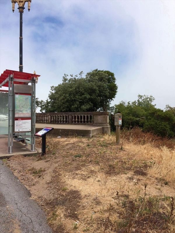
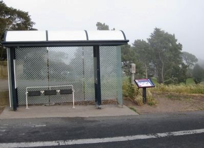
Location. 37° 47.099′ N, 122° 29.965′ W. Marker is in San Francisco, California, in San Francisco City and County. It is in Lincoln Park. Marker is on 34th Avenue near El Camino del Mar, on the left when traveling south. The Western Terminus marker and accompanying monument are located next to the bus stop in the parking lot of the Palace of Legion of Honor in Lincoln Park. Touch for map. Marker is in this post office area: San Francisco CA 94121, United States of America. Touch for directions.
Other nearby markers. At least 8 other markers are within walking distance of this marker. Jeanne d'Arc (within shouting distance of this marker); Frances E. Willard (within shouting distance of this marker); Soldiers who Perished in WWII (within shouting distance of this marker); "The Holocaust" (about 300 feet away, measured in a direct line); The Arrival of the First Japanese Naval Ship (about 500 feet away); Historic Shipwrecks - Lost at the Golden Gate (approx. 0.3 miles away); China Beach (approx. half a mile away); Electric Streetcar Line (approx. half a mile away). Touch for a list and map of all markers in San Francisco.
More about this marker. Directly below the provided text is pictured a map of the US, showing the route of the Lincoln Highway (in red) and feeder routes (in blue), as approved and adopted in September 1913 by the Lincoln Highway Association. Superimposed upon the map are a number of photographic vignettes:
1) A view of Donner Lake, California
2) A car driving through Church Buttes, Wyoming
3) A shot of the Transcontinental Convoy in 1919, depicting a truck be pulled out of a ditch
4) A car driving through mud up to its axles in Story County, Iowa
5) Cars parked next to the Grand View Ship Hotel in Pennsylvania
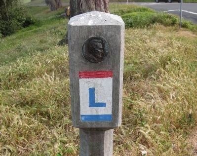
The left of the marker depicts a typical route-marking highway monument (depicting a right turn).
The right side of the marker contains photographic portraits (top to bottom) of: Abraham Lincoln, 16th US President; Carl G. Fisher, visionary; Henry B. Joy, 1st President, Lincoln Highway Association; Dwight D. Eisenhower, 34th U.S. President.
The lower left of the marker has a sidebar whose text is presented below with the last picture.
Also see . . . The Lincoln Highway. The Federal Highway Administration's history of the Lincoln Highway, by Richard F. Weingroff. (Submitted on April 21, 2009.)
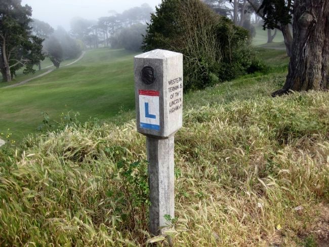
Photographed By Andrew Ruppenstein, April 18, 2009
5. The End of the Road - The Western Terminus of the Lincoln Highway
{Text from the sidebar on the marker reads:}
On September 1, 1928, a San Francisco Boy Scout troop positioned the original concrete marker just a few feet from this site that read, "Western Terminus of the Lincoln Highway." On June 14, 2002, Boy Scout Troop 17 of San Francisco positioned this replica marker in remembrance of the Lincoln Highway, once the Main Street of the Nation.
Credits. This page was last revised on February 7, 2023. It was originally submitted on April 20, 2009, by Andrew Ruppenstein of Lamorinda, California. This page has been viewed 4,393 times since then and 64 times this year. Photos: 1. submitted on April 20, 2009, by Andrew Ruppenstein of Lamorinda, California. 2. submitted on April 17, 2022, by Adam Margolis of Mission Viejo, California. 3, 4, 5. submitted on April 21, 2009, by Andrew Ruppenstein of Lamorinda, California. • Syd Whittle was the editor who published this page.
