Suffolk, Virginia — The American South (Mid-Atlantic)
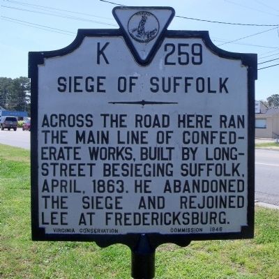
Siege of Suffolk
Erected 1946 by Virginia Conseration Commission. (Marker Number K-259.)
Topics and series. This historical marker is listed in this topic list: War, US Civil. In addition, it is included in the Virginia Department of Historic Resources (DHR) series list. A significant historical year for this entry is 1863.
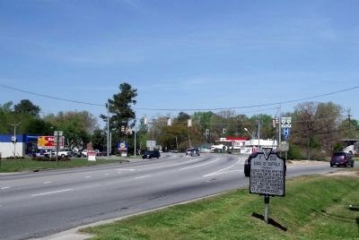
Location. 36° 45.547′ N, 76° 35.2′ W. Marker is in Suffolk, Virginia. Marker is at the intersection of North Main Street (U.S. 460) and Godwin Boulevard, on the right when traveling north on North Main Street. Touch for map. Marker is in this post office area: Suffolk VA 23434, United States of America. Touch for directions.
Other nearby markers. At least 8 other markers are within 2 miles of this marker, measured as the crow flies. A different marker also named Siege of Suffolk (approx. 0.7 miles away); Early History of Suffolk (approx. 1.4 miles away); Cedar Hill Cemetery (approx. 1˝ miles away); Riddick’s Folly (approx. 1˝ miles away); First Suffolk Church (approx. 1.6 miles away); The Site of the First Church (approx. 1.6 miles away); World War I Monument (approx. 1.7 miles away); Korea and Vietnam Wars Memorial (approx. 1.7 miles away). Touch for a list and map of all markers in Suffolk.
Credits. This page was last revised on February 1, 2023. It was originally submitted on April 21, 2009, by Bernard Fisher of Richmond, Virginia. This page has been viewed 2,425 times since then and 52 times this year. Photos: 1, 2, 3, 4. submitted on April 21, 2009, by Bernard Fisher of Richmond, Virginia.


