LaFayette in Chambers County, Alabama — The American South (East South Central)
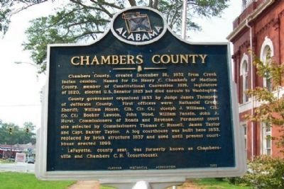
Chambers County
Chambers County, created December 18, 1832 from Creek Indian cession. Named for Dr. Henry C. Chambers of Madison County, member of Constitutional Convention 1819, legislature of 1820, elected U.S. Senator 1825 but died enroute to Washington.
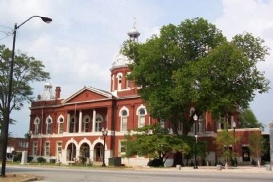
County government organized 1833 by Judge James Thompson of Jefferson County. First officers were: Nathaniel Greer, Sheriff; William House, Clk. Cir. Ct.; Joseph J. Williams, Clk. Co. Ct.; Booker Lawson, John Wood, William Fannin, John A. Hurst, Commissioners of Roads and Revenue. Permanent court site selected by Commissioners Thomas C. Russell, James Taylor and Capt. Baxter Taylor. A log courthouse was built here 1833, replaced by brick structure 1837 and used until present courthouse erected 1899.
LaFayette, county seat, was formerly known as Chambersville and Chambers C. H. (courthouse).
Erected 1972 by Alabama Historical Association.
Topics and series. This historical marker is listed in these topic lists: Native Americans • Political Subdivisions • Settlements & Settlers. In addition, it is included in the Alabama Historical Association series list. A significant historical date for this entry is December 18, 1861.
Location. 32° 53.96′ N, 85° 24.068′ W. Marker is in LaFayette , Alabama, in Chambers County. Marker is on Lafayette Street North (U.S. 431) just south of Alabama Avenue, on the right when traveling north. Marker is on the west grounds of the county courthouse. Touch for map. Marker is at or near this postal address: 21 Lafayette St N, Lafayette AL 36862, United States of America. Touch for directions.
Other nearby markers. At least 8 other markers are within walking distance of this marker. Chambers County War Memorial (a few steps from this marker); Joe Louis (a few steps from this marker); Muscogee Indians (a few steps from this marker); The LaFayette Presbyterian Church (about 600 feet away, measured in a direct line); LaFayette Cemetery (approx. 0.4 miles away); Vines Funeral Home and Ambulance Service (approx. half a mile away); Chambers County Training School (approx. 0.8 miles away); Essie J. Handy Memorial Cemetery (approx. 0.9 miles away). Touch for a list and map of all markers in LaFayette.
Credits. This page was last revised on December 19, 2023. It was originally submitted on April 21, 2009, by William Fischer, Jr. of Scranton, Pennsylvania. This page has been viewed 2,885 times since then and 43 times this year. Photos: 1, 2. submitted on April 21, 2009, by William Fischer, Jr. of Scranton, Pennsylvania. • J. J. Prats was the editor who published this page.

