Edenton in Chowan County, North Carolina — The American South (South Atlantic)
Josephine Napoleon Leary
An amazing and legendary life from slavery to incredible success
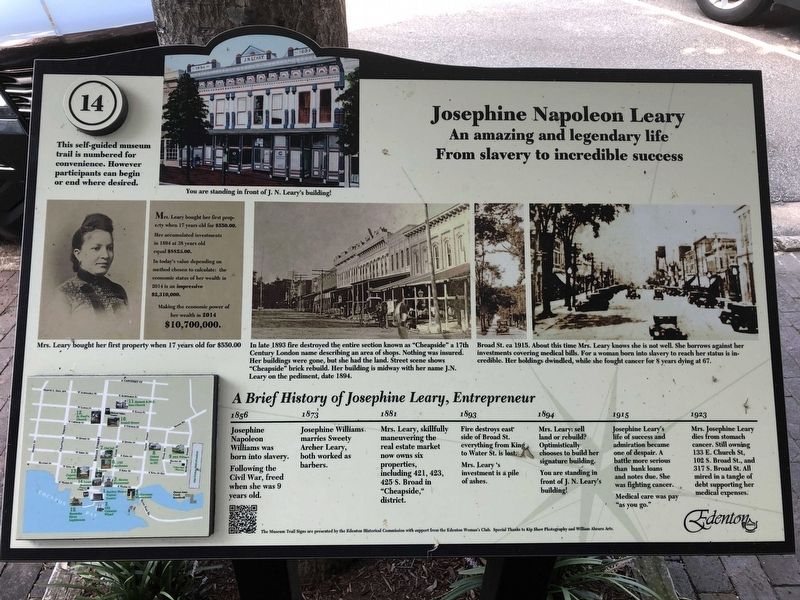
Photographed by Ray Gurganus, September 11, 2021
1. Josephine Napoleon Leary Marker
A Brief History of Josephine Leary, Entrepreneur
1856: Josephine Napoleon Williams was born in to slavery. Following the Civil War, freed when she was 9 years old.
1873: Josephine Williams marries Sweety Archer Leary, both worked as barbers
1881: Mrs. Leary, skillfully maneuvering the real estate market now owns six properties, including 421, 423, 425 S. Broad in "Cheapside" district.
1893: Fire destroys east side of Broad St, everything from King to Water St is lost. Mrs. Leary's investment is a pile of ashes.
1894: Mrs. Leary: sell land or rebuild? Optimistically chooses to build her signature building. You are standing in front of J. N. Leary's building!
1915: Josephine Leary's life of success and admiration became one of despair. A battle more serious than bank loans and notes due. She was fighting cancer. Medical care was pay "as you go".
1923: Mrs. Josephine Leary dies from stomach cancer. Still owning 133 E. Church St, 102 S. Broad St, and 317 S. Broad St. All mired in a tangle of debt supporting her medical expenses.
Erected by the Edenton Historical Commission with support from the Edenton Woman's
this page online
Topics. This historical marker is listed in these topic lists: African Americans • Disasters • Industry & Commerce • Women.
Location. 36° 3.447′ N, 76° 36.553′ W. Marker is in Edenton, North Carolina, in Chowan County. It is on South Broad Street north of East Water Street, on the right when traveling north. Touch for map. Marker is at or near this postal address: 419 South Broad Street, Edenton NC 27932, United States of America. Touch for directions.

Regionally, this marker is in the Coastal Plain. It is also in the American South, specifically in the Upper South, in the Tidewater, and on the Eastern Seaboard. Globally, it is in the North Atlantic Region, North America, the Western Hemisphere, the Western World, and the Anglosphere. Historically, it finds itself in what was once the territory of the Mississippian Culture, one of the original Thirteen Colonies, one of the Confederate States of America, and the Antebellum South.
Other nearby markers. At least 8 other markers are within walking distance of this marker: 1758 Cupola House (within shouting distance of this marker); Vinyl Night (within shouting distance of this marker); Site of the Old Cupola House Kitchen? (within shouting distance of this marker); Joseph Hewes (within shouting distance of this marker); Residence of Mrs. Elizabeth King (about 300 feet away, measured in a direct line); Edenton Tea Pot (about 300 feet away); 1767 Chowan County Courthouse (about 400 feet away); a different marker also named Joseph Hewes (about 400 feet away). Touch for a list and map of all markers in Edenton.
Another marker is no longer nearby. Our Confederate Dead (was about 300 feet away but has been confirmed missing).
Related markers. Click here for a list of markers that are related to this marker. Edenton Historical Commission Museum Trail
Also see . . . Museum Trail – 1894 – Josephine Leary Building. (Submitted on September 13, 2021.)
Credits. This page was last revised on June 7, 2023. It was originally submitted on September 12, 2021, by Ray Gurganus of Washington, District of Columbia. This page has been viewed 2,198 times since then and 63 times this year. Photo 1. submitted on September 12, 2021, by Ray Gurganus of Washington, District of Columbia. • Bernard Fisher was the editor who published this page.
Editor’s want-list for this marker. A wide shot of the marker in context • Can you help?
