Near Franklin in Southampton County, Virginia — The American South (Mid-Atlantic)
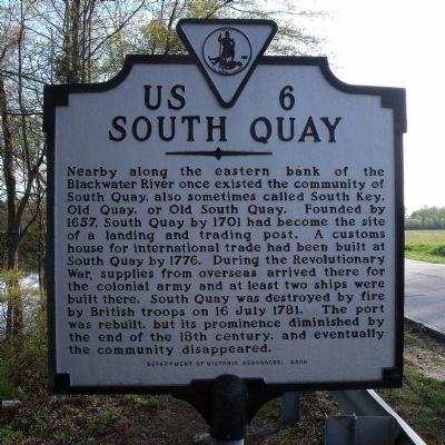
South Quay
Erected 2000 by Department of Historic Resources. (Marker Number US-6.)
Topics and series. This historical marker is listed in these topic lists: Colonial Era • Settlements & Settlers • War, US Revolutionary. In addition, it is included in the Virginia Department of Historic Resources (DHR) series list. A significant historical date for this entry is July 16, 1781.
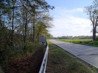
Location. 36° 37.155′ N, 76° 54.69′ W. Marker is near Franklin, Virginia, in Southampton County. Marker is on South Quay Road (Virginia Route 189) half a mile east of Bethany School Road, on the left when traveling west. Touch for map. Marker is in this post office area: Franklin VA 23851, United States of America. Touch for directions.
Other nearby markers. At least 8 other markers are within 4 miles of this marker, measured as the crow flies. William Mahone's Birthplace (approx. 2˝ miles away); Della Irving Hayden (approx. 3.3 miles away); The Blackwater Line (approx. 3.8 miles away); Battle of Franklin (approx. 3.8 miles away); Confederate Commissary Center (approx. 3.8 miles away); The Barretts: A Franklin Pioneer Family (approx. 3.8 miles away); The Age of Steam (approx. 3.8 miles away); "Can't Is Not in the Camp's Vocabulary" (approx. 3.8 miles away). Touch for a list and map of all markers in Franklin.
Credits. This page was last revised on June 16, 2016. It was originally submitted on April 22, 2009, by Bernard Fisher of Richmond, Virginia. This page has been viewed 1,694 times since then and 30 times this year. Photos: 1, 2. submitted on April 22, 2009, by Bernard Fisher of Richmond, Virginia.

