Near Wiley in Prowers County, Colorado — The American Mountains (Southwest)
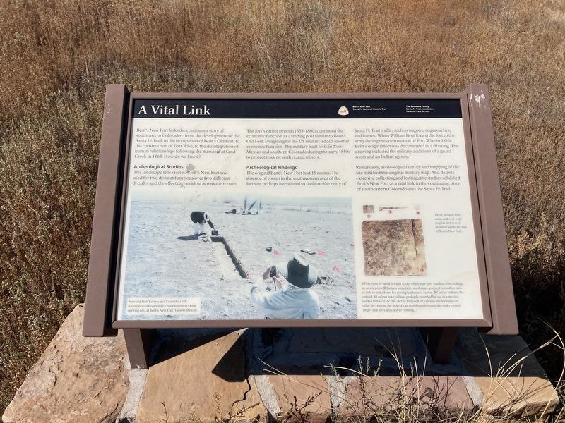
A Vital Link
Archeological Studies
The landscape tells stories. Bent's New Fort was used for two distinct functions over two different decades and the effects are evident across the terrain.
The fort's earlier period (1853-1860) economic function as a trading post similar to Bent's Old Fort. Freighting for the US military added another economic function. The military built forts in New Mexico and southern Colorado during the early 1850s to protect traders, settlers, and miners.
Archaeological Findings
The original Bent's New Fort had 15 rooms. The absence of rooms in the southwestern area of the fort was perhaps intentional to facilitate the entry of Santa Fe traffic, such as wagons, stagecoaches, and horses. When William Bent leased the fort to the army during the construction of Fort Wise in 1860, Bentís original fort was documented in a drawing. The drawings included the military additions of a guard room and an Indian agency.
Remarkably, archeological survey and mapping of the site matched the original military map. And despite extensive collecting and looting, the studies solidified Bent's New Fort as a vital link in the continuing story of southeastern Colorado and the Santa Fe Trail.
Captions: These artifacts were excavated near a tipi ring located several hundred feet to the east of Bent's New Fort.
1 This piece of metal is waste scrap, which may have resulted from making an arrow point.
2 Indians sometimes used sharp-pointed horseshoe nails as awls to make holes for sewing leather and canvas.
3 Cast by Indians, the unfired .48 caliber lead ball was probably intended for use in a muzzle- loaded Indian trade rifle.
4 The flattened tin can was intentionally cut off at the bottom; the strip of can could have been used to make conical jingles that were attached to clothing. Associates staff complete a test excavation in the tipi ring area at Bent's New Fort.
Erected by The Semmens Family; Santa Fe Trail Association; National Park Service.
Topics. This historical marker is listed in these topic lists: Anthropology & Archaeology • Forts and Castles • Industry & Commerce • Native Americans. A significant historical year for this entry is 1853.
Location. 38° 5.621′ N, 102° 45.598′ W. Marker is near Wiley, Colorado, in Prowers County. Marker can be reached from County Highway 35.25 south of County Highway JJ. Touch for map. Marker is in this post office area: Wiley CO 81092, United States of America. Touch for directions.
Other nearby markers. At least 8 other markers are within 8 miles of this marker, measured as the crow flies. Why a Massacre? (within shouting distance of this marker); Bentís New Fort (within shouting distance of this marker); His Final Fort (about 300 feet away, measured in a direct line); Bentís Trading Post at Big Timbers (about 500 feet away); Tragedy and Restoration (about 600 feet away); Madonna of the Trail (approx. 7.7 miles away); Welcome to Colorado - Lamar Country (approx. 7.7 miles away); Experience the Past on the Santa Fe Trail (approx. 7.7 miles away). Touch for a list and map of all markers in Wiley.
Credits. This page was last revised on September 17, 2021. It was originally submitted on September 14, 2021, by Connor Olson of Kewaskum, Wisconsin. This page has been viewed 115 times since then and 19 times this year. Photo 1. submitted on September 14, 2021, by Connor Olson of Kewaskum, Wisconsin. • Andrew Ruppenstein was the editor who published this page.
