Vidalia in Toombs County, Georgia — The American South (South Atlantic)
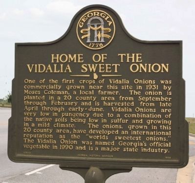
Home of the Vidalia Sweet Onion
Inscription.
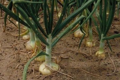
One of the first crops of Vidalia Onions was commercially grown near this site in 1931 by Moses Coleman, a local farmer. The onion is planted in a 20 county area from September through February and is harvested from late April through early-June. Vidalia Onions very low in pungency due to a combination of the native soils being low in sulfur and the growing in a mild climate. The onions, grown in this 20 county area, have developed an international reputation as the "world's sweetest onion." The Vidalia Onion was named Georgia's official vegetable in 1990 and is a major state industry.
Erected 1999 by Georgia Historic Marker. (Marker Number 138-3.)
Topics and series. This historical marker is listed in these topic lists: Agriculture • Horticulture & Forestry • Industry & Commerce. In addition, it is included in the Georgia Historical Society series list. A significant historical year for this entry is 1931.
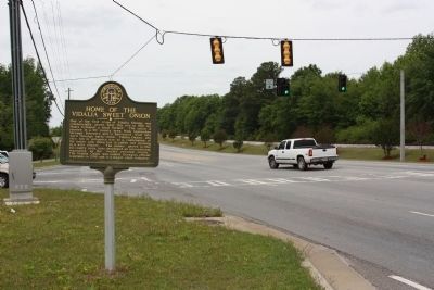
Location. 32° 12.291′ N, 82° 21.761′ W. Marker is in Vidalia, Georgia, in Toombs County. Marker is on East 1st Street (U.S. 280) near Pete Phillips Drive, on the right when traveling east. Touch for map. Marker is in this post office area: Vidalia GA 30474, United States of America. Touch for directions.
Other nearby markers. At least 8 other markers are within 4 miles of this marker, measured as the crow flies. Toombs County (approx. 2.1 miles away); Lyons Garden Club Building (approx. 2˝ miles away); Peterson-Wilbanks House (approx. 3 miles away); McMillan Burial Ground (approx. 3.1 miles away); Unknown Confederate Graves (approx. 3.1 miles away); To Commemorate the 100th Anniversary of the Sons of Confederate Veterans (approx. 3.1 miles away); Paul Anderson (approx. 3.3 miles away); Minenwerfer (approx. 3.4 miles away). Touch for a list and map of all markers in Vidalia.
Also see . . . What Makes Vidalia Onions So Unique. The Grove blog entry (Submitted on August 8, 2022, by Larry Gertner of New York, New York.)
Credits. This page was last revised on August 8, 2022. It was originally submitted on April 23, 2009, by Mike Stroud of Bluffton, South Carolina. This page has been viewed 1,739 times since then and 11 times this year. Photos: 1, 2, 3. submitted on April 23, 2009, by Mike Stroud of Bluffton, South Carolina. • Craig Swain was the editor who published this page.


