Ketchikan in Ketchikan Gateway Borough, Alaska — Northwest (North America)
Keeping the Catch!
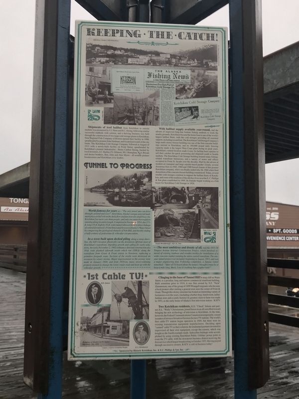
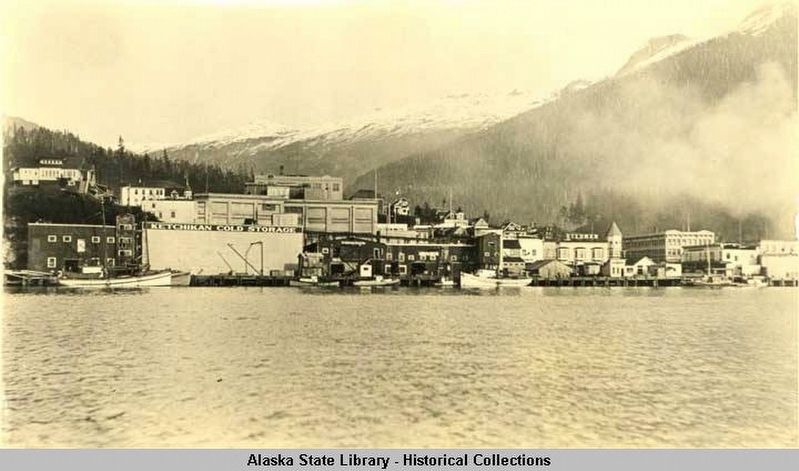
Shipments of iced halibut from Ketchikan to outside markets was pioneered by F.J. Hunt and H.C. Strong, following similar successful methods with salmon, and a thriving business was built through the construction of two large cold storage plants in Ketchikan. New England Fish Company of Boston opened their facility in 1908, spearheaded by pioneer John Stedman, and located just south of the city limits. The Ketchikan Cold Storage Company followed in August of 1913 with a newly-built facility on Front Street, spearheaded by Ketchikan's pioneer industrialist — Henry Carlton Strong, backed by local investors, J.C. Barber, P.J. Gilmore, M.J. Heneghan, W.A. Bryant and doctor brothers, Ben, John and Alex Myers — all notable pioneer businessmen and Ketchikan civic leaders.
With halibut supply available year-round, and the advent of improved long-line bottom fishing methods to work the nearby grounds, Ketchikan became the home base to one of the world's largest halibut fleets, with the cold storages providing all essential support, including ice and bait. The Ketchikan Cold Storage Company's large multi-story freezer building was one of the first concrete buildings erected in Ketchikan, and its 180,000-pound daily freezing capacity made it the largest West Coast plant during its peak years. Ketchikan's central location made it easy for halibut boat captains to sell their catches for quick processing and shipment south to Seattle markets. The Ketchikan Cold Storage building housed many fishing-related waterfront businesses, and a variety of stores and offices occupied its Front St. facade over the decades. Hurt by the advent of modern air transport and large outside-based packer vessels, several disastrous fires in 1945, 1960 and 1968 forced closure of this pioneer Ketchikan company, whose era finally ended July 24, 1968 when final demolition of the concrete freezer building commenced. Today, several smaller cold storages continue to support the halibut fleets of Ketchikan, and some of the tradition of the old days lives on at the E.C. Phillips & Son plant established in 1949. Its founder began working as a fish buyer for Ketchikan Cold Storage in 1926.
Tunnel to Progress
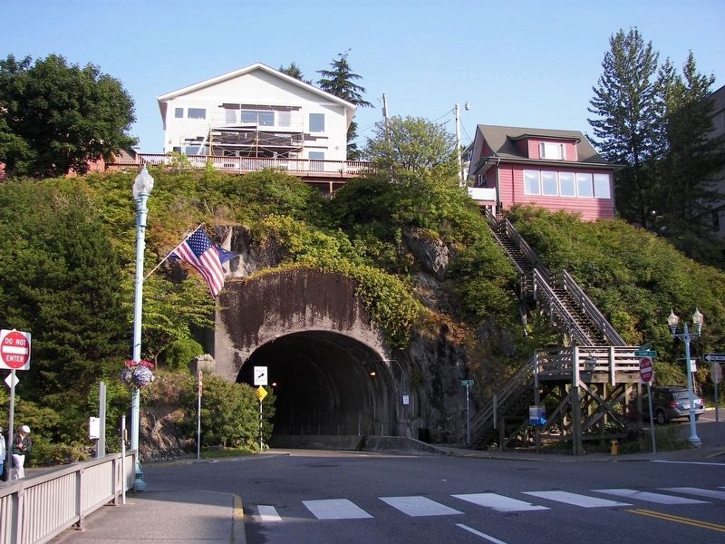
World-famous for years as “The only tunnel you can drive through, around and over!”, Ketchikan, Alaska's unique arterial landmark plays a vital role in the daily flow and function of a small busy city. Ketchikan has more cars than people, and only one main thoroughfare running along its entire length. Completed in November 1954, this 273-ft. long (19-ft. high by 30-ft. wide) tunnel allowed the first direct linkage of central downtown's Front Street and Newtown District's Water Street by conquering
the geological obstacle of Nob Hill, and thereby ending a half-century of pedestrian & vehicular circumvention.
In a town built upon decked piling along a steep shoreline, the hill's location physically cut the downtown off from most of Ketchikan's waterfront, impeding growth and calling for early solutions. An early November 2, 1902 ordinance directed construction of a 10-ft. wide planked sidewalk trestle which ran 1200-ft. along the waterfront from Grant & Front streets to Newtown, replacing a primitive footpath route. Sections of the trestle were destroyed on occasion by winter storms. Major improvements to the avenue were made in January 1908, and from 1919-on, many street-widening projects ensued to change the town's main road and keep up with the vehicular growth.
The most ambitious and drastic of all was the 1953-54 Tongass Avenue Arterial Construction Project, which involved removal of existing roadway and wooden trestles for installation of a wider concrete viaduct running the entire central waterfront. The one-year tunnel project was included, beginning in August, 1953, and was a major engineering feat. Following completion, a Juneau visitor remarked “After all I'd heard about the tunnel, I thought it must be at least a mile long. Heck, I see it's nothing but a gopher hole!”
1st Cable TV!
Clinging to the base of Tunnel
Hill's steep cliff on Water Street is a peculiar, long and narrow commercial storefront building. Built sometime prior to 1914, it was first owned by N.F. “Nick” Zimmerman, one of the group of 1899 Wrangell migrants who became a local pioneer after starting a general store near the corner of Front & Grant. Though this skinny structure has hosted an interesting variety of businesses over the years (including a barber shop, lunch room, ladies' fashion store and a candy factory), its greatest claim to fame was made in 1953, as the early home of Alaska's first television station — KATV.
Two Ketchikan residents, R.D. “Chuck” Jensen and partner, E.L. “Wally” Christiansen, joined forces in an all-out effort toward bringing the new technology of television to Ketchikan. At the time, however, the Federal Communications Commission temporarily ceased issuance of airwave broadcast licenses for new TV stations. The world's first cable TV station began operation in 1949, but there were no existing transmission equipment manufacturers. Deciding upon “canned” cable TV as their solution, the undaunted partners invented or improvised all their own equipment, except the camera, which was bought as the fourth example made. Subscriber hookups were accomplished by using existing Ketchikan Public Utilities power poles to route the TV cable, with the downtown business district receiving the first service which began broadcasting in October 1953. Having passed through successive owners, KATV is still in business today!
Captions
(Top)
• Ketchikan, Alaska 1930 waterfront H.E. Hunt/Tongass Historical Society
• 8/13/45 fire THS
(Center, clockwise from left)
• Sidewalk trestle circa 1904 H.E. Hunt/THS
• 'Stop-n-Go' 8/3/53 Paul Saari
• Tunnel breakthrough — Feb. 15, 1954 Paul Saari
(Bottom, clockwise from top left)
• R.D. Jensen
• Downtown wired for TV 10/29/53 Paul Saari
• E.L. Christiansen
• Birthplace of Alaska's 1st TV station, Ketchikan — Oct. 1953 Courtesy Georgiana Murphy
Erected by Historic Ketchikan, Inc.
Topics. This historical marker is listed in these topic lists: Bridges & Viaducts • Communications • Industry & Commerce • Roads & Vehicles. A significant historical month for this entry is January 1908.
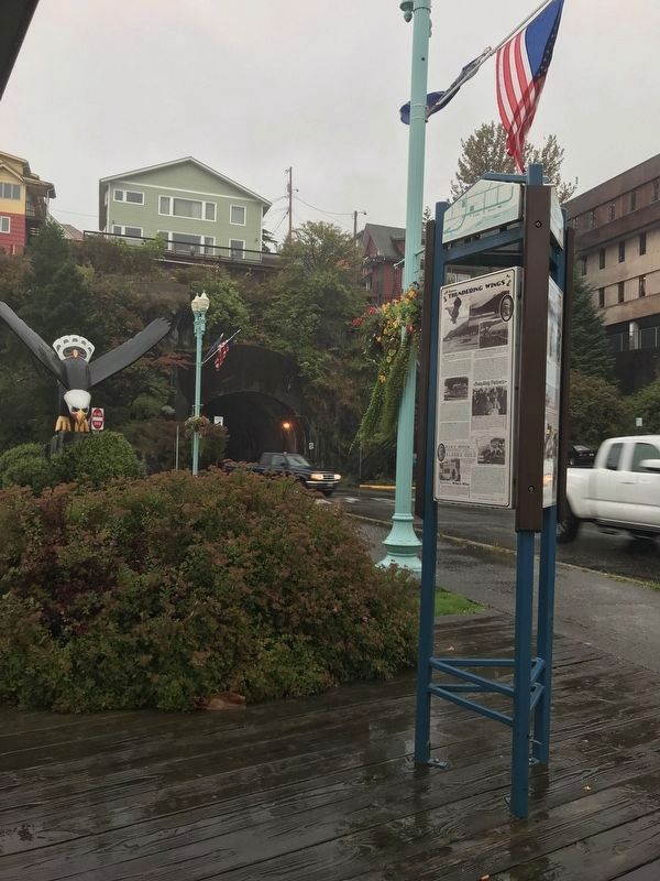
Location. 55° 20.549′ N, 131° 38.912′ W. Marker is in Ketchikan, Alaska, in Ketchikan Gateway Borough. Marker is at the intersection of Front Street and Water Street, on the right when traveling south on Front Street . Touch for map. Marker is at or near this postal address: 348 Front Street, Ketchikan AK, United States of America. Touch for directions.
Other nearby markers. At least 8 other markers are within walking distance of this marker. Upon 'Thundering Wings' (here, next to this marker); From Planks to Pavement (here, next to this marker); The Gilmore Hotel (within shouting distance of this marker); Tongass Trading Company (about 400 feet away, measured in a direct line); Star-crossed Square Riggers (about 500 feet away); Proud Canoes & Coastal Traders (about 500 feet away); When 'Steam was Queen' (about 500 feet away); Ketchikan Waterfront from Pennock Island, 1905 (about 600 feet away). Touch for a list and map of all markers in Ketchikan.
Regarding Keeping the Catch!. Edward "Wally" Christiansen died Nov. 27, 2009 in Billings, Montana. Randall D. "Chuck" Jensen died Nov. 1, 2013 in Scottsdale, Arizona.
Also see . . .
1. Ketchikan Cold Storage and colorful Mgr. Jim Pinkerton (PDF). Retrospective by June Allen in the online news site Stories in the News, posted December 9, 2003. (Submitted on September 15, 2021, by Duane and Tracy Marsteller of Murfreesboro, Tennessee.)
2. Ketchikan's Iconic Tunnel Turns 60 (PDF). Retrospective by Dave Kiffer in the online news site Stories in the New, posted June 17, 2014. (Submitted on September 15, 2021, by Duane and Tracy Marsteller of Murfreesboro, Tennessee.)
3. Cable TV came to Ketchikan 60 years ago (PDF). History column by Dave Kiffer in the online news site Stories in the News, posted December 14, 2013. (Submitted on September 15, 2021, by Duane and Tracy Marsteller of Murfreesboro, Tennessee.)
Credits. This page was last revised on April 6, 2022. It was originally submitted on September 15, 2021, by Duane and Tracy Marsteller of Murfreesboro, Tennessee. This page has been viewed 184 times since then and 17 times this year. Photos: 1, 2, 3, 4. submitted on September 15, 2021, by Duane and Tracy Marsteller of Murfreesboro, Tennessee.


