Marker Logo HMdb.org THE HISTORICAL
MARKER DATABASE
“Bite-Size Bits of Local, National, and Global History”
Near Wytheville in Wythe County, Virginia — The American South (Mid-Atlantic)
 

Wythe County Poorhouse Farm


Wythe County Poorhouse Farm Marker image. Click for full size.
Photographed By Dawn Bowen, July 20, 2007
1. Wythe County Poorhouse Farm Marker
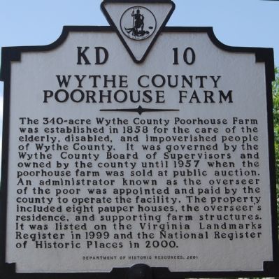
Inscription. The 340-acre Wythe County Poorhouse Farm was established in 1858 for the care of the elderly, disabled, and impoverished people of Wythe County. It was governed by the Wythe County Board of Supervisors and owned by the county until 1957 when the poorhouse farm was sold at public auction. An administrator known as the overseer of the poor was appointed and paid by the county to operate the facility. The property included eight pauper houses, the overseer’s residence, and supporting farm structures. It was listed on the Virginia Landmarks Register in 1999 and the National Register of Historic Places in 2000.
 
Erected 2001 by Department of Historic Resources. (Marker Number KD-10.)
 
Topics and series. This historical marker is listed in this topic list: Agriculture. In addition, it is included in the Virginia Department of Historic Resources (DHR) series list. A significant historical year for this entry is 1858.
 
Location. 36° 58.712′ N, 81° 1.709′ W. Marker is near Wytheville, Virginia, in Wythe County. Marker is on Peppers Ferry Road (County Route 610) 2.1 miles east of Interstate 77. Touch for map. Marker is in this post office area: Wytheville VA 24382, United States of America. Touch for directions.
 
Other nearby markers. At least 8 other markers are within 4 miles of this marker, measured as the crow flies. Walter Crockett (approx. 2.7 miles away); Robert Enoch Withers
Paid Advertisement
Click on the ad for more information.
Please report objectionable advertising to the Editor.
Click or scan to see
this page online
(approx. 3 miles away); Our Confederate Dead (approx. 3.1 miles away); Crockett’s Cove (approx. 3.2 miles away); War Between The States Marker (approx. 3.3 miles away); Crockett's Cove Presbyterian Church (approx. 3.3 miles away); Wytheville Training School (approx. 3.4 miles away); St. John's Episcopal Church (approx. 3½ miles away). Touch for a list and map of all markers in Wytheville.
 
Also see . . .  The Wythe County Poorhouse Farm. (Submitted on July 23, 2007, by Dawn Bowen of Fredericksburg, Virginia.)
 
Wythe County Poorhouse Farm Marker image. Click for full size.
Photographed By J. J. Prats, May 28, 2011
2. Wythe County Poorhouse Farm Marker
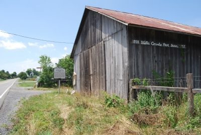
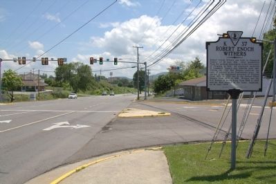
Marker on Peppers Ferry Road image. Click for full size.
Photographed By Dawn Bowen, July 20, 2007
3. Marker on Peppers Ferry Road
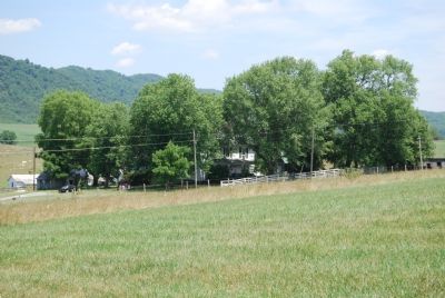
Overview of the poorhouse farm image. Click for full size.
Photographed By Dawn Bowen, July 20, 2007
4. Overview of the poorhouse farm
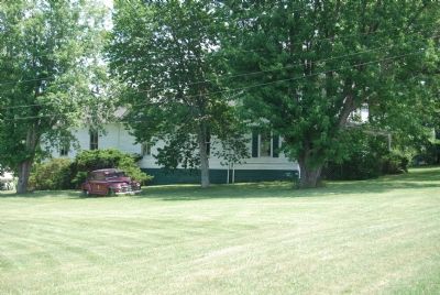
The main farm house image. Click for full size.
Photographed By Dawn Bowen, July 20, 2007
5. The main farm house
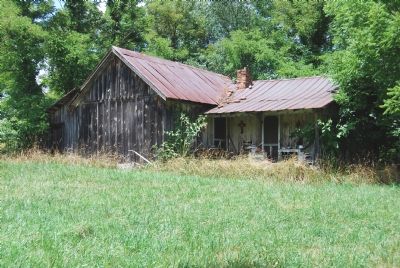
The tenant's cabin image. Click for full size.
Photographed By Dawn Bowen, July 20, 2007
6. The tenant's cabin
 
 
Credits. This page was last revised on June 16, 2016. It was originally submitted on July 22, 2007, by Dawn Bowen of Fredericksburg, Virginia. This page has been viewed 2,290 times since then and 44 times this year. Photos:   1. submitted on July 22, 2007, by Dawn Bowen of Fredericksburg, Virginia.   2. submitted on July 23, 2011, by J. J. Prats of Powell, Ohio.   3, 4, 5, 6. submitted on July 22, 2007, by Dawn Bowen of Fredericksburg, Virginia. • J. J. Prats was the editor who published this page.
Share this page.  
Share on Tumblr
m=1820

CeraNet Cloud Computing sponsors the Historical Marker Database.
This website earns income from purchases you make after using our links to Amazon.com. We appreciate your support.
Paid Advertisement
Apr. 23, 2024