
Fishers Hill in Shenandoah County, Virginia — The American South (Mid-Atlantic)
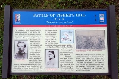
Battle of Fisher’s Hill
“Indications were ominous”
| — | 1864 Valley Campaign | — |
Photographed by Bernard Fisher, September 13, 2015
1. Battle of Fisher’s Hill Marker
Early, however, lacked the manpower to cover the nearly four-mile-long front from Little North Mountain on the
this page online
(captions)
(left) Lt. John M. Gould Courtesy Nicholas Picerno Collection
(center) Capt. Henry Kyd Douglas Courtesy Antietam National Battlefield
(right) Sheridan’s army following Early up the Valley of the Shenandoah Courtesy Library of Congress
Erected by Virginia Civil War Trails.
Topics and series. This historical marker is listed in this topic list: War, US Civil. In addition, it is included in the Virginia Civil War Trails series list. A significant historical date for this entry is September 22, 1864.
Location. Marker has been permanently removed. It was located near 38° 59.3′ N, 78° 25.01′ W. Marker was in Fishers Hill, Virginia, in Shenandoah County. It could be reached from Battlefield Road (Virginia
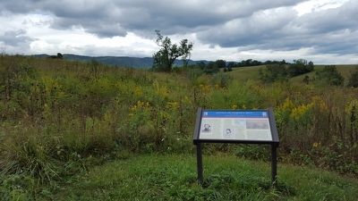
Photographed by Bernard Fisher, September 13, 2015
2. Battle of Fisher’s Hill Marker
We have been informed that this marker is no longer there and will not be replaced. This page is an archival view of what was.
Regionally, this marker was in Virginia’s Shenandoah Valley. It was also in the American South, specifically in the Upper South, and in the Mid-Atlantic. Globally, it was in North America, the Western Hemisphere, the Western World, and the Anglosphere. Historically, it found itself in what was once the territory of the Mississippian Culture, one of the original Thirteen Colonies, one of the Confederate States of America, and the Antebellum South.

Other nearby markers. At least 8 other markers are within walking distance of this location: Eve of Battle (a few steps from this marker); The Fight for the "Bull Pens" (about 300 feet away); Confederate Gibraltar (about 400 feet away); Pegram's Division Collapses
Photographed by Bernard Fisher
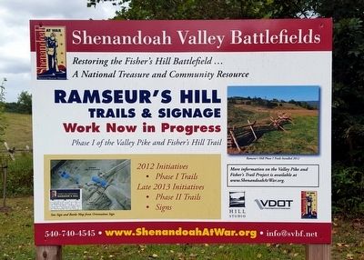
3. Ramseur's Hill - Fisher's Hill Battlefield
Other markers no longer nearby. Fisher’s Hill (was about 300 feet away, measured in a direct line but has been permanently removed); a different marker also named Fisher's Hill (was about 400 feet away but has been permanently removed); a different marker also named Fisher’s Hill (was about 600 feet away but has been permanently removed); a different marker also named Fisher’s Hill (was about 800 feet away but has been permanently removed); a different marker also named Fisher's Hill (was approx. 0.2 miles away but has been permanently removed).
Related marker. Click here for another marker that is related to this marker. This marker has been replaced by another nearby.
Also see . . .
1. Battle of Fisher’s Hill. Shenandoah at War (Submitted on September 13, 2015.)
2. Fisher's Hill. American Battlefield Trust (Submitted on September 26, 2021.)
Credits. This page was last revised on November 6, 2024. It was originally submitted on September 13, 2015, by Bernard Fisher of Richmond, Virginia. This page has been viewed 1,179 times since then and 31 times this year. Last updated on September 23, 2021, by Bradley Owen of Morgantown, West Virginia. Photos: 1, 2, 3. submitted on September 13, 2015, by Bernard Fisher of Richmond, Virginia. • J. Makali Bruton was the editor who published this page.
