Mio in Oscoda County, Michigan — The American Midwest (Great Lakes)
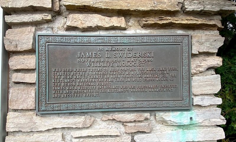
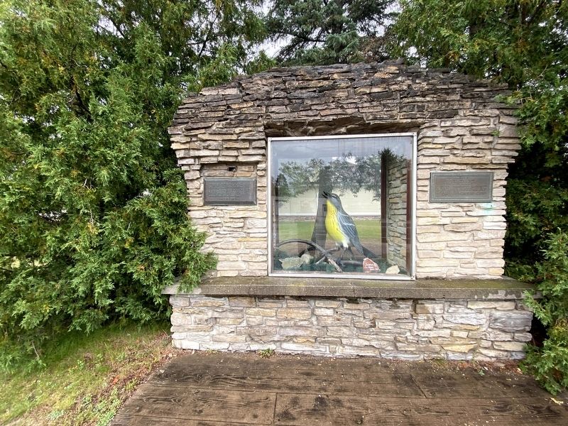
In Memory of James L. Swiderski
November 8, 1950 - May 5, 1980
James was a wildlife enthusiast who was personally involved with and dedicated to the Kirtland's warbler management and recovery effort.
Topics. This historical marker is listed in these topic lists: Disasters • Environment • Horticulture & Forestry. A significant historical date for this entry is May 5, 1980.
Location. 44° 38.949′ N, 84° 7.789′ W. Marker is in Mio, Michigan, in Oscoda County. Marker is at the intersection of Morenci Avenue (State Highway 33) and 11th Street, on the right when traveling north on Morenci Avenue. Located at the Oscoda County Courthouse. Touch for map. Marker is at or near this postal address: 311 Morenci Avenue, Mio MI 48647, United States of America. Touch for directions.
Other nearby markers. At least 3 other markers are within walking distance of this marker. Oscoda County Veterans Memorial (within shouting distance of this marker); Mio Hydro (approx. 0.9 miles away); Mio Hydroelectric Plant / Hydroelectric Power (approx. 0.9 miles away).
Related marker. Click here for another marker that is related to this marker.
Also see . . . Staff Ride to the Mack Lake Fire. Excerpt:
Due to a series of events, ignition of the prescribed burn was started later than planned. This, in combination with a frontal passage and increased winds, led to frequent spot fires. Eventually the fire spotted on the east side of Highway M-33.(Submitted on September 23, 2021, by J.T. Lambrou of New Boston, Michigan.)
Credits. This page was last revised on June 24, 2022. It was originally submitted on September 23, 2021, by J.T. Lambrou of New Boston, Michigan. This page has been viewed 259 times since then and 29 times this year. Photos: 1, 2, 3. submitted on September 23, 2021, by J.T. Lambrou of New Boston, Michigan. • Mark Hilton was the editor who published this page.


