Victoria in Lunenburg County, Virginia — The American South (Mid-Atlantic)
Places of the Past
Honoring Our History
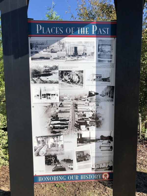
[Captions:]
Dave's Auto Treat
First school house in Victoria
First pumper 1941 Chevrolet (watch out)
1941 Chevrolet Oren Fire Truck
First factory-built fire truck for the town, built in Roanoke, Virginia and delivered to Victoria on the Virginian Railway
First bridge across Nottoway River before Dan was built. Had stee box fame with wooden deck, railings, etc. (Below present Rt. 49 bridge.
Bridge no: _]
First bridge across Nottoway River (left)
Nottoway Falls Mill (below)
Nottoway Falls Hill
"A water wheel full" of visitors. Note long dresses, hats & bows.
Main St looking east
Corner Eighth & Main St.
"Pender" Grocery
Victoria dispatch printed in rear of building
Main Street (originally named Jackson Street)
(6th Street was laid out for/as Main St.)
Eighth Street looking North, Victoria, Va.
Main saw mill of Victoria Supply Co.
Main sawmill at Victoria, VA. of Victoria Supply Co., Inc.
Main St looking West (circa 1950's)
Peebles Shopping Center (view looking down 8th Street)
Penders (a big chain grocery-fore runner to Colonial Stores) on corner of 8th St & Main. A half-block down Main was an A&P Store, another of the big chains. Next to Penders is the Victoria Dispatch Bldg. Sanitary Barber Shop & "Docs" Cold Drinks, etc., 1940
Note one of Victoria's deepest snows:
Home Economics and Agriculture Building (Victoria High School, circa 1945)
Erected by Town of Victoria, Virginia.
Topics. This historical marker is listed in these topic lists: Education • Industry & Commerce • Roads & Vehicles • Waterways & Vessels. A significant historical year for this entry is 1941.
Location. 36° 59.566′ N, 78° 13.591′ W. Marker is in Victoria, Virginia, in Lunenburg County. Marker is at the intersection of Firehouse Road and 6th Street, on the right when traveling north on Firehouse Road. Touch for map. Marker is at or near this postal address: 1301 6th St, Victoria VA 23974, United States of America. Touch for directions.
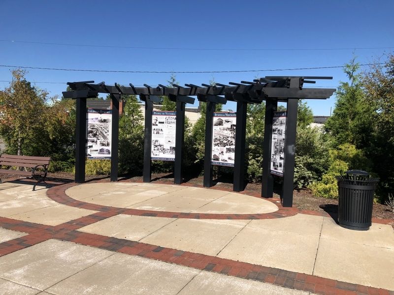
Other nearby markers. At least 8 other markers are within 3 miles of this marker, measured as the crow flies. Businesses & Merchants (here, next to this marker); People of Victoria (here, next to this marker); Railroad History (here, next to this marker); Town of Victoria (about 300 feet away, measured in a direct line); The Peoples Community Center (approx. half a mile away); Nathaniel Lee Hawthorne (approx. 0.7 miles away);
Credits. This page was last revised on September 26, 2021. It was originally submitted on September 26, 2021, by Devry Becker Jones of Washington, District of Columbia. This page has been viewed 135 times since then and 19 times this year. Photos: 1, 2. submitted on September 26, 2021, by Devry Becker Jones of Washington, District of Columbia.

