Tiptonville in Lake County, Tennessee — The American South (East South Central)
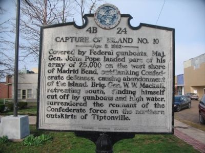
Capture of Island No. 10
Apr. 8. 1862
Erected by Tennessee Historical Commission. (Marker Number 4B 24.)
Topics and series. This historical marker is listed in this topic list: War, US Civil. In addition, it is included in the Tennessee Historical Commission series list.
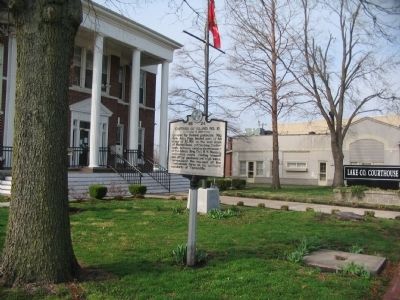
Location. 36° 22.695′ N, 89° 29.038′ W. Marker is in Tiptonville, Tennessee, in Lake County. Marker is at the intersection of Church Street (Tennessee Route 21) and South Court Street, on the right when traveling east on Church Street. Located on the grounds of the county court house. Touch for map. Marker is in this post office area: Tiptonville TN 38079, United States of America. Touch for directions.
Other nearby markers. At least 8 other markers are within 5 miles of this marker, measured as the crow flies. General Clifton Bledsoe Cates (about 300 feet away, measured in a direct line); Tiptonville Presbyterian Church (approx. half a mile away); a different marker also named General Clifton Bledsoe Cates (approx. 2.9 miles away); Reelfoot Lake (approx. 3 miles away); Civilian Conservation Corps and Reelfoot Lake State Park (approx. 3 miles away); Confederate Burials (approx. 3.9 miles away); a different marker also named Capture of Island No. 10 (approx. 4˝ miles away); Confederate Forts & Batteries (approx. 4˝ miles away). Touch for a list and map of all markers in Tiptonville.

Photographed By Craig Swain, March 17, 2009
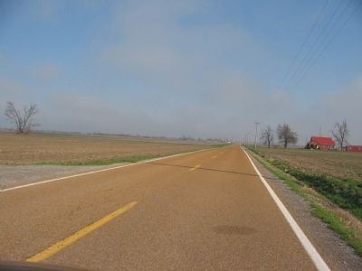
3. Confederate Retreat
Looking north along State Route 22, north of Tiptonville. After the Federal landings at Tiptonville, the Confederates attempted a breakout down a narrow road leading between the Mississippi River bottom swamps and Reelfoot Lake to the east. Today the ground surrounding the road is farmland, drained in the early 20th century.
Credits. This page was last revised on October 15, 2021. It was originally submitted on April 25, 2009, by Craig Swain of Leesburg, Virginia. This page has been viewed 1,470 times since then and 44 times this year. Photos: 1, 2, 3. submitted on April 25, 2009, by Craig Swain of Leesburg, Virginia.

