Mount Vernon near Alexandria in Fairfax County, Virginia — The American South (Mid-Atlantic)
Advantageous Fencing
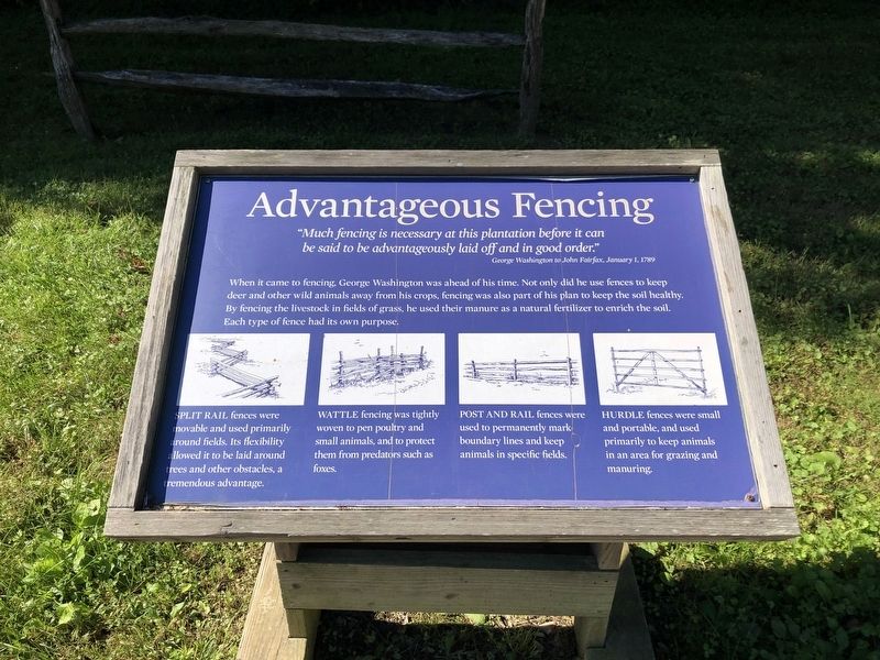
"Much fencing is necessary at this plantation before it can be said to be advantageously laid off and in good order."
George Washington to John Fairfax, January 1, 1789
When it came to fencing, George Washington was ahead of his time. Not only did he use fences to keep deer and other wild animals away from his crops, fencing was also part of his plan to keep the soil healthy. By fencing the livestock in fields of grass, he used their manure as a natural fertilizer to enrich the soil. Each type of fence had its own purpose.
Split rail fences were movable and used primarily around fields. Its flexibility allowed it to be laid around trees and other obstacles, a tremendous advantage.
Wattle fencing was tightly woven to pen poultry and small animals, and to protect them from predators such as foxes.
Post and rail fences were used to permanently mark boundary lines and keep animals in specific fields.
Hurdle fences were small and portable, and used primarily to keep animals in an area for grazing and manuring.
Topics and series. This historical marker is listed in these topic lists: Agriculture •
this page online
Location. 38° 42.34′ N, 77° 5.434′ W. Marker is near Alexandria, Virginia, in Fairfax County. It is in Mount Vernon. It can be reached from the intersection of Mount Vernon Memorial Highway (Virginia Route 235) and George Washington Memorial Parkway, on the right when traveling east. Touch for map. Marker is in this post office area: Alexandria VA 22309, United States of America. Touch for directions.

Regionally, this marker is in the Washington Metropolitan Area and in Northern Virginia. It is also in the American South, specifically in the Upper South, in the Mid-Atlantic, and on the Eastern Seaboard. Globally, it is in the North Atlantic Region, North America, the Western Hemisphere, the Western World, and the Anglosphere. Historically, it finds itself in what was once the territory of the Mississippian Culture, one of the original Thirteen Colonies, one of the Confederate States of America, and the Antebellum South.
Other nearby markers. At least 8 other markers are
Credits. This page was last revised on January 27, 2023. It was originally submitted on September 27, 2021, by Devry Becker Jones of Washington, District of Columbia. This page has been viewed 452 times since then and 28 times this year. Photos: 1, 2. submitted on September 27, 2021, by Devry Becker Jones of Washington, District of Columbia.
