Old Saybrook Center in Middlesex County, Connecticut — The American Northeast (New England)
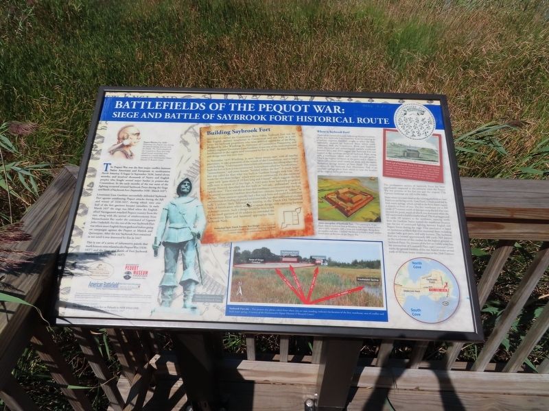
Battlefields of the Pequot War
Siege and Battle of Saybrook Fort Historical Route
The Pequot War was the first major conflict between Native Americans and Europeans in northeastern North America. It began in September 1636, lasted eleven months, and involved thousands of Native and English peoples who fought several major battles in present-day Connecticut. In the early months of the war most of the fighting occurred about a half-mile east of this marker during the Siege and Battle of Saybrook Fort (September 1636 - March 1637).
Lieutenant Lion Gardiner successfully defended Saybrook Fort against unrelenting Pequot attacks during the fall and winter of 1636-1637, during which time over half of the fort garrison became casualties. In early March 1637 the siege was lifted when the English-allied Narragansett attacked Pequot country from the east, along with the arrival of reinforcements from Massachusetts Bay under the command of Captain John Underhill. For the rest of the war Saybrook Fort was where most English forces gathered before going on campaigns against the Pequot at Mistick and Quinnipiac. After the war Saybrook Fort remained in use until it was destroyed by fire in 1647.
This is one of a series of informative panels that mark historic sites related to the Pequot War (1636-1637) and the Siege and Battle of Fort Saybrook (September 1636 - March 1637).
Building Saybrook Fort
Intended to control the Connecticut River Valley, Saybrook Fort was the first English military installation in Connecticut and was built as a safe haven for Saybrook proprietors who were political opponents of the King. Designed by John Winthrop, Jr., Governor of Connecticut Plantations, and military engineer Lieutenant Lion Gardiner, it was one of the most important fortifications in the region until consumed by fire in 1647. Its exact location and design were lost over time.
In November 1635 Winthrop, Jr. sent “about twenty men, with all needful provisions, to take possession of the mouth of the Connecticut, and to begin some building.” Unfortunately there is little information describing where they built the fort or how it was constructed. Instructions called for "fortifications, "intrenchment," and some houses “builded within the fort.” A much larger fort was called for than what was built as Gardiner brought with him “iron worke for two draw bridges” which were never constructed. He also mentions a gate with "great doors of 10 foot long and 4 broad” which suggests the fort walls were in excess of 12 feet high. A 1643 letter from Saybrook proprietor George Fenwick described the fort walls as “red oak...pallasadoes” made of whole trees.” There was also at least one warehouse constructed near the fort. On several occasions Gardiner described two cannons, known as "sakers,"
at the fort. These cannons typically had a five-inch bore and could fire different ammunition including six pound solid iron balls, bar-shot and loads of musket balls. Gardiner likely followed his training in the Dutch Old Netherland Style of fortification which utilized a square design with opposing bastions to mount cannon. Such a design would be best suited for his small garrison of 20 soldiers to command the Connecticut River and landward approaches from Saybrook Neck.
Netherland Style, Dutch Frontier Fort Design — Lion Gardiner was a Dutch-trained military engineer and likely incorporated a similar design when constructing Saybrook Fort.
Where is Saybrook Fort?
There are no historical records indicating the exact location of the first Saybrook Fort. However, from his training as a military engineer, Gardiner sought to select the best, defendable location on Saybrook Point which could command both the Connecticut River and Saybrook Point. Historical and archaeological research conducted between 2012 and 2013 suggest that Saybrook Fort was located in the northeast corner of Saybrook Point along with a warehouse, wharf, and a paled (fenced) garden. This is the highest elevation on the point and is closest to North Cove where small vessels can dock, and the nearby freshwater springs known as Gees Pond. The present location of the Saybrook Fort Monument Park is an excellent vantage point from which to view the location of the original Saybrook Fort site.
The northeastern section of Saybrook Point has been significantly impacted in the centuries since the Pequot War but portions of the fort site and the original 17th Century landscape are still visible today.
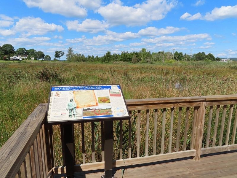
From where you now stand at the viewing platform at Gees Pond you are facing north. Gees Pond, a small pond fed by fresh water springs, which served as the forts water supply is directly in front of you. The fort warehouse site is 300 yards (275 meters) north of this spot atop the hill that rises beyond the pond, much of which was destroyed when the hill was leveled to build a nearby wharf. The sloping ground 50 yards (45 meters) to the northwest, running north from the Gardiner Statue toward the warehouse location was the site of continued fighting between English and Pequot forces during the siege. This conclusion is based on numerous artifacts that were recovered there including musket balls, gun parts, and early buttons. The Saybrook Fort site is located approximately 400 yards (365 meters) to the northwest of this marker on the highest ground on Saybrook Point. No remains of the fort are visible today but the intersection of Cromwell Place and Cromwell Court marks the general location of the site, buried under several yards of fill from home construction in the 20th Century.
( photo captions )
Artist conception of Saybrook Fort — This painting by Roger Epply depicts Saybrook Fort as Winthrop may have hoped to have seen it built, complete with a moat and drawbridges. Being short on supplies and men, Gardiner was forced to build a much smaller fortification at the time of the Pequot War.
South view of Laily Fenwick's Monument on Saybrook Point.
North end of Saybrook Point, Ca. 1830 — A sketch by John Warner Barber which depicts the remains of the old “battery mound” from the Second Saybrook Fort (right), Gee's Pond (middle) and the high ground where the first Saybrook Fort was located (left), Barber stood near the site of the current Saybrook Fort Memorial Park when he drew this scene.
Saybrook Fort site — This present-day photo taken from where you are now standing, indicates the location of the fort, warehouse, area of conflict and fresh water spring, (Courtesy of the Mashantucket Peguot Museum & Research Center)
Background Image: The figure of the Indians fort or Palizado in New England Captain John Underhill • Newes from America, 1637
Topics. This historical marker is listed in these topic lists: Colonial Era • Forts and Castles • Native Americans. A significant historical month for this entry is March 1637.
Location. 41° 17.089′ N, 72° 21.112′ W. Marker is in Old Saybrook, Connecticut, in Middlesex County. It is in Old Saybrook Center. Marker can be reached from College Street (Connecticut Route 154) east of Fenwick Street, on the left when traveling east. Located on the viewing platform in Fort Saybrook Monument Park. Touch for map. Marker is in this post office area: Old Saybrook CT 06475, United States of America. Touch for directions.
Other nearby markers. At least 8 other markers are within walking distance of this marker. Adriaen Block & New Netherland (a few steps from this marker); Welcome to Fort Saybrook (within shouting distance of this marker); Fishing on the Connecticut (within shouting distance of this marker); The Saybrook Bar (within shouting distance of this marker); The Connecticut Valley Railroad (within shouting distance of this marker); Connecticut Valley Railroad Roundhouse & Turntable Site (within shouting distance of this marker); The Connecticut River (within shouting distance of this marker); Fort Saybrook – 1635 (within shouting distance of this marker). Touch for a list and map of all markers in Old Saybrook.
Also see . . .
1. Old Saybrook Historical Society. (Submitted on September 28, 2021, by Michael Herrick of Southbury, Connecticut.)
2. Pequot War (Wikipedia). (Submitted on September 28, 2021, by Michael Herrick of Southbury, Connecticut.)
Credits. This page was last revised on February 10, 2023. It was originally submitted on September 28, 2021, by Michael Herrick of Southbury, Connecticut. This page has been viewed 158 times since then and 20 times this year. Photos: 1, 2. submitted on September 28, 2021, by Michael Herrick of Southbury, Connecticut.

