Keyser in Mineral County, West Virginia — The American South (Appalachia)
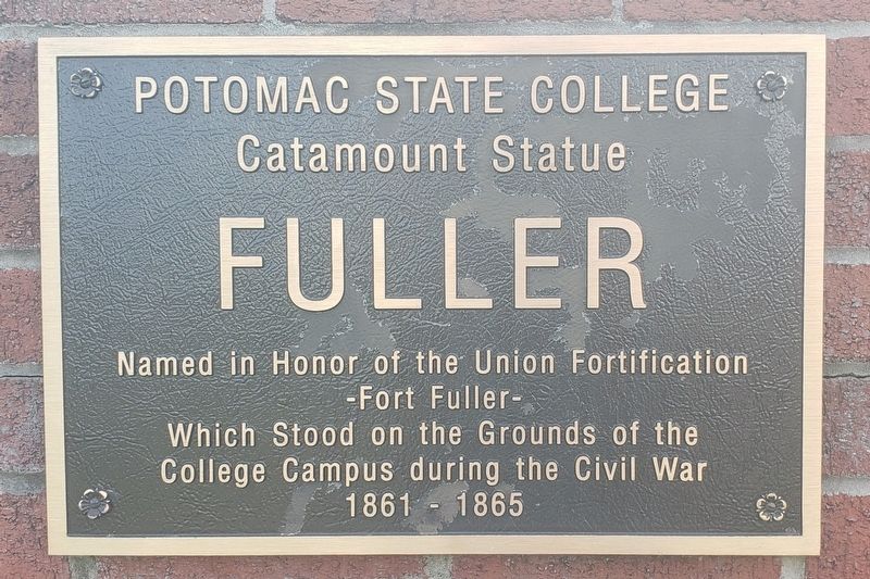
Fuller
Potomac State College
| — | Catamount Statue | — |
Photographed by Bradley Owen, August 21, 2021
1. Fuller Marker
-Fort Fuller-
which stood on the grounds of the
college campus during the Civil War
1861 - 1865
Erected 2006 by Potomac State College President Dr. Odell, Dr. Henry and Terry Falkowski.
Topics. This historical marker is listed in these topic lists: Education • Forts and Castles • War, US Civil.
Location. 39° 26.372′ N, 78° 58.913′ W. Marker is in Keyser, West Virginia, in Mineral County. It is at the intersection of Fort Avenue and James Street, on the left when traveling west on Fort Avenue. Marker is located at the Fort Avenue entrance for the West Virginia University Potomac State College campus. Touch for map. Marker is in this post office area: Keyser WV 26726, United States of America. Touch for directions.

Regionally, this marker is in the Eastern Panhandle. It is also in the American South, specifically in the Upper South, in Appalachia, and specifically in Northern Appalachia. Globally, it is in North America, the Western Hemisphere, the Western World, and the Anglosphere. Historically, it
this page online
Other nearby markers. At least 8 other markers are within walking distance of this marker: Fort Fuller (about 500 feet away, measured in a direct line); Potomac State College (approx. 0.2 miles away); Fort Fuller / Capture of New Creek (approx. 0.2 miles away); Thomas McCoole Home (approx. ¼ mile away); Veterans Memorial (approx. ¼ mile away); The Medal of Honor (approx. ¼ mile away); Jonah Edward Kelley (approx. ¼ mile away); Clifton E. Brooks Sr. (approx. ¼ mile away). Touch for a list and map of all markers in Keyser.
Other markers no longer nearby. Encircling the Nazi War Machine & German Capitulation (was approx. ¼ mile away but has been replaced with another marker now near it); The Bridge at Remagen (was approx. ¼ mile away but has been replaced with another marker now near it); a different marker also named The Bridge at Remagen (was approx. ¼ mile away but has been replaced with another marker now near it); a different marker also named The Bridge at Remagen (was approx. ¼ mile away but has been replaced with another marker now near it);
Photographed by Bradley Owen, August 21, 2021
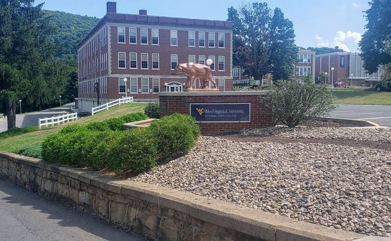
2. Fuller Marker
Marker is located at the far left of the brick base, below the Catamount Statue.
Regarding Fuller. The catamount, or mountain lion, is the school's athletic mascot.
Credits. This page was last revised on September 30, 2021. It was originally submitted on August 21, 2021, by Bradley Owen of Morgantown, West Virginia. This page has been viewed 388 times since then and 24 times this year. Last updated on September 28, 2021, by Bradley Owen of Morgantown, West Virginia. Photos: 1, 2. submitted on August 21, 2021, by Bradley Owen of Morgantown, West Virginia. • Devry Becker Jones was the editor who published this page.
