Westmoreland in Macon County, Tennessee — The American South (East South Central)
Epperson Springs
Resort and Wartime Enlistment Center
Photographed by Don Morfe, July 23, 2013
1. Epperson Springs Marker
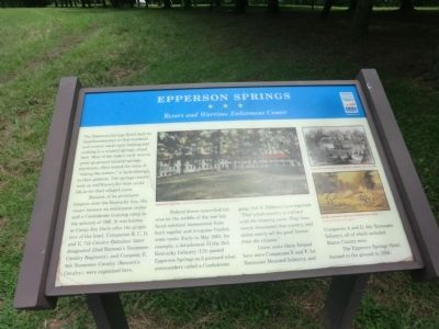
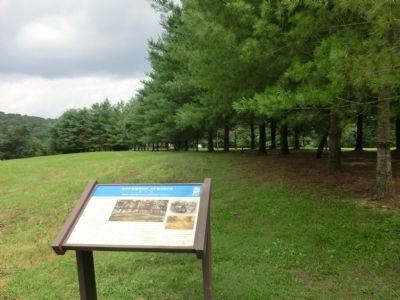
The Epperson Springs Hotel, built by local businessmen so that residents and visitors could enjoy bathing and soaking in a mineral springs, stood here. Most of the state’s early resorts grew up around mineral springs; physicians often touted the value of “taking the waters,” or hydrotherapy, to their patients. The springs resorts were as well known for their social life as for their alleged cures.
Because of its prominent location near the Kentucky line, the resort became an enlistment center and a Confederate training camp in the autumn of 1861. It was known as Camp Jim Davis after the proprietor of the hotel. Companies B, C, D, and E, 7th Cavalry Battalion (later designated 22nd Barteau's Tennessee Cavalry Regiment), and Company E, 9th Tennessee Cavalry)were organized
Federal forces controlled the area by the middle of the war but faced constant harassment from both regular and irregular Confederate units. Early in May 1863, for example, a detachment of the 11th Kentucky Infantry (US) passed Epperson Springs as it pursued what commanders called a Confederate gang. Col. S. Pallance Love reported: "That whole country is infested with the thieving party. They have nearly devastated that country, and stolen nearly all the good horses from the citizens."
Union
this page online
The Epperson Springs Hotel burned to the ground in 1926.
Erected by Tennessee Civil War Trails.
Topics and series. This historical marker is listed in this topic list: War, US Civil. In addition, it is included in the Tennessee Civil War Trails series list. A significant historical month for this entry is May 1863.
Location. Marker has been reported missing. It was located near 36° 34.4′ N, 86° 11.983′ W. Marker was in Westmoreland, Tennessee, in Macon County. It was on Epperson Springs Road 0.2 miles west of Tooley Branch Road, on the left when traveling west. Touch for map. Marker was at or near this postal address: 9695 Epperson Springs Road, Westmoreland TN 37186, United States of America. Touch for directions.

Regionally, this marker was in Middle Tennessee and in the Highland Rim. It was also in the American South and specifically in the Upper South. Globally, it was in North America, the Western Hemisphere, the Western World, and the Anglosphere.
Photographed by Don Morfe, July 23, 2013
2. Epperson Springs Marker
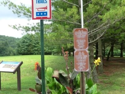
Other nearby markers. At least 8 other markers are within 9 miles of this location, measured as the crow flies: Site of Epperson Springs (here, next to this marker); Site of Civil War Confederate Training Camp Jim Davis (here, next to this marker); Camp Jim Davis Epperson Springs (approx. 2.1 miles away); William Owen Bradley (approx. 2½ miles away); In honor of those who served (approx. 2.7 miles away); H. G. Kirby (approx. 2.8 miles away); A Family Tragedy (approx. 8.3 miles away); The Home of William Dunn (approx. 8.3 miles away). Touch for a list and map of all markers in Westmoreland.
Photographed by Don Morfe, July 23, 2013
3. Epperson Springs Marker
Photographed by Darren Jefferson Clay, August 21, 2021
4. Epperson Springs Marker
Credits. This page was last revised on September 30, 2021. It was originally submitted on September 9, 2013, by Don Morfe of Baltimore, Maryland. This page has been viewed 2,447 times since then and 146 times this year. Last updated on September 29, 2021, by Darren Jefferson Clay of Duluth, Georgia. Photos: 1, 2, 3. submitted on September 9, 2013, by Don Morfe of Baltimore, Maryland. 4. submitted on September 29, 2021, by Darren Jefferson Clay of Duluth, Georgia. • Devry Becker Jones was the editor who published this page.
