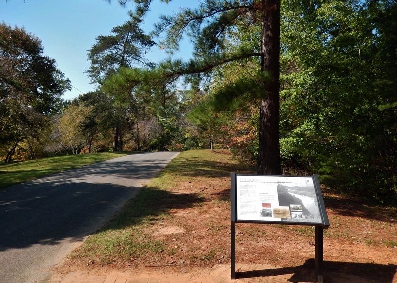
Riverside in Lynchburg, Virginia — The American South (Mid-Atlantic)
The Long View
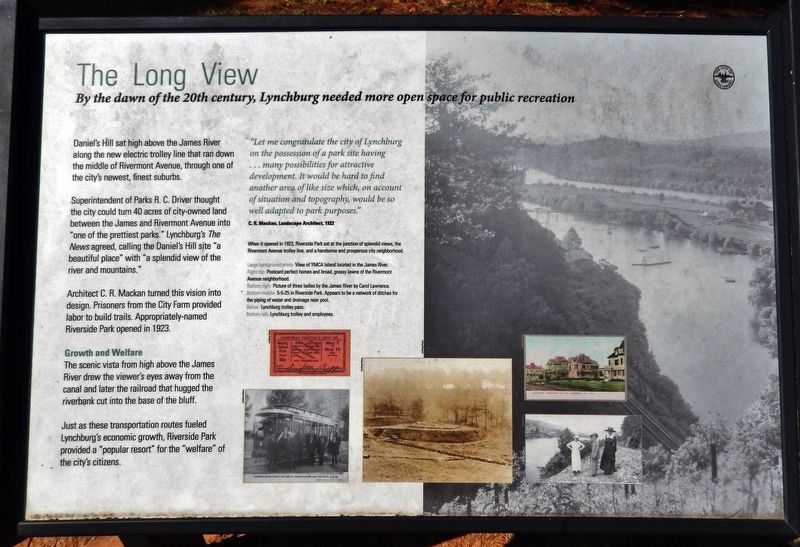
Daniel's Hill sat high above the James River along the new electric trolley line that ran down the middle of Rivermont Avenue, through one of the city's newest, finest suburbs.
Superintendent of Parks R. C. Driver thought the city could turn 40 acres of city-owned land between the James and Rivermont Avenue into "one of the prettiest parks." Lynchburg's The News agreed, calling the Daniel's Hill site "a beautiful place" with "a splendid view of the river and mountains."
Architect C. R. Mackan turned this vision into design. Prisoners from the City Farm provided labor to build trails. Appropriately-named Riverside Park opened in 1923.
Growth and Welfare
The scenic vista from high above the James River drew the viewer's eyes away from the canal and later the railroad that hugged the riverbank cut into the base of the bluff.
Just as these transportation routes fueled Lynchburg's economic growth, Riverside Park provided a "popular resort" for the "welfare" of the city's citizens.
"Let me congratulate the city of Lynchburg on the possession of a park site having… many possibilities for attractive development. It would be hard to find another area of like size which, on account of situation and topography, would be so well adapted to park purposes."
—C. R. Mackan, Landscape Architect, 1922
When it opened in 1923, Riverside Park sat at the junction of splendid views, the Rivermont Avenue trolley line, and a handsome and prosperous city neighborhood.
[photo captions]
Large background photo View of YMCA Island located in the James River.
Right top Postcard perfect homes and broad, grassy lawns of the Rivermont Avenue neighborhood.
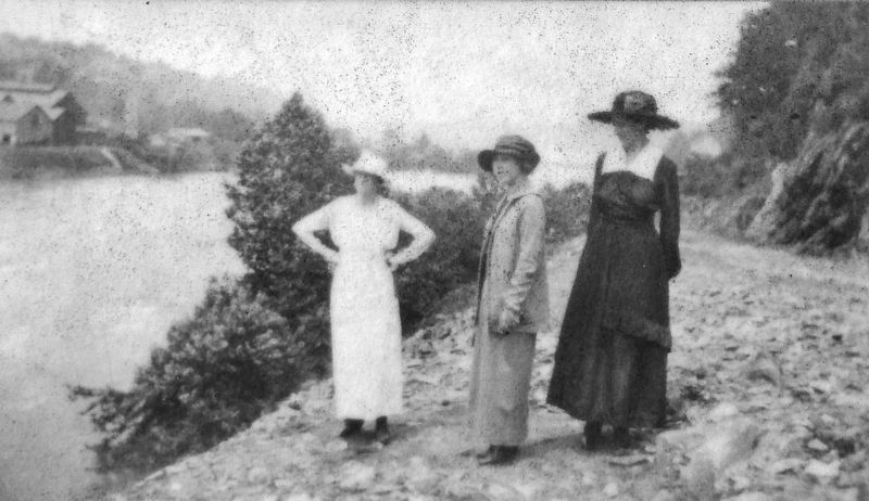
Bottom right Picture of three ladies by the James River by Carol Lawrence.
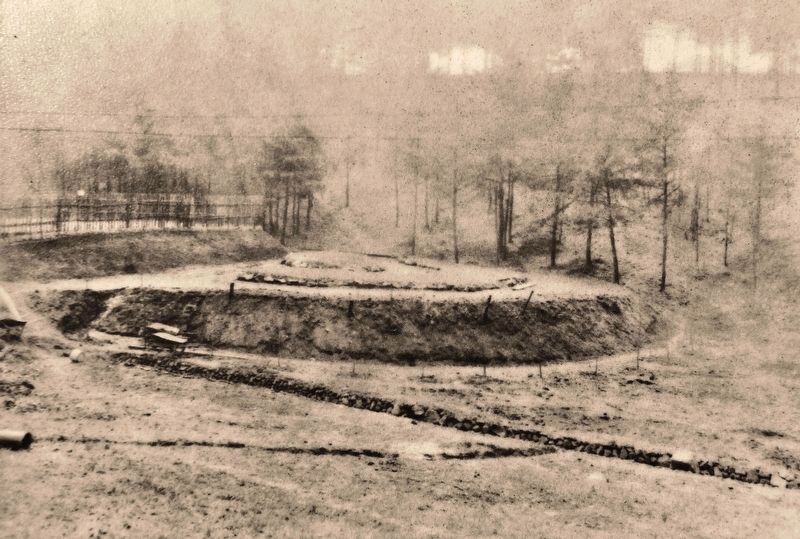
Bottom middle 5-5-25 in Riverside Park. Appears to be a network of ditches for the piping of water and drainage near pool.
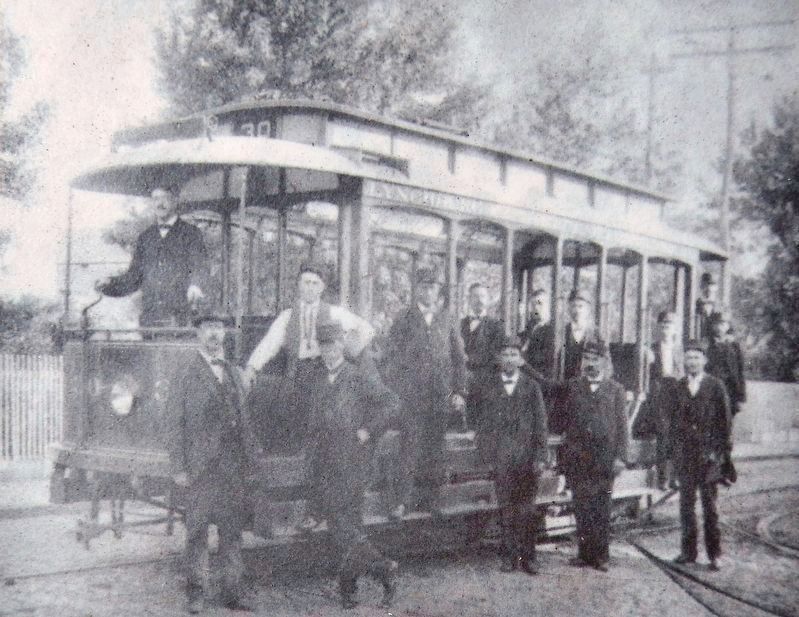
Below Lynchburg trolley pass.
Bottom left Lynchburg trolley and employees.
Erected by City of Lynchburg.
Topics. This historical marker is listed in these topic lists: Parks & Recreational Areas • Waterways & Vessels. A significant historical year for this entry is 1923.
Location. 37° 26.4′ N, 79° 9.84′ W. Marker is in Lynchburg, Virginia. It is in Riverside. Marker can be reached from Riverside Street, 0.1 miles north of Rivermont Avenue. Marker is located on Treasure Island Road (the park loop trail) inside Riverside Park. Touch for map. Marker is at or near this postal address: 2238 Rivermont Avenue, Lynchburg VA 24503, United States of America. Touch for directions.
Other nearby markers. At least 8 other markers are within walking distance of this marker. Packet Boat Marshall (about 300 feet away, measured in a direct line); Hull of the Packet Boat Marshall (about 400 feet away); Fink Deck Truss (about 400 feet away); Troubled to Healing Waters (about 400 feet away); Miller-Claytor House (approx. ¼ mile away); Safe Haven in Lynchburg: Project Y (approx. 0.3 miles away); Pearl S. Buck (approx. half a mile away); Randolph-Macon Woman's College (approx. 0.6 miles away). Touch for a list and map of all markers in Lynchburg.
Also see . . . The History of Riverside Park in Lynchburg, Virginia. Riverside Park was wildly popular by 1925 with pool attendance during the summer reaching 30,961 swimmers. Park attendance was recorded as 284,342 for the year. (Submitted on September 29, 2021, by Cosmos Mariner of Cape Canaveral, Florida.)
Credits. This page was last revised on February 1, 2023. It was originally submitted on September 29, 2021, by Cosmos Mariner of Cape Canaveral, Florida. This page has been viewed 194 times since then and 13 times this year. Photos: 1, 2, 3, 4, 5. submitted on September 29, 2021, by Cosmos Mariner of Cape Canaveral, Florida.
