Near Orienta in Major County, Oklahoma — The American South (West South Central)
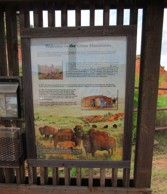
Welcome to the Gloss Mountains
The Gloss Mountains region has witnessed the passage of many visitors. Until the 1800's this area was the hunting domain of such Plains Indian tribes as the Apache, Kiowa and Comanche. Countless herds of buffalo once traveled here in their search for prairie grass.
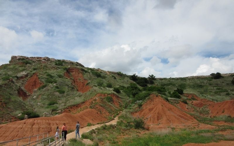
Explorers Thomas James (1821) and Daniel Boone's son, Nathan Boone (1843) passed through this area. Searching for a trade route to Santa Fe, New Mexico, James called these colorful formations the "Shining Mountains." The name Glass Mountains, derived from the abundance of transparent gypsum crystals (the mineral selenite} scattered on the slopes, was first used on a map issued by the U.S. General Land Office in 1873. At a distance, the selenite shimmers in sunlight and appears to be glass. In 1875, a second map labeled this area s the Gloss Mountains, but apparently it was a drafting error. A third map, released shortly afterward, reverted back to Glass Mountains.
In 1835, this region was part of over six million acres that were conveyed by the U.S. Government to the Cherokee Nation. Known as the Cherokee Outlet, it was leased to the Cherokee Strip Livestock Association from 1880 to 1883.
By 1892, the Cherokee Nation reluctantly agreed to cede the unoccupied lands of the Cherokee Outlet for white settlement. The Cherokee Outlet Run of 1893 brought many pioneers. These hard-working homesteaders built farms, ranches and towns. Cedar trees which once covered mesas, were used as fence posts and as rafters for sod houses and dugouts.
Along with these industrious settlers, a few outlaws also roamed the land. Desperados like Dick Yeager took refuge in this rugged country.
Modern-day explorers have probed the depths of this region in search of valuable deposits of oil and natural gas. Major County has been one of Mid-Continent's most active drilling fields.
Topics. This historical marker is listed in these topic lists: Exploration • Native Americans • Settlements & Settlers. A significant historical year for this entry is 1800.
Location. 36° 21.739′ N, 98° 34.916′ W. Marker is near Orienta, Oklahoma, in Major County. Marker is on U.S. 412, 5 miles west of U.S. 60, on the right when traveling west. The marker is ocated at the entrance to Gloss Mountain State Park. Touch for map. Marker is in this post office area: Fairview OK 73737, United States of America. Touch for directions.
Other nearby markers. At least 4 other markers are within 12 miles of this marker, measured as the crow flies. Red Mesas of the Blaine Escarpment (here, next to this marker); Horseshoe Bend (approx. 0.2 miles away); Glass Mountains or Gloss Mountains (approx. 0.2 miles away); Sod House (approx. 11˝ miles away).
Credits. This page was last revised on October 4, 2021. It was originally submitted on October 2, 2021, by Jason Armstrong of Talihina, Oklahoma. This page has been viewed 292 times since then and 51 times this year. Photos: 1, 2. submitted on October 2, 2021, by Jason Armstrong of Talihina, Oklahoma. • J. Makali Bruton was the editor who published this page.

