Hudson Square in Manhattan in New York County, New York — The American Northeast (Mid-Atlantic)
Spring Street Park
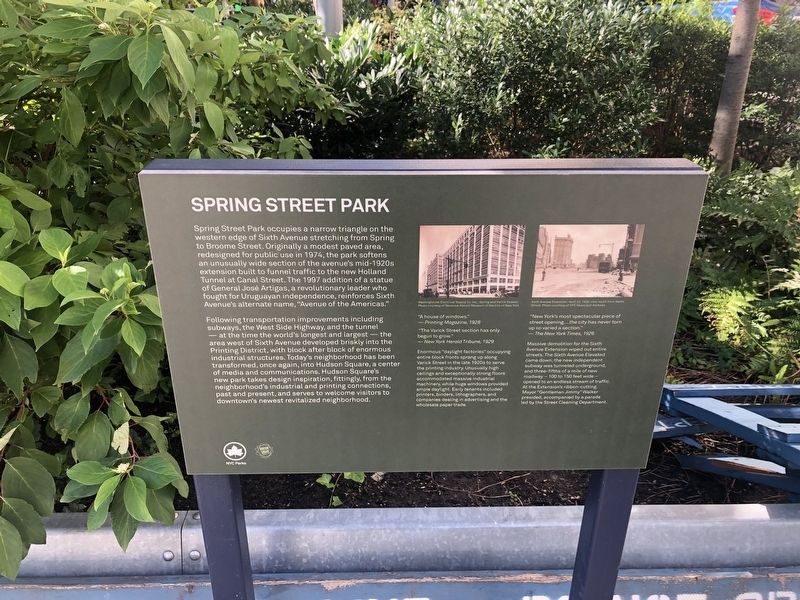
Spring Street Park occupies a narrow triangle on the western edge of Sixth Avenue stretching to Broome Street. Originally a modest paved area, redesigned for public use in 1974, the park softens an unusually wide section of the avenue's mid-1920s extension built to funnel traffic to the new Holland Tunnel at Canal Street. The 1997 addition of a statue of General José Artigas, a revolutionary leader who fought for Uruguayan independence, reinforce's Sixth Avenue's alternate name, "Avenue of the Americas."
Following transportation improvements including subways, the West Side Highway, and the tunnel — at the time the world's longest and largest — the area west of Sixth Avenue developed briskly into the Printing District, with block after block of enormous industrial structures. Today's neighborhood has been transformed, once again, into Hudson Square, a center of media and communications. Hudson Square's new park takes design inspiration, fittingly, from the neighborhood's industrial and printing connections, past and present, and serves to welcome visitors to downtown's newest revitalized neighborhood.
[Captions:]
"A house of windows." — Printing Magazine, 1928
"The Varick Street section has only begun to grow."
— New York Herald Tribune, 1929
Enormous "daylight factories" occupying entire block fronts sprang up along Varick Street in the late 1920s to serve the printing industry. Unusually high ceilings and exceptionally strong floors accommodated massive industrial machinery, while huge windows provided ample daylight. Early tenants included printers, binders, lithographers, and companies dealing in advertising and the wholesale paper trade.
"New York's most spectacular piece of street opening....the city has never torn up so varied a section."
— The New York Times, 1926
Massive demolition for the Sixth Avenue Extension wiped out entire streets. The Sixth Avenue Elevated came down, the new independent subway was tunneled underground, and three-fifths of a mile of new roadway — 100 to 150 feet wide — opened to an endless stream of traffic. At the Extension's ribbon-cutting, Mayor "Gentleman Jimmy" Walker presided, accompanied by a parade led by the Street Cleaning Department.
Erected by New York City Parks; Hudson Square Association.
Topics. This historical marker is listed in these topic lists: Arts, Letters, Music • Industry & Commerce • Parks & Recreational Areas • Roads & Vehicles. A significant historical year for this entry is 1974.
Location. 40° 43.53′ N, 74°
Other nearby markers. At least 8 other markers are within walking distance of this marker. General José Artigas (within shouting distance of this marker); 83,85 Sullivan Street (about 300 feet away, measured in a direct line); Charlton-King-Vandam Historic District (about 300 feet away); 116 Sullivan Street (about 500 feet away); Father Fagan Park (about 600 feet away); Today’s IFC Film Center Building in 1926 (about 600 feet away); Saw Mill on King Street 1830 (about 600 feet away); 203 Prince Street (about 700 feet away). Touch for a list and map of all markers in Manhattan.
Credits. This page was last revised on January 31, 2023. It was originally submitted on October 3, 2021, by Devry Becker Jones of Washington, District of Columbia. This page has been viewed 105 times since then and 15 times this year. Photos: 1, 2. submitted on October 3, 2021, by Devry Becker Jones of Washington, District of Columbia.

