Dana Point in Orange County, California — The American West (Pacific Coastal)
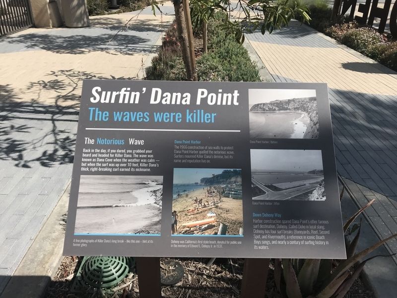
Surfin' Dana Point
The Waves Were Killer
The Notorious Wave
Back in the day, if you dared, you grabbed your board and headed for Killer Dana. The wave was known as Dana Cove when the weather was calm - but when the surf was over 10 feet, Killer Dana's thick, right-breaking curl earned its nickname.
Dana Point Harbor
The 1966 construction of sea walls to protect Dana Point Harbor quelled the notorious wave. Surfers mourned Killer Dana's demise, but its neam and reputation live on.
Down Doheny Way
Harbor construction spared Dana Point's other famous surf destination, Doheny. Called Doho in local slang, Doheny has four surf breaks (Boneyards, Reef, Second Spot, and Rivermouth), a reference in iconic Beach Boy songs, and nearly a century of surfing history in its waters.
Captions:
A few photographs of Killer Dana’s long break – like this one – hint at its former glory.
Doheny was California’s first state beach, donated for public use in the memory of Edward L. Doheny Jr. in 1931.
Dana Point Harbor Before
Dana Point Harbor After
Topics. This historical marker is listed in these topic lists: Industry & Commerce • Parks & Recreational Areas • Sports • Waterways & Vessels. A significant historical year for this entry is 1966.
Location. 33° 27.896′ N, 117° 41.166′ W. Marker is in Dana Point, California, in Orange County. Marker is on Pacific Coast Highway (California Route 1) west of Doheny Park Road, on the right when traveling north. Touch for map. Marker is in this post office area: Dana Point CA 92629, United States of America. Touch for directions.
Other nearby markers. At least 8 other markers are within walking distance of this marker. The Endless Summer (a few steps from this marker); Bruce Brown (1937-2017) (a few steps from this marker); Hobie Alter / The Surfboard King (within shouting distance of this marker); Hobie Cat / Innovation and Hard Work (within shouting distance of this marker); John Severson (1933-2017) (within shouting distance of this marker); Phil Edwards (b. 1938) (within shouting distance of this marker); Dana Point (within shouting distance of this marker); Doheny State Beach (about 300 feet away, measured in a direct line). Touch for a list and map of all markers in Dana Point.
Credits. This page was last revised on October 15, 2021. It was originally submitted on October 3, 2021, by Adam Margolis of Mission Viejo, California. This page has been viewed 308 times since then and 51 times this year. Photos: 1, 2. submitted on October 3, 2021, by Adam Margolis of Mission Viejo, California. • J. Makali Bruton was the editor who published this page.

